Every April Has One...
Find Eric Fisher on Twitter & Facebook
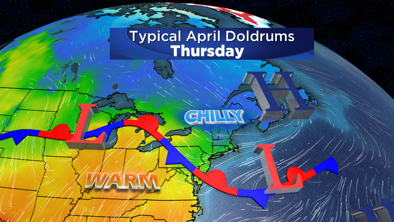
It's a rite of passage for New England spring, just like the first Red Sox home run or street sweeper coming down your road to clean up the winter mess. Yes there's always (at least one) junky stretch of April where the clouds and chill roll off the ocean for days on end. This is that week, and at least we're getting it out of the way early. Overall indications are for milder days ahead so once we get past this, and we may finally get a respectable stretch of enjoyable spring weather!
In the winter, it's the cold northwest wind that keeps chill in the air as arctic air masses invade. In the spring, our adversary is often the Atlantic. It too just endured a record cold winter, and has cooled off accordingly to levels that would leave George Costanza embarrassed (I was in the pool!!) Sea surface temps are in the 30s to our east and northeast, and so when the wind comes off the water there isn't a whole lot of warmth to be found. There are two ways to bring in those cold temps. The first is via your typical sea breeze that develops on days with a weak pressure gradient. Warm sun heats the land, creating a circulation that draws the cold air inland. The other way to do it is with a general onshore flow, with high pressure to the north or low pressure to the south (or both!). In the case of this week's weather, it's mainly a strong area of high pressure holding court over eastern Canada that will bring us well below average temps.
Winds that were southerly on Monday will be turning to the northeast Tuesday and increasing, bringing chilly marine air across the whole region instead of just the immediate coast. There will also be more clouds to go along with this, and a wave of low pressure will help provide a raw rainfall. A few showers around in the morning will transition to a steadier rain later in the afternoon/evening as highs struggle to reach the low 40s.
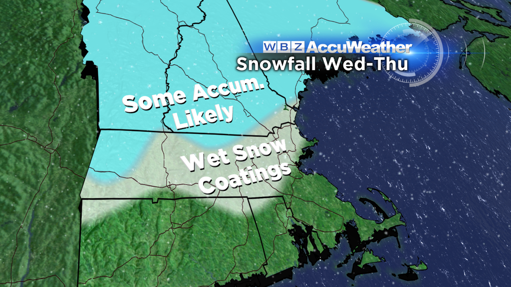
As the high slides a bit farther east and strengthens its position, the air becomes even colder on Wednesday. In fact, temperatures aloft all fall below freezing, and surface temperatures won't escape the 30s in most towns. That's cold enough for snow folks, and so wet flakes are likely going to set in as the next disturbance arrives late Wednesday into early Thursday. Currently I'm not expecting widespread significant accumulation, but we could end up with as much as several inches of wet snow (especially on grassy surfaces) across southern New Hampshire with slightly less across northern Massachusetts. The best shot of this occurring is where some terrain is involved. Higher elevations could easily pick up the wet snow and with temps close to freezing could also require the salt/sand trucks to come back out. In the Boston area any snow would likely be more of the nuisance variety, and the flakes likely won't be able to make it all the way down to the South Coast or Cape.
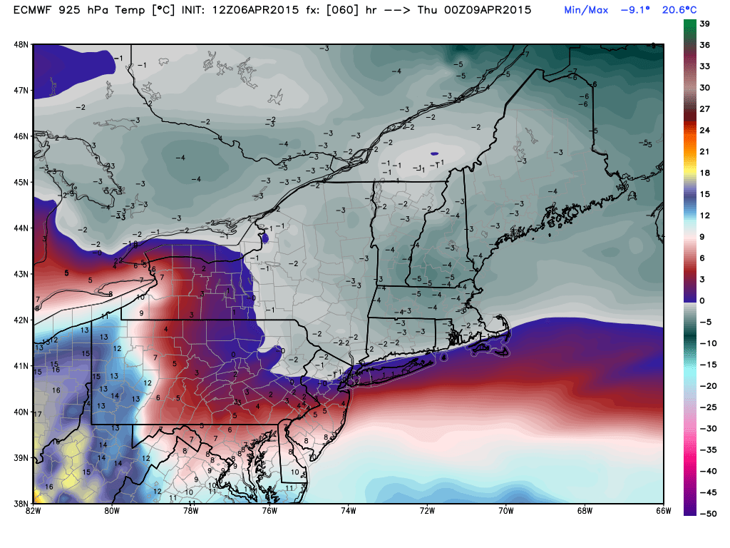
ECMWF forecast temps at 925mb and 850mb Wednesday evening. There should be a pretty thick layer of subfreezing temps aloft, and with 30s at the surface it should be cold enough to bring snow/sleet all the way down to ground level for a pretty large part of Massachusetts (and certainly New Hampshire/Vermont/Maine). Source: Weatherbell
This stout onshore flow holds its ground on Thursday, although winds start to turn back more southerly aloft and so the snow threat will decrease. Some flakes may linger into the morning, but any other showers on Thursday will likely be rain. There may be enough drying in the atmosphere to give us a few breaks of sun, but it will still be quite chilly with highs near 40 degrees.
Friday doesn't quite look like a gem, but it will at least become more tolerable as the boundary lifts back north as a warm front and allows the 50s to return. There are some timing issues still to work out, but it looks like most of the rain activity on Friday may be late as the next front moves in from the west (this one's a cold front, which thankfully doesn't have a very cold air mass behind it...just a drier one). Once this passes through the region Friday night, we should be able to bring back the sun en force and set up a pretty nice spring weekend! So at least we should get a payoff at the end of an overall dreary week.
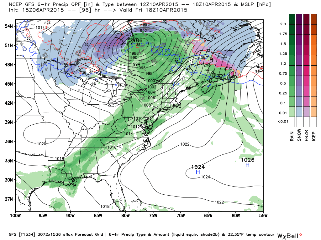
More from the good news files: All the rain/snow this week will be spread out over 4 days and won't add up to all that much. In general, it looks like 0.5" - 1.5" of precipitation will fall Tuesday through Friday night. Since we've had very gradual snow melt and the rivers are not very swollen by April standards, this should pose no flood threat. We've been extremely fortunate with this pattern so far and snow water equivalent numbers have been falling - helping us to escape a major spring flood. There's very little snow left in Metro Boston outside of the shady/protected spots, and it's disappearing even across northern Massachusetts/southern New Hampshire. By this weekend, more progress will be made without flooding. So it's becoming safe to say that the flood threat will be reduced to major rivers only (Connecticut, Merrimack) and even that threat is going down. If we can avoid the big 2-4" rainstorm in the medium range, then we'll be in the clear! That would be a lucky end to a tough winter.


