Flying Over Snow-Covered New England Helps Predict Spring Flooding
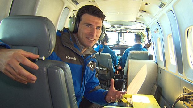
BOSTON (CBS) – Lieutenant commander Patrick Didier doesn't just endure winter weather - he intentionally follows it.
"I'm kind of like a reverse snowbird," said Didier, who flies with the National Oceanic and Atmospheric Administration.
Didier will spend sweltering summers in the tropics hunting hurricanes, and the coldest months of the year plotting a course around the snowiest climates in the country.
The plane he welcomed WBZ-TV on board of will be flying to Alaska later this week.
But this year, you're hard pressed to find a snowier scene than New England.
During a mission NOAA has been flying since the late 1970s, the bird's eye view helps predict what will happen when all of the white on the ground becomes wet.
A flight 500 feet above the ground measures exactly how much water is locked up in a record amount of snow.
Once airborne, Didier and his co-pilot Michael Hirsch will fly dozens of paths wherever they're needed. They're measuring something unseen to most, but something that is always there - radiation.
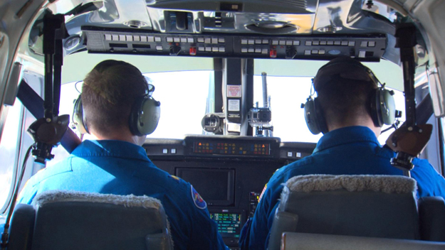
They'll fly the same flight path in the fall time when there isn't any snow. That will allow Didier and Hirsch to compare the radiation coming up out of the ground to the radiation during the winter months when there's a lot of snow blocking that radiation's signature.
"I hesitate to say basic nuclear physics, but you have potassium, thallium, and uranium and they're all present in the soil and they're releasing isotopes," said Didier.
In other words, there are small traces of gamma radiation. If there's water between that radiation source and the plane, the signal is weaker.
By comparing the values, NOAA can measure to the centimeter exactly how much water is ready to be released for a potential spring flood.
They're on the lookout for ground ice, standing water, flooded fields, anything they think might be hydrologically significant.
Visual notes are taken down, and once back on the ground, all this data gets to river forecasters within an hour.
The end result for us is the most accurate picture possible of our flood risk in the hopes that we'll be prepared for winter's final calling card.


