Cycles Of The Weather Engine
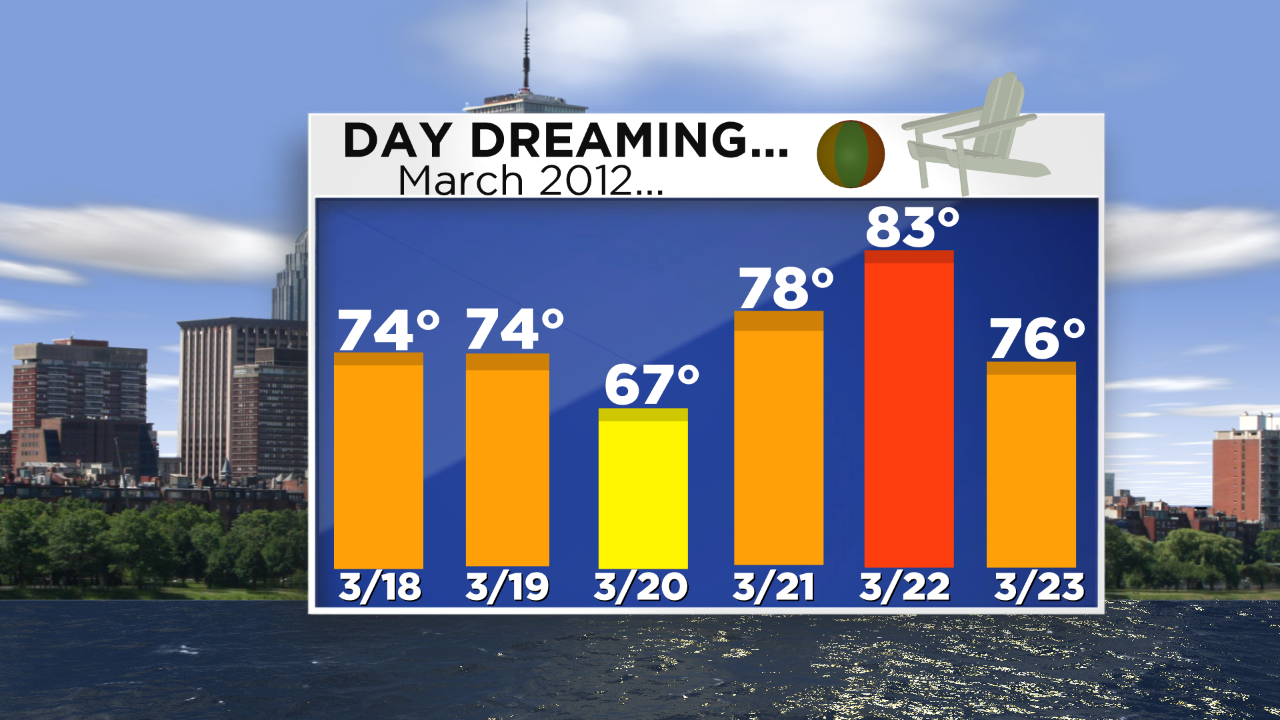 There is an amazing connectivity between the oceans and the atmosphere. Through extensive research over the past two decades, brilliant scientists/meteorologists have discovered many fascinating global factors that control our climate. There are multiple oscillations in the air and the sea and their variations and interactions that are in a state of flux and the whole amphitheater is governed by the sun. Sets and subsets of global factors are analyzed and conclusions are reached regarding dominating factors ie the big players for any particular season. Our weather, our climate engine clearly is cycling. Three years ago, we had 11 consecutive months of above to much above average temperatures climaxed by March 2012 which had a mean temperature anomaly of a whopping +8.4 degrees! These were Boston's high temperatures in the warmest stretch of that month with 83 degrees on the 22nd smashing the old record high by 9 degrees!
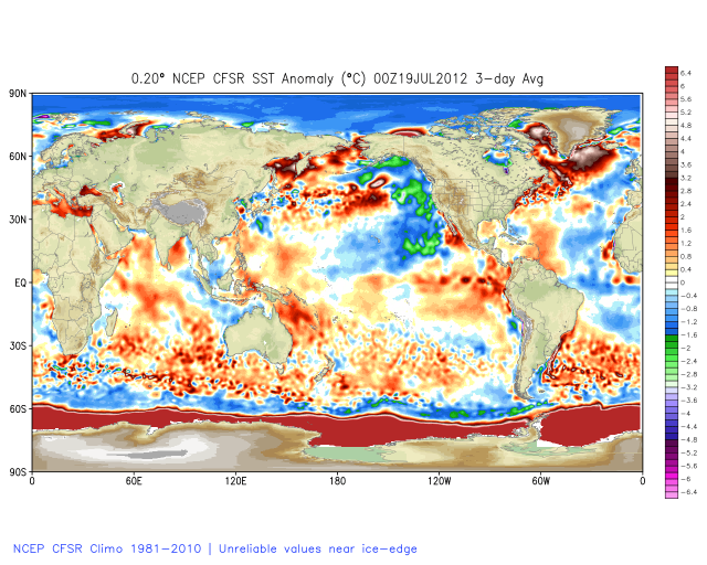
Study the top graphic which is a sea surface temperature anomaly map. Focus on the ocean temperatures over the eastern Pacific. There is a minus anomaly there which means colder than average which is the flip of what has existed there over the past several months. This reverse depicting warmer than average temperatures in the eastern Pacific combined with a horseshoe of colder than average temperatures in the eastern Atlantic combined to induce a negative Eastern Pacific Oscillation and positive Pacific North American Oscillation favoring the unusually cold weather here in the Northeast. (Credit: Many thanks to Joe D'Aleo and Joe Bastardi for their great work and research at WeatherBell for educating me on this truly fascinating science of seasonal forecasting.)
It's a black and white, day and night disparity. The trick is determining how these warmer and colder pools of ocean water are going to change going forward. Studies show that the warm water in the eastern Pacific and the corresponding positive phase of the Pacific Decadal Oscillation is only temporary but it will take time to break down this zone of warm water as the PDO returns to its negative or cold phase. What does this portend for us in the months and seasons ahead? Advance modeling indicates it will be a slower deterioration than in past warm events. Consequently, it suggests that our summer will not be a super hot one but closer to or possibly slightly below average. This thinking leads me to believe that the Boston area will have about 10-12 days at 90 degrees or higher. The average number of 90-degree days is 14 but there were only 8 last summer and the first one didn't happen until July 2! It was a truly atypical summer without heat waves! The chance of that repeating is slim but I am relatively confident in predicting no repeat of the summer of 2013 which had 18 days above 90 or the sweltering summer of 2010 contained a mammoth 25 days at 90 or higher! Interestingly, the record-breaking warm winter of 2012 was not followed by a hot summer. There were only 12 days at 90 or higher but this doesn't necessarily mean that a super cold winter will be followed by unbearable heat in the summer either..
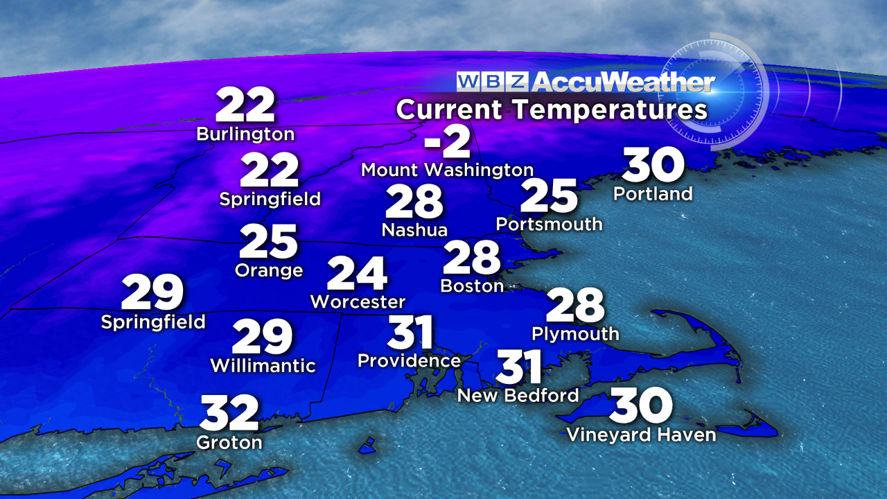 Just thought I'd give you some warming thoughts on this very cold day which seems like January. It's back to reality with these astonishing temperatures at 2pm on March 23. They are about 20 degrees below average. Three years ago today it was a balmy 76! Well, hang in there because warmer days are just around the corner and that means this week. Get set for 55-60 degrees on Thursday!
Make it a great week!