Snow, Rain Likely During Fifth Straight Weekend Storm
BOSTON (CBS) – It has become a weekend tradition. Either preparing for or dealing with a significant snow storm.
Check: Weather Blog | Current Conditions | Share Photos
Starting with the January blizzard, for the last four weekends we have been forced to shovel, plow, roof rake, ice chisel and battle ridiculous lines at the grocery store. We need a break.
I wish I had better news, but it appears we will make it five weekends in a row.
Yes, more snow is coming, but this one will be different. Most importantly, this is not going to be a major storm. No talk of Nor'easter or blizzard this go around. No strong winds, no blowing and drifting, no coastal concerns.
More good news. Snow amounts will likely be light, relatively speaking. Sadly, at this point, I think anything under a foot is hardly even considered a storm. We should stay well under a foot of snow in all of southern New England. In fact, there may even be a little mixing with rain for the first time in a long time.

TIMELINE
Saturday Afternoon: Snow begins after 2 p.m. from west to east and is very light. We are only expecting a coating to an inch or two by 7 p.m.
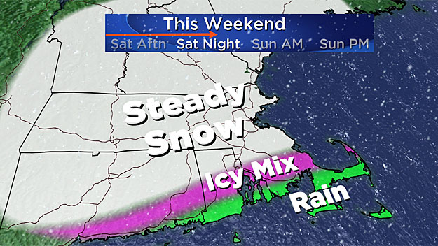
Saturday Night: Steady snow falling light to moderate. Temperatures will actually rise overnight and by Sunday morning, most of southern New England will be near or slightly above 32 degrees. Just about all of our snow storms in the last month have been pure light and fluffy powder.
The cold and powdery snow storms can accumulate 2 or 3 times as quickly as a storm near the freezing mark. Given that temperatures Saturday night and Sunday will be rising through the 20s and low 30s, the snow will be slower to accumulate. By Sunday morning, total snow accumulation will average about 3-to-6 inches across the region.
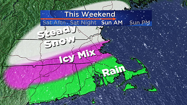
Sunday Morning: The snow will begin to mix with freezing rain in colder pockets north and west of Boston and plain rain in Boston and points south. Good news here is that precipitation amounts will remain light. An additional 1/4-inch or so of liquid is expected Sunday morning and midday. This will make a sloppy mess of the snow to the south and add a crusty, icy layer on top to the north.
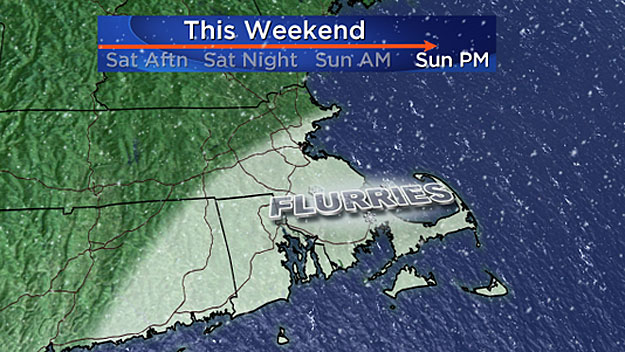
Sunday Midday/Afternoon: Precipitation tapers off. Time to clean up – again.
ACCUMULATION
Widespread 3-to-6 inches accumulations are expected from Boston to Worcester and points north, with potential for slightly higher amounts in spots. We are not expecting anyone to reach a foot this time.
Totals around 1-to-3 inches will be seen along the south coast, Cape Cod and islands with mixing likely.
Read: FEMA Snow Load Safety Guidance
While this storm does not appear to be major, at this point any precipitation (snow or rain) will add stress and weight to roofs. While most roofs are not at risk for snow induced collapse or failure, it is always a good idea to remove as much snow and ice as you can, and do so safely.
If you have just a minor accumulation of snow on your roof, the likelihood of actually damaging the roofing material can outweigh the benefits of removal, this according to FEMA.
There are many personal hazards associated with roof snow removal. No amount of snow and ice is worth risking your life to clear it.


