Quick Moving Storm To Deliver Shot of Snow Tuesday
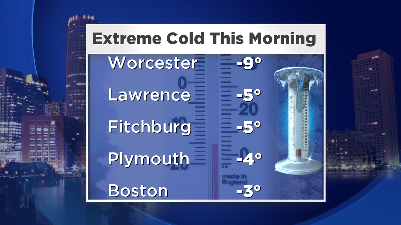
This winter is unrelenting. If it's not the snow, it's the cold –and this morning, we hit our coldest temperature (-3 degrees) in Boston in 11 years. On top of that, the wind behind our weekend blizzard is still strong, creating dangerously cold feels like temperatures out there. Despite the sunshine, we'll only come into the teens this afternoon, challenging record cold high temperatures for the date.
Tonight, the wind will subside and the clouds will move back in – so it won't be AS cold as this morning. I mean we'll still be in the single digits, but that's a little bit better, right??
And just as we finish the cleanup from the last storm (or should I say continue the cleanup!) – our next shot of accumulating snow is right around the corner. An area of low pressure down near the Gulf Coast states will slide through the Mid-Atlantic tonight and pass south of us tomorrow. This storm has it all – snow on the northern side, rain on the south side and freezing rain in between. Of course, we're on the colder side, so precipitation will be in the form of snow. I know many of us are pretty much done with the snow…but honestly at this point, a few inches of the white stuff is better than rain which would exacerbate the roof collapse situation significantly.
So here are the details:
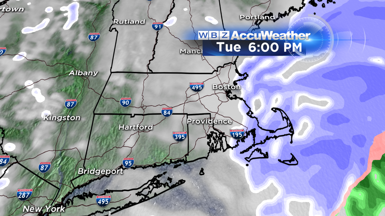
Snow arrives tomorrow morning between 5-7 AM, continuing through the afternoon at a light to moderate clip before tapering off between 4-6 PM. Snowfall rates won't be nearly as intense as they've been in previous storms this winter.
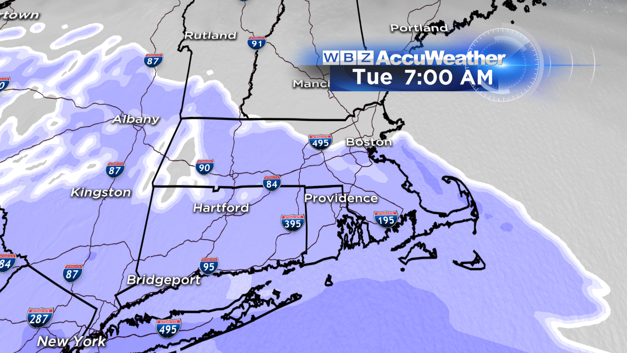
Accumulations will generally range from 1-3 in and around the city to 3-6" in southeast MA. If anything, the trend may be to lower these expected accumulations later today - so stay tuned to WBZ.
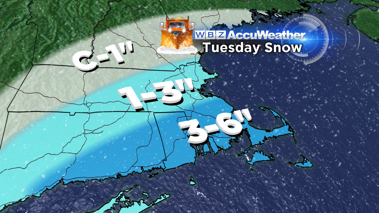
The wind won't be a concern with this event, nor will the threat for coastal flooding. It's a quick shot of snow , gone by Tuesday evening….or is it?
There are signals that a lingering trough over eastern New England Tuesday night into Wednesday could yield additional snow showers, mainly at the coast. A very localized band of steadier snow may try to organize, but historically, that band would be focused to our north (somewhere along the Maine coast). Nonetheless, something to watch.
Behind the storm? You guessed it…more cold.
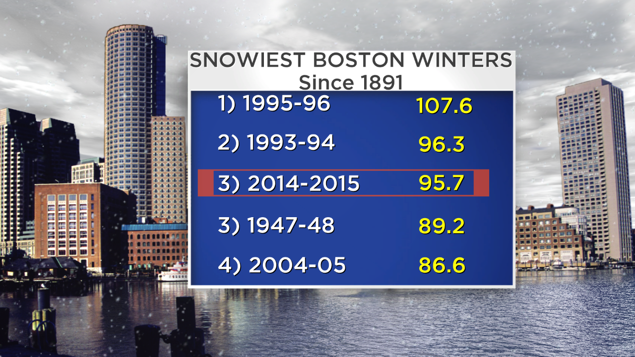
At this point - I feel like it's all or nothing. We're on track for the 2nd coldest February on record...and we're 11.9" away from the snowiest winter ever. Go big or go home!
Stay warm :)
-Danielle