From Snow To Ice To Rain Tonight
Our first winter storm of the year is moving our way. Snow, ice, rain will all move into New England tonight.
This Afternoon: We stay dry with cloudy skies for much of the day. Temperatures will be in the upper 20s and lower 30s...right around freezing.
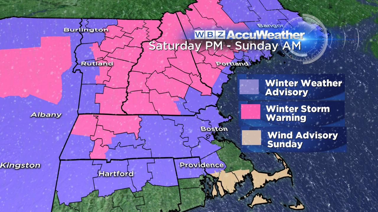
Warning/Advisories: A winter storm warning goes into effect for the locations in pink 4pm to 10am Sunday. Travel will be difficult due to the heavier snow accumulation and icing. A winter weather advisory goes into effect for the locations in purple 4pm to 2am Sunday in Massachusetts. Still tough travel, but only expecting minor snow accumulation and light icing before quickly changing to rain. A wind advisory has been issued for The Cape 7am to 10pm Sunday as winds gust up to 50 mph.
Timing: Snow showers move into New England between 2pm and 7pm. First snow begins in the southwest then spreads into the northeastern areas. The Cape & islands may see some snow mixing with the rain, but mainly an all rain event for you. Temps creep up as the night goes by until we hit high temps in the upper 50s on Sunday.
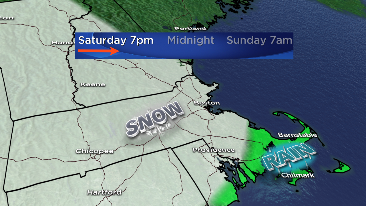
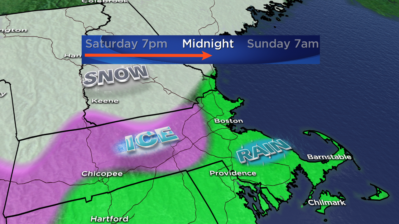
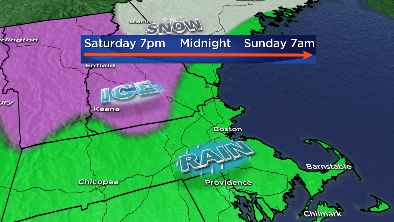
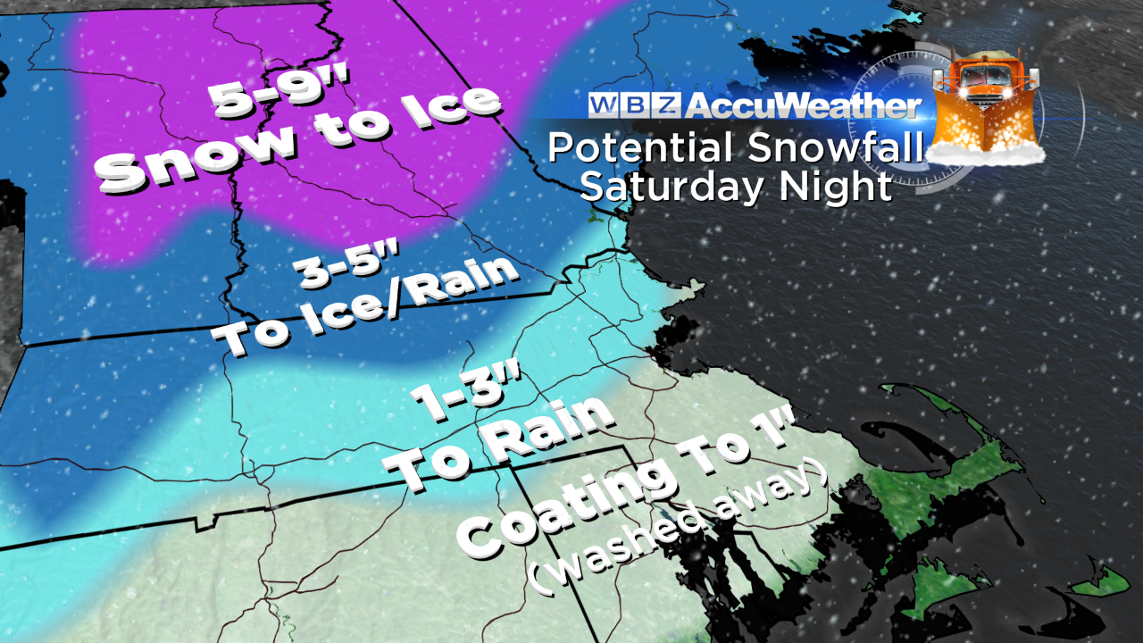
The Cape, RI, CT: Light coating of wet, slushy snow early in the evening. Changing to all rain for the rest of the night.
Mass Pike, Boston, Central MA: Snow accumulates between 4pm & 7pm. 1" to 3" of wet, heavy snow. Brief chance for ice, then changing to all rain by 10pm.
Worcester Hills, Western MA: Snow accumulates between 2pm & 7pm. 3" to 5" of snow, then light icing. Berkshires could get higher ice accumulation around 10pm. Changing to all rain by midnight.
Northern VT & Northern NH: Heavy snow from 6pm to midnight with 5" to 9" of accumulation. Changing to ice by midnight. Rain by daybreak Sunday.