A Chilling Tale
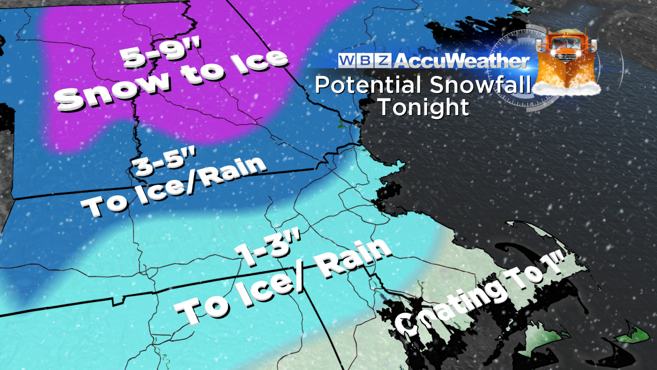
Unlike the frigid storm one year ago from January 2-3 which dumped 8-24" of the fluffiest powder snow we ever get around here, this weekend's system is minor indeed. Nevertheless, it is creating a winter wonderland and exciting the snow lovers with its 1-3"or so. Additionally, it has produced hazardous traveling conditions triggering many accidents. Warmer air is rushing in aloft while cold air is trapped at the low levels. Consequently, precipitation will be transitioning through various phases as the night progresses. Snow will be replaced by sleet then freezing rain deeper inland as the temperatures remain constant then sluggishly rise just a few degrees the rest of the night. It appears the precipitation will not remain steady and become more showery instead yielding only pockets of briefly heavier rain.
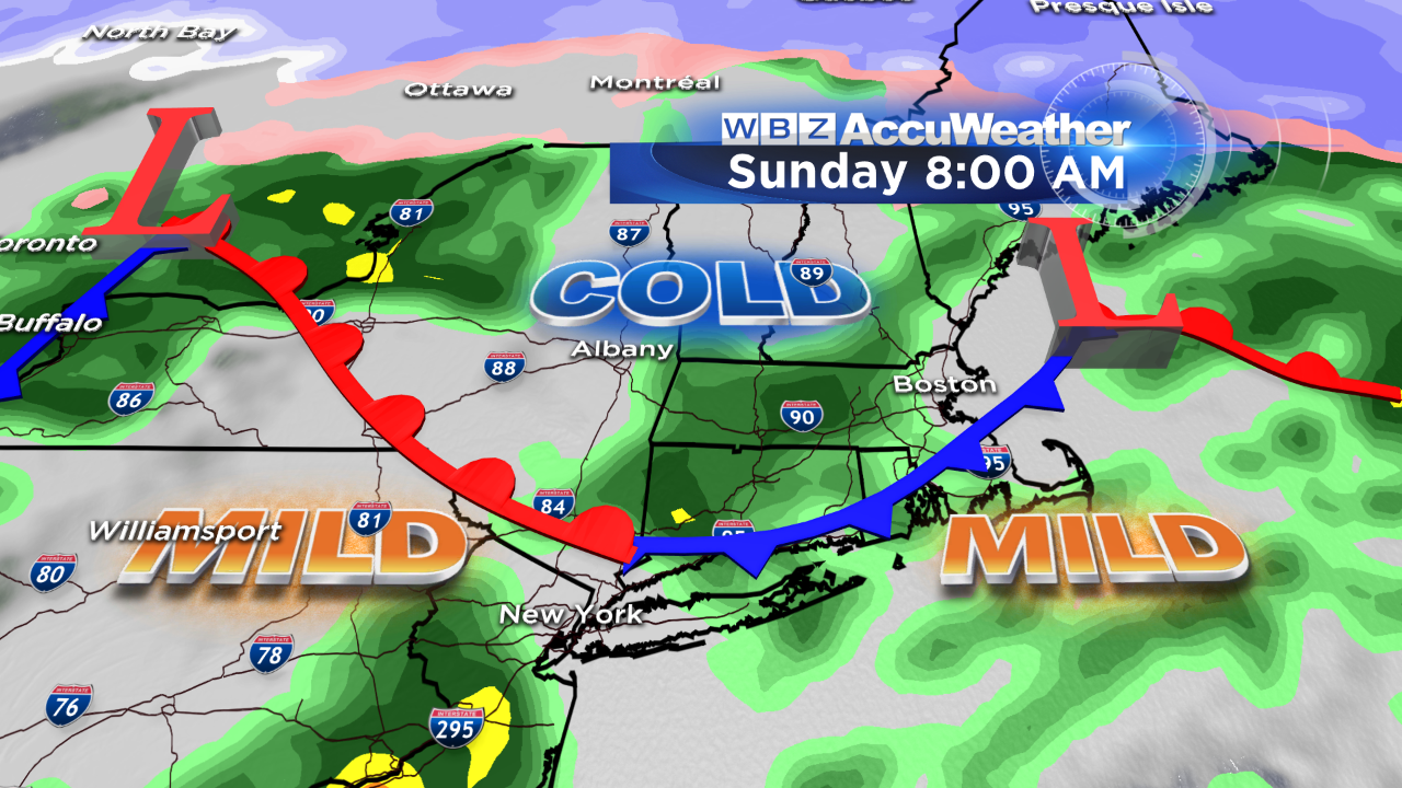 As a result, ice accretion over far interior locations should remain below critical thickness for extensive tree damage and power outages but I cannot rule out isolated cases. The dilemma in the forecast is determining the high temperatures tomorrow. Consensus of the meteorological models indicates a slam dunk for a very warm January day for Sunday. The problem is a departing wave of low pressure which is producing our wintry conditions tonight. Since this system will cross southeastern MA tonight and advance across the Gulf of ME tomorrow, low level cold may circulate around it and get left behind over the region tomorrow morning. It is crucial that the wedge of warmth surging up into PA maintains its momentum into New England. Another storm heading toward the St. Lawrence Valley appears potent enough to increase the gradient enabling the warmth to advance into New England but there may be areas in valleys where the cold doesn't get scoured out. With all of this in mind, I am not convinced now that the 50s are a sure bet but I will nervously accept the computer prognosis and predict it will warm up through at least the 40s in the afternoon and perhaps the 50s over southeastern MA up into the Boston area. If that verifies, much of the snow cover will shrink and vanish. In the morning, if it appears that the warming will not be as strong, we need to remove any remaining snow off steps, walks, driveways, etc. as plentiful bone-chilling air beckons to freeze it solid.
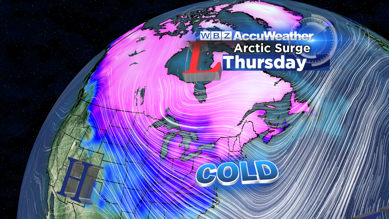
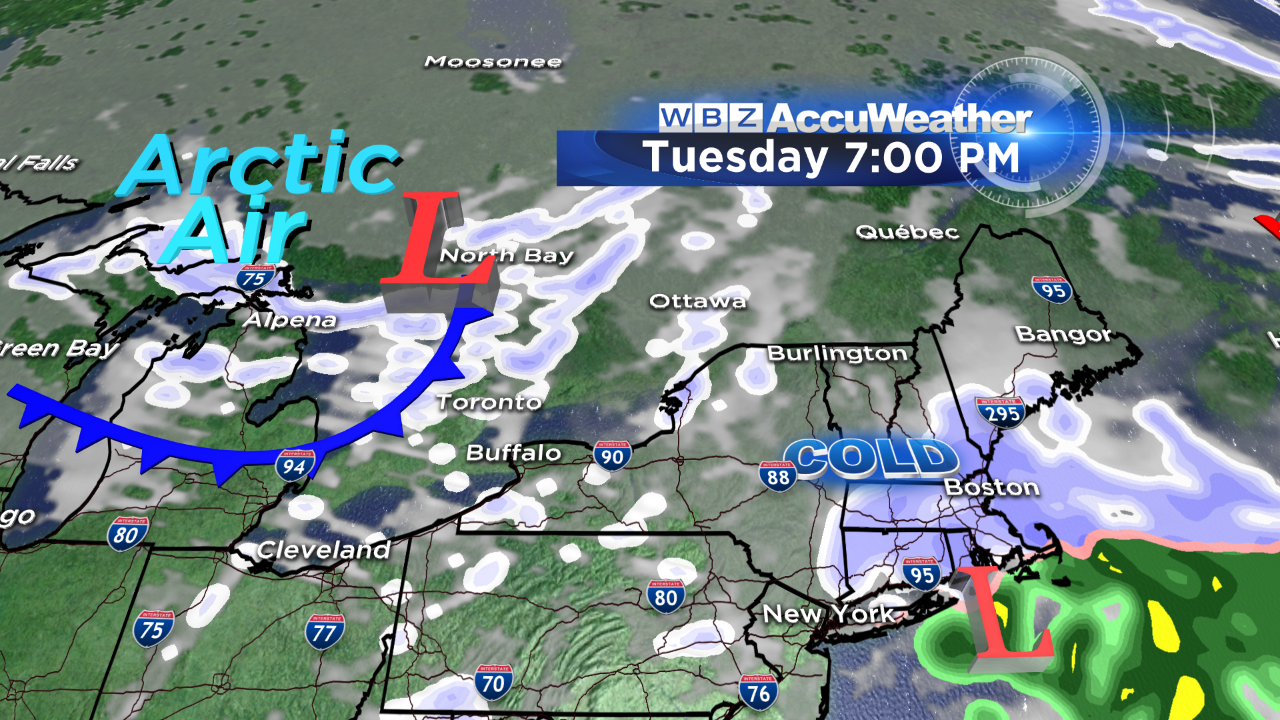 NO big storms are in sight but three installments of very cold air will occur in the next 7 days. The first batch will rush in on strong, gusty west-northwesterly winds on Monday. An approaching bundle of energy will spark a weak system releasing mostly flurries or light snow on Tuesday afternoon and evening. The second batch of arctic air arrives on Wednesday as a strong cold front digs across the region with some more flurries and potential snow squalls. This unloads the coldest air of the season with potential high temperatures of 5-15 degrees across the region on Thursday with lows near zero that morning. There will be some moderation Thursday night as the wind turns southwesterly again ahead of the next push of arctic air that will be preceded by some flurries and a few spotty squalls on Friday.
 After some upper 20s on Friday, the max temperatures are back to the upper teens to near 20 next Saturday. Presently, the weather outlook for the Patriots in the AFC Divisional Playoff Game next Saturday is for mainly clear and very cold conditions with temperatures in the upper teens and not much wind at the 4:30PM kickoff.
GO PATS! ![]()