Facts And Forecasts
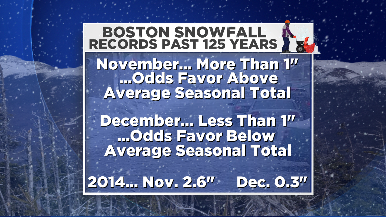
Can we draw conclusions and accurate forecasts from a slew of statistics? In certain cases yes and in certain cases no. Upon digging into Boston's snowfall records over the past 125 years, I discovered some interesting data this weekend. Over that period of time, there were 36 Novembers with more than 1" of snow which yielded 24 seasons with above average snowfall. Over that same period of time of about 125 years, there were 16 Decembers with less than 1" of snow which yielded 14 seasons of below average snowfall. Boston received more than 1" of snow in November (2.6") and less than 1" in December (0.3"). Thus, these mixed signals have presented us with a conundrum here folks. Do we change our seasonal forecast or go against all odds?There are always exceptions to the rule and we clearly cannot draw conclusions from this information. The clues are in the current set of global factors at play and those destined to go into play soon.
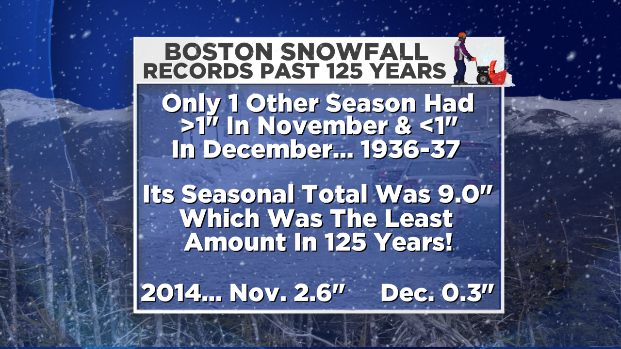 The only other season in the past 125 years that had more than 1" of snow in November (4.4") and less than 1" of snow in December (0.7") was 1936-37. In that season, the total snowfall turned out to be the least amount on record! It was followed by 2011-12 at 9.3" which had no snow in November and no snow in December. Number 3 was 1972-73 at 10.3" which had 0.6" in November and 3.3" in December. Interestingly, the recent season of 2012-13 was benign with only 8.8" of snow through January! After that, 54.6" fell in February and March! That season is not an analog year based upon the present and projected global factors in play this season. Nevertheless, I believe there are overwhelming oceanic and atmospheric signals that favor several not necessarily consecutive snowy weeks ahead. Consequently, I am not backing off yet from the WBZ Weather Team snowfall forecast of 55-65" in Boston through April.
 I still feel reasonably confident that with a weak El Nino evolving, the pool of warm water from the Gulf Of Alaska southward to Baja maintaining a semi-permanent ridge near and just off the West Coast of North America, a subtropical jet stream delivering some southern stream systems across the southern U.S., the polar jet stream digging southward as the Arctic Oscillation tanks delivering some more arctic outbreaks as occurred in November and potential eventual North Atlantic blocking, the stage is set for periodical harsh winter weather in the next couple of months. March 2015 should not be as severely cold as last March with hints of spring coming much earlier.
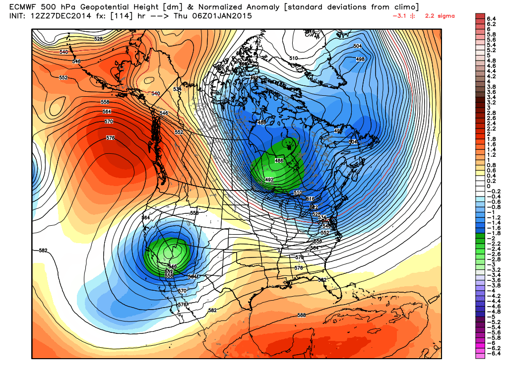
Here is a prognostic chart depicting the flow at upper levels namely 500 millibars. The notable features are the super ridge poking up into Alaska, the cross polar flow into central Canada and the upper low in the southwestern portion of the nation that will create our storm next weekend. Presently it appears the storm will be an inside runner so that means rain and it may turn quite warm again briefly with cold times rushing in behind for at least the first full week or two of January.
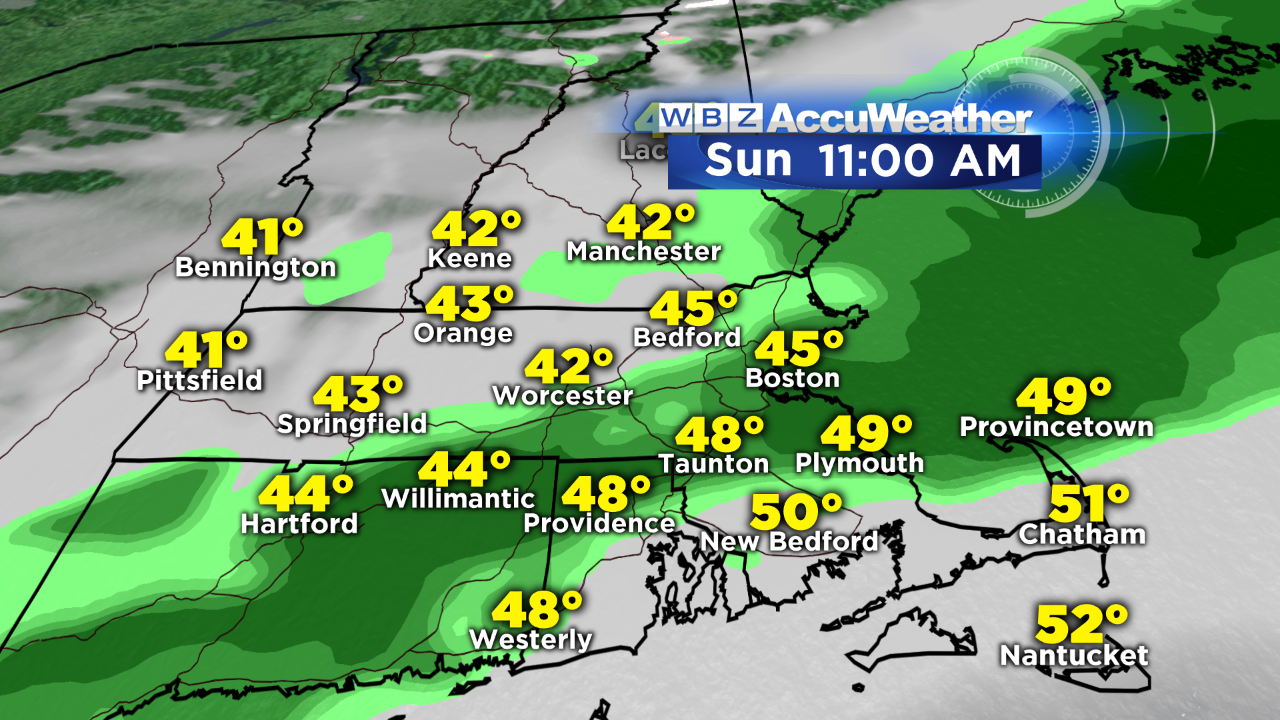 Backing up to the present, we have been living a charmed life this week and after a gorgeous Saturday and the 5th day this month above 50 degrees, I am expecting a string of light showers and sprinkles amounting to a few hundredths of an inch in places Sunday from mid-morning to early afternoon from northwest to southeast. Temperatures will still be close to 10 degrees above the average raising the mean temperature for the month of December to about 4 degrees above average which is amazing despite the lack of much sunshine. A cold frontal boundary will be slicing through the region and moving off the South Coast by late afternoon. Colder air will be draining in yielding highs near 40 with sunshine on Monday then only near 30 on Tuesday and Wednesday under a partly cloudy sky.
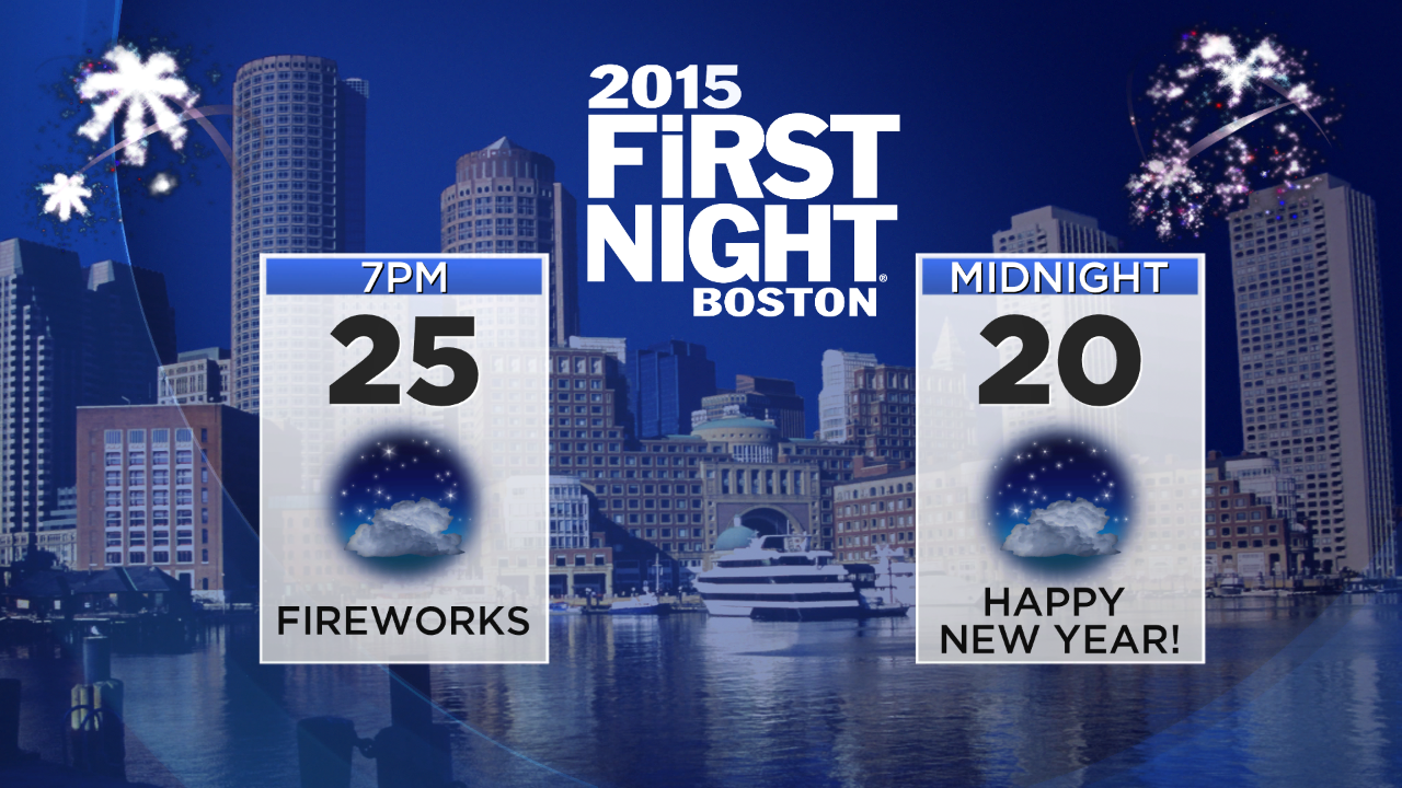 The weather will not be nearly as pleasantly mild but it will still be cooperative for First Night activities. It will be frigid but certainly cold enough to sustain the ice sculptures meaning you will need to bundle up. The breeze will be cold at times but it will not be a gusty, stinging wind of 20-40 mph. Nevertheless, the wind chill will be in the teens to near 10 degrees at midnight as we ring in the New Year of 2015! January 1 will be sunny to partly cloudy around here with snow flurries possible over the northern mountains. Sufficiently cold air will be in place for the ski resorts to turn on the snow-making guns again to improve conditions for the vacation week.
Have a happy and safe holiday week one and all! Barry B.