A Recipe For Weekend Snowflakes
Find Eric Fisher on Twitter and Facebook
It's not snow on Christmas Eve, but lovers of dendrites will have to settle for this weekend. And hey why not? There's certainly a holiday feel this weekend with Christmas right around the corner and Hanukkah in full swing. Presents will be wrapped, cookies will be baked, Christmas Vacation will be watched, and some snow outside. What could be better?
We're not working with a major storm here, or really any storm at all. Essentially a little trough is going to set up near coastal Massachusetts and high pressure to the north will help funnel in some cold air both at the surface and aloft. Just enough ingredients for snowflakes. What exactly is a 'trough'? Think of it as a line where air is coming together, or 'converging.' You see these on our weather maps as a dotted black line. When air converges along a point or line, there's nowhere to go but up! Rising air is what produces clouds and in many cases precipitation.
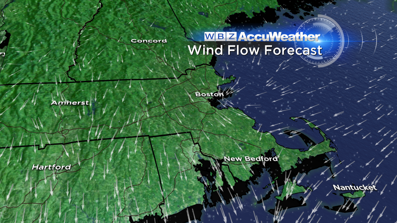
Forecast wind flow by Saturday evening (RPM). Note where easterly winds from the ocean meet up with northerly winds close to the coast. This is our 'convergence zone' where precipitation is most likely. In this case, we're talking about eastern Massachusetts.
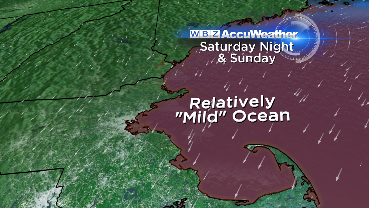
It's also helpful to generate some instability, and do that we need a good spread in temperature from the surface to air aloft. The Atlantic sitting off our coast is about 42-45ºF right now at the surface, or about 5-7ºC. The air aloft this weekend at 850mb will be closer to -7C. That's a spread of ~13ºC, an acceptable amount of instability helping air to rise. And of course we have a moisture source - the Atlantic!
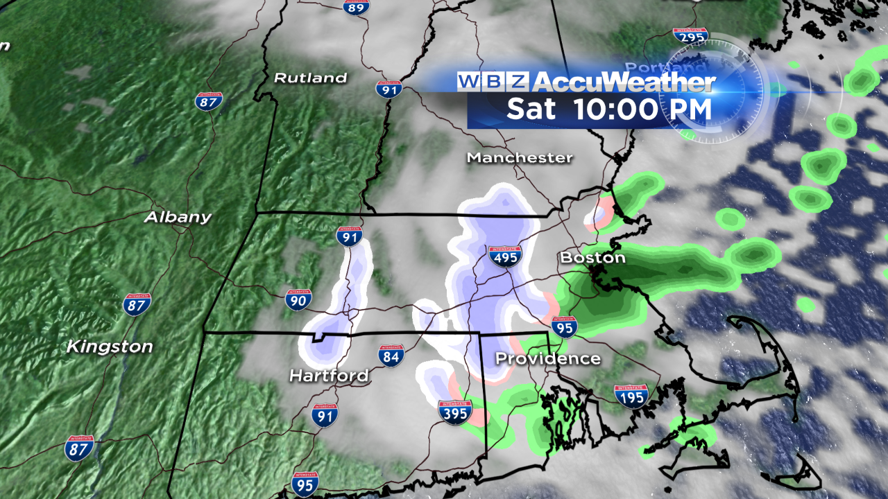
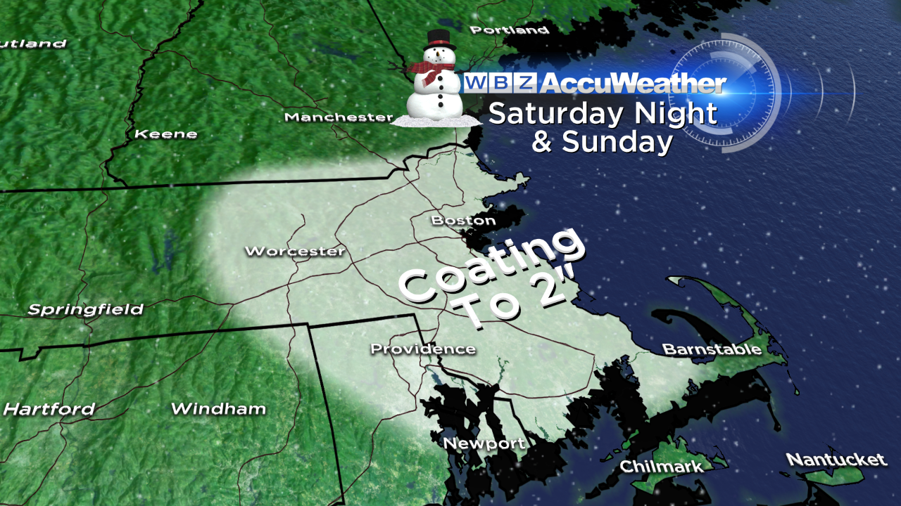
So what does that mean for us? There may be some light areas of rain/snow developing around Cape Cod early in the morning, but for most of eastern MA it won't be until the afternoon & evening that light snow develops. There's a small outside risk that some freezing drizzle may develop and mix in with all this heading into the evening, which we'll have to stay mindful of when it comes to travel. Snowfall doesn't look terribly impressive in terms of accumulation, but we may be able to squeeze out a couple inches in spots. The best chance for those higher end totals look to be in a band just west and south of Boston, a bit removed from the immediate coastline. Not exactly a wicked storm, but enough where there may be some low visibility and poor travel at times if you're out and about. The time frame I'd be most cautious with is the evening and overnight.
There's one possible wildcard here, and that's a little wave of mid-level support that's expected to swing through Saturday evening. A 'vort-max' should pass overhead at this time, and *may* be able to enhance snowfall rates at times. We'll be monitoring this Saturday night but there's always a small risk that these types of setups can over-achieve.
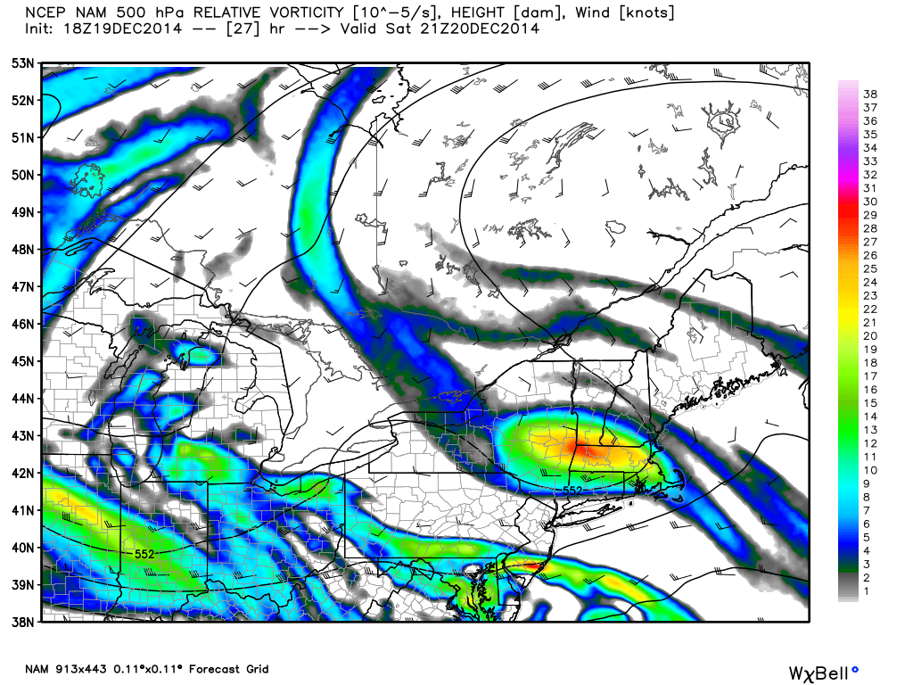
NAM forecast relative vorticity at 4pm Saturday. Source: Weatherbell
Sunday features more scattered areas of rain and snow showers, plus plenty of clouds. There's not a whole lot of sunshine in the forecast anytime soon. Most towns will stay mainly cloudy through the weekend, the exception being western MA, VT, and perhaps parts of southwestern NH. On Monday we're still expecting quite a bit of cloud cover with seasonal temps near 40.
For Tuesday we get an 'appetizer' event that may start as some freezing rain and sleet in the interior. As the day wears on it should warm enough to change that over to rain, but either way we're dealing with an overcast day. And then it's all clouds on Wednesday as heavy rain and wind swing through the region for Christmas Eve.
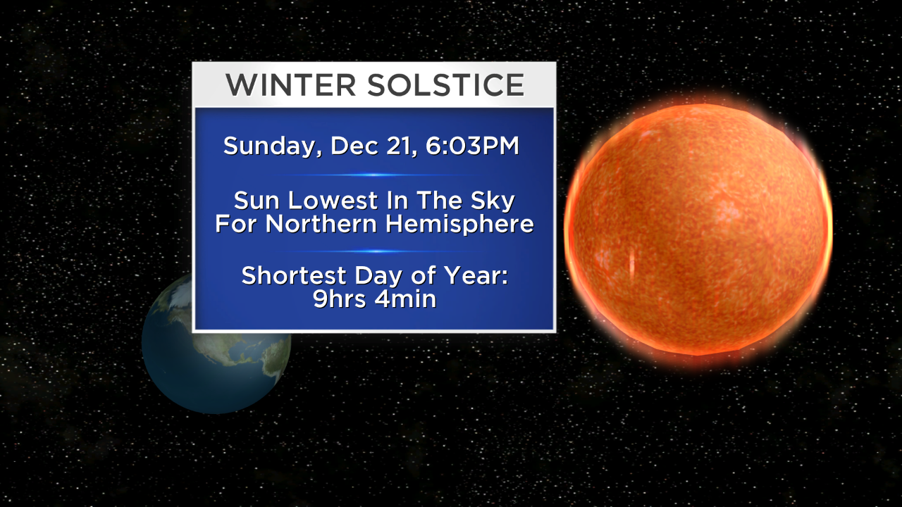
Here's some good news though - Sunday marks the shortest day of the year in terms of daylight! It's the winter solstice, taking place at 6:03pm. That means the sun will ride at its lowest point in the southern sky during the day, and we'll only manage a meager 9 hours and 4 minutes of sunshine. BUT it also means daylight is on the uptick after Sunday! Always encouraging to know we've bottomed out and brighter days are ahead of us.
![]()