Weather Threat Shifting From Icy Spots To Flooding
BOSTON (CBS) -- It was a rough morning in many communities with pockets of freezing rain and freezing drizzle hanging tough along the 495 belt in through central MA and southern NH. That all-important 32 degree line will continue to work its way northward through the early afternoon. Now, the threat is shifting to localized flooding as bands of heavy rain pivot in from the south. Reduced visibility, ponding of water on the roads, and hydroplaning will all become a bigger concern lasting through the evening commute. Plan accordingly and leave extra time and patience for your ride home!
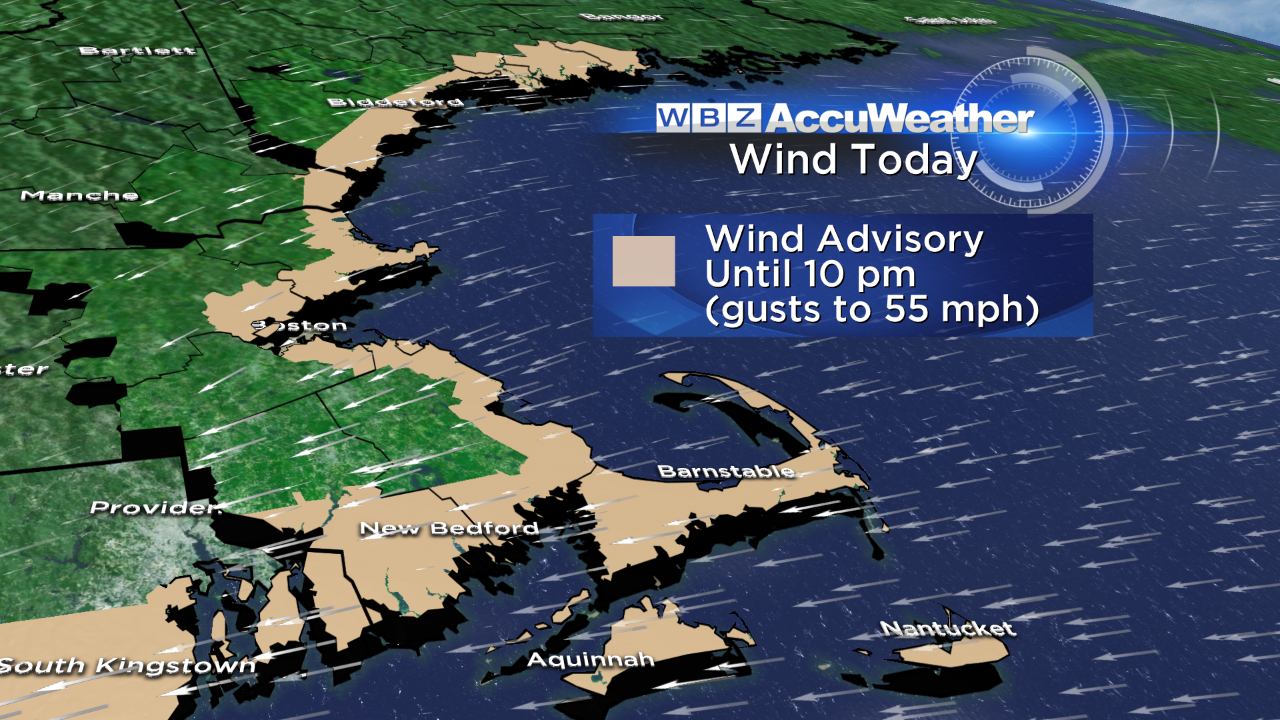
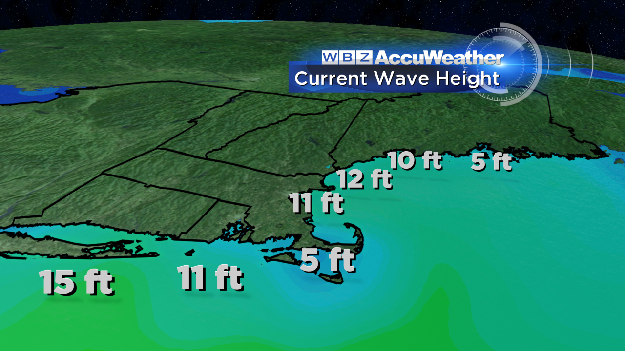
We're also building to an early afternoon high tide. The east-northeast wind has been cranking…and as a result, has built the seas along the coast. Waves have built over 10' just offshore. The typically prone spots will experience minor pockets of flooding and beach erosion through mid afternoon.
Today's weather is the worst we'll see over the next few days, but we're not out of the woods completely. The upper level low responsible for this storm will be slow to depart…very slow. In turn, clouds and occasional showers will persist through midweek. I'd have the umbrella on standby, but know there will be plenty of dry periods as well.

Barry has you covered tonight and I'll see you again in the morning!
-Danielle
MORE LOCAL NEWS FROM CBS BOSTON