More Active Weather Ahead? Two Systems To Watch
Find Eric Fisher on Twitter and Facebook
It sure has been busy in the weather office during much of October, November, and now into December. By my count we've had 5 separate 'wintry' events already with 2 weak snowy systems in early November, the larger snowstorm for interior New England before Thanksgiving, some coastal snow after Thanksgiving, and snow/icing again in the interior Tuesday night. We've got two more chances in the short-term forecast, so let's dig right in.
First up a couple of quiet days. Thursday looks nice and bright as sunshine makes a strong comeback and drier air filters in. Even though temperatures will be cooler for most than on Wednesday (especially for eastern Mass.) it should feel fine with less wind and more sun. Highs will range from the upper 30s to the NW of Boston to the low 40s across SE Mass. A perfect setup for radiational cooling will follow that, meaning clear skies and calm winds. Many towns will dip well back into the 10s overnight with some low 20s closer to the coast. Another night to get good use out of the fireplace.
Friday looks calm with morning sun and some late day clouds rolling in. Highs will stay chilly in the 30s to low 40s. No travel issues through the evening commute, but during the overnight we'll deal with storm #1. This isn't a terribly potent one, but is a good 'overrunning' setup that will encounter cold air at the onset. This should bring a mix of snow/sleet and icing overnight into the pre-dawn hours of Saturday, especially for interior MA and into NH/VT. If you have overnight travel plans, keep in mind it could be pretty slick out there. Any accumulations look to be light at this time.
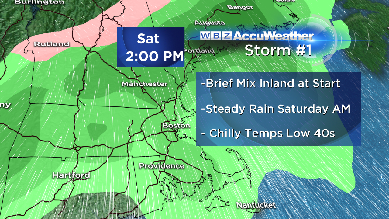
By Saturday morning temperatures both aloft and at the surface should be warm enough for all rain, and it'll be a great day to get some indoor chores done. Time to send out some Christmas cards or bake a few dozen cookies? Sounds like a solid day to me. Highs will stay stuck in the low 40s for many and you'll be packing along an umbrella if holiday shopping is on the to-do list.
This storm should be shunted to our south on Sunday as a strong area of high pressure builds over SE Canada and northern New England. With that setup, skies will be brightest to the north but clouds may linger farther to the south...and it may be possible that rain could hold on along the South Coast/Cape/Islands. That's something we'll iron out over the next couple days. Temps again look chilly in the 30s to low 40s as high pressure pumps down a colder air mass.
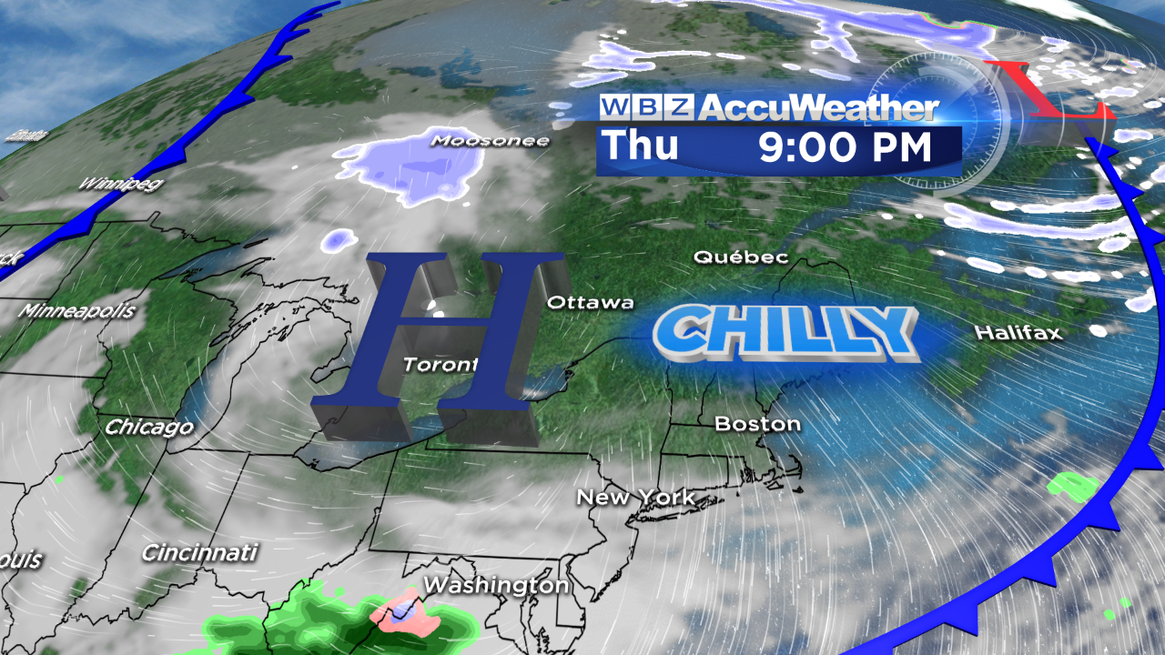
Storm #2 is the more interesting one, and it still remains to be seen whether or not it will form at all. There's low certainty, albeit increasing certainty, that one will be spinning near our coastline. The questions are the same as they often are 5 days out - where exactly will it be and what exactly will the temperature profile look like around here?
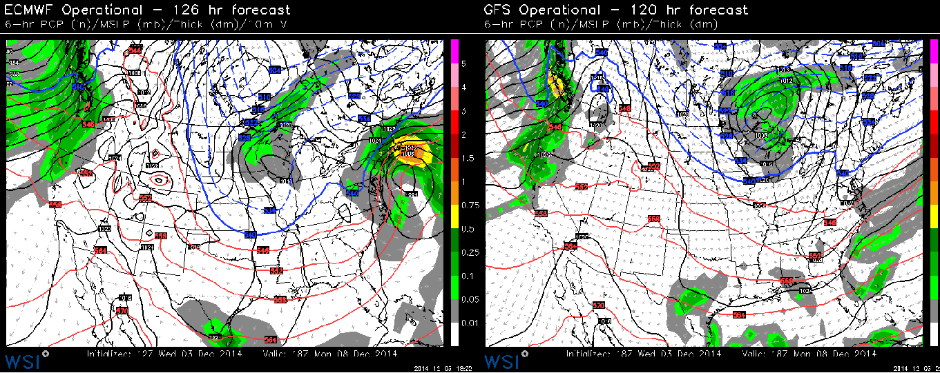
Side by side from Wednesday's model runs show the uncertainty that still exists for next week. At the same time of day on Monday, the Euro has a significant nor'easter while the GFS has absolutely nothing at all. Source: WSI Energycast
The ECMWF supports a setup for nasty weather in southern New England. A low develops to our south, with a strong high to the north. This would toss plenty of moisture into the region with a mix of snow, sleet, freezing rain, and rain. The verbatim track from today's runs is too close for any significant snow near the coast, but of course we'd expect the exact track to change a bit from what we're looking at now. The other thing to factor in is that astronomical tides are running fairly high early next week (10.3' on Monday, 10' on Tuesday in Boston). It's not as high as they go, but it's high enough that any persistent onshore flow could pump in some big surf and coastal flood/erosion concerns. The movement of the storm will also play into this - a slower moving storm will build up more water over multiple tide cycles. Something we'll keep monitoring.
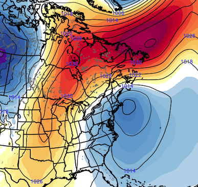
ECMWF EPS MSLP anomalies (that's a lot of acronyms that mean 'red/yellow is likelihood of high pressure, blue/purple is likelihood of low pressure). There's a pretty strong signal for a coastal low early next week. Source: Weatherbell
The GFS has been less consistent and more progressive up to this point. It keeps us dry for most of Monday, with a low quickly slipping by heading into Tuesday. It would be a much lower impact scenario.
I'd lean a little more toward the ECMWF for a couple reasons - one being its consistency, another its success in this time range, and the other being that it's easily been the most accurate model lately (you can check verification scores online, it's been performing extremely well recently). The devil is always in the details and so as you can imagine, it's too early to be able to talk totals, rain/snow lines, etc. The picture will get clearer as we draw a little closer.
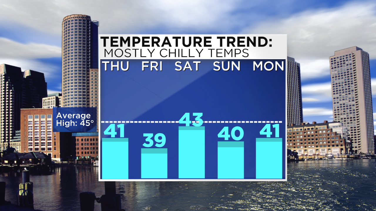
The other end of all this is the temperature story - which as I've been talking about is not as rosy as some of the outlooks around the internet have been hinting at. The CPC temp outlooks have consistently tried to put us above average, but that's definitely not going to be the case anytime soon. In fact, we may have a run of 8 straight days of below average temps Thursday through next week. It won't be dramatically below average - just a few degrees below the line. But warming air is not something we're expecting. Highs mainly in the 30s and 40s should stay put, except for potentially far SE Mass where a coastal event could bring a tongue of warmer air in.
It would be fitting if we did see a nor'easter early next week - our newest Meteorologist, Pamela Gardner, is joining us on Monday! She likely will not start on air right away as we'll have to get her up to speed on our systems here, etc. But when she does start she will be on weekend mornings and weekday fill-in, and I'm sure we'll get to hang out in a storm or two! She's had plenty of experience with wild weather coming from Indianapolis. They've had record cold and snow, record drought, record heat, devastating tornadoes and major flooding all in the past 3 years. It's given New England a run for its money when it comes to extremes. Please give her a warm welcome.