November Revelations
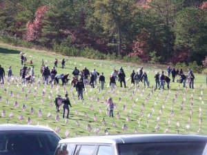
Veterans Day celebrations and tributes were held in various communities over the weekend and these will continue over the next few days. For instance, the annual Veterans Day service at Massachusetts National Cemetery in Bourne took place yesterday afternoon in Bourne. Flags were recently placed on all 57,000 graves and they will be removed on November 16. Veterans Day is a federal holiday that honors all of the people who have served in the U.S. Armed Forces.
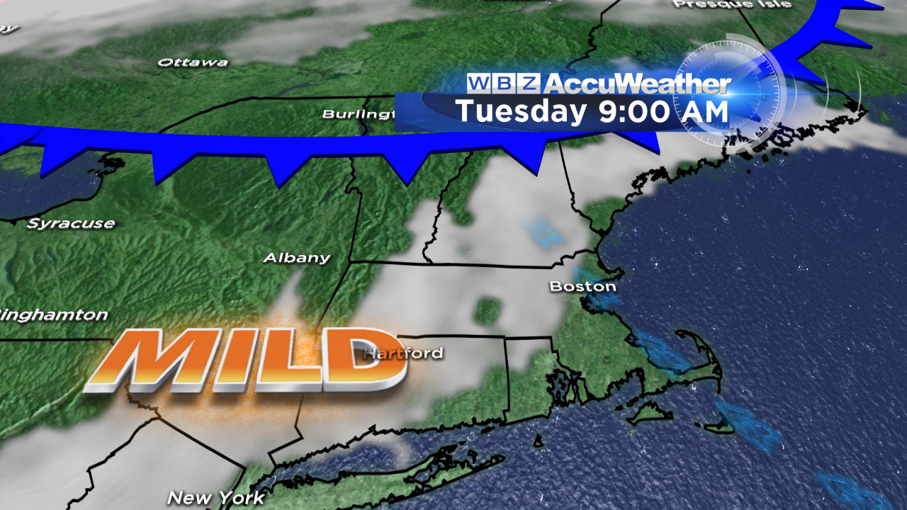
The weather for this special day will be cooperative for outside events tomorrow as the wind will be light and the temperatures will rise to the middle 50s near the coast to near 60 over many inland locations. As the air becomes more moist over the next couple of days, there is a risk of patchy low clouds tomorrow morning which should burn off in places yielding some sunshine.
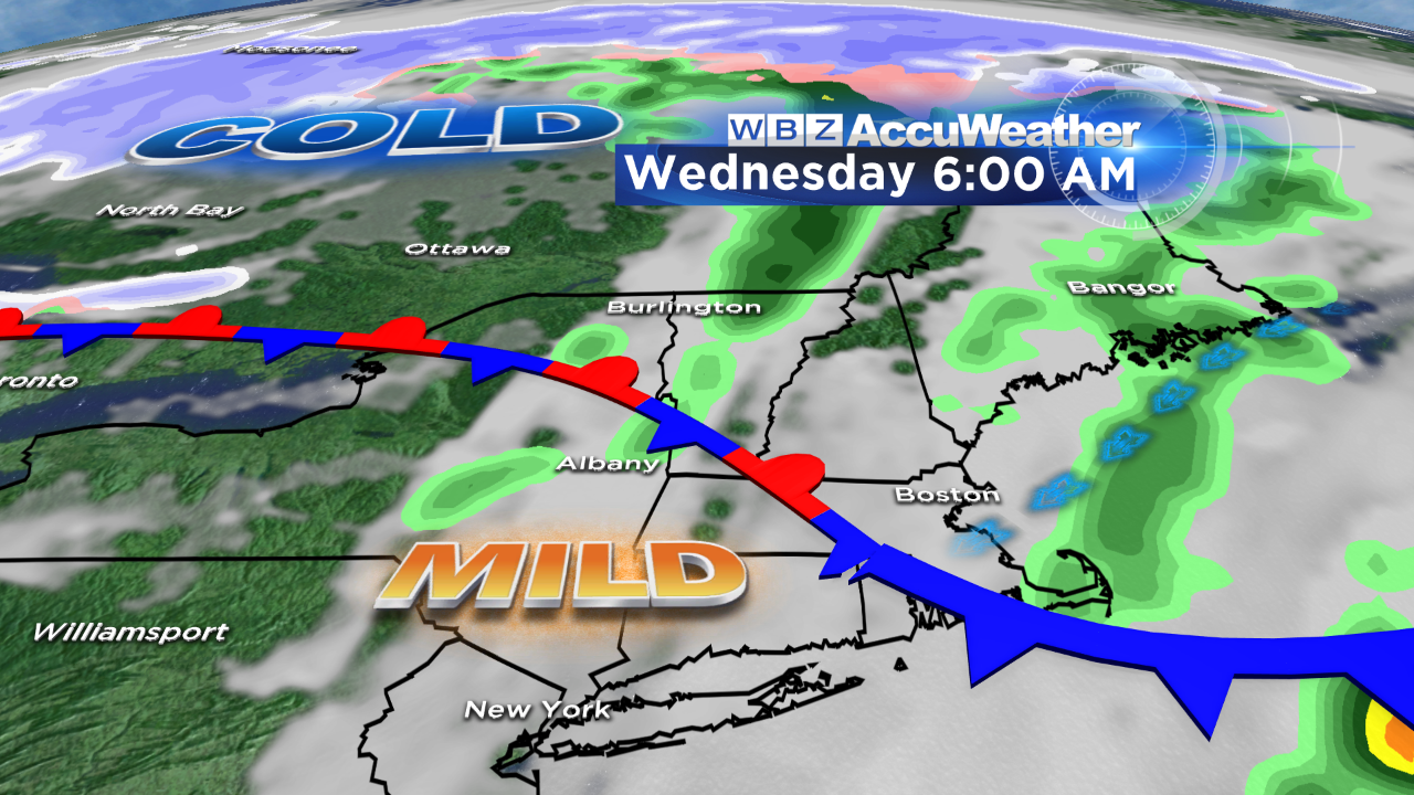
We'll be watching the progress of a frontal boundary draped across far northern New England. As a zone of high pressure builds into eastern Canada, the risk is increasing that it will ridge southwestward into eastern New England resulting in the frontal boundary pivoting southwestward as a so-called "backdoor front". This action suggests that a low overcast is likely with some migrating patches of mist, sprinkles and light showers. Sunshine will be limited and most likely popping out over portions of southwestern New England where some temperatures in the lower to middle 60s are possible. Another approaching frontal boundary from the west will clean the house late Wednesday night so Thursday will feature a return of bright sunshine and cooler weather.
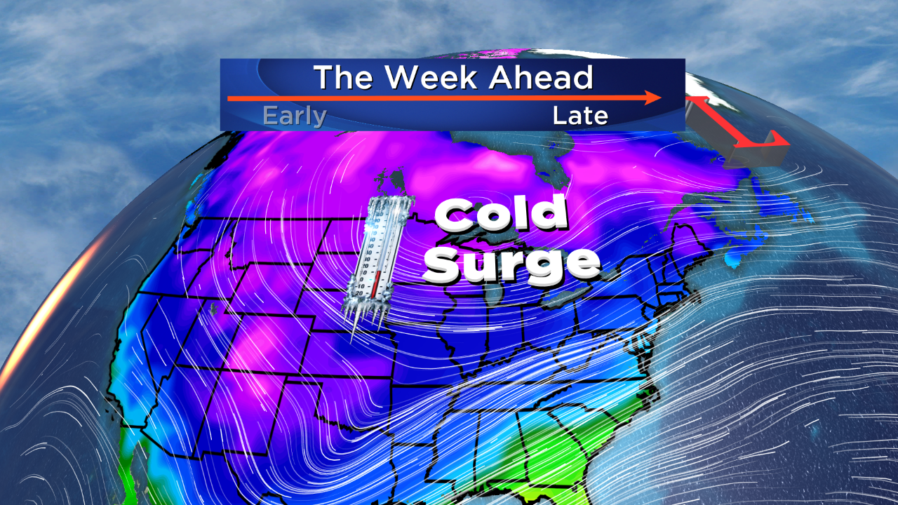
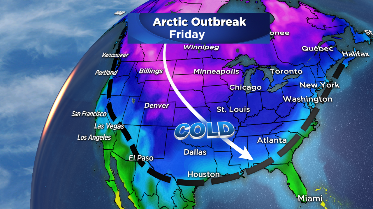 The major weather story that is going to create significant implications is the plunge of arctic air into much of the nation. The temperatures will tank by as much as 50 or more degrees in some areas especially from the northern Rockies into the Plains States. Some overnight lows may approach zero in some northern communities! This magnitude of cold is impressive but not unprecedented for November. It appears that our temperatures will be running near or slightly above average through Wednesday then turn below average for many consecutive days to follow. In fact, I wouldn't be surprised to see that much of the second half of this month will be in negative territory . Consequently, November will likely go into the record books with a mean temperature far below average. Is this a harbinger of things to come? Statistics have revealed that the existing pattern during November usually is a recurring pattern for a large chunk of the winter especially the first half. Last year, November was 2 degrees below average and all of the next several months were well below average especially March. Flip side was 3 years ago when November 2011 was the second warmest November on record at +5.7 degrees! That was followed by several months of similar warmth with March 2012 at an astonishing +8.4 degrees!! That was the year without a winter and we saved on heating bills bigtime and virtually no snow to deal with! How sweet was that???