The Party Is Over
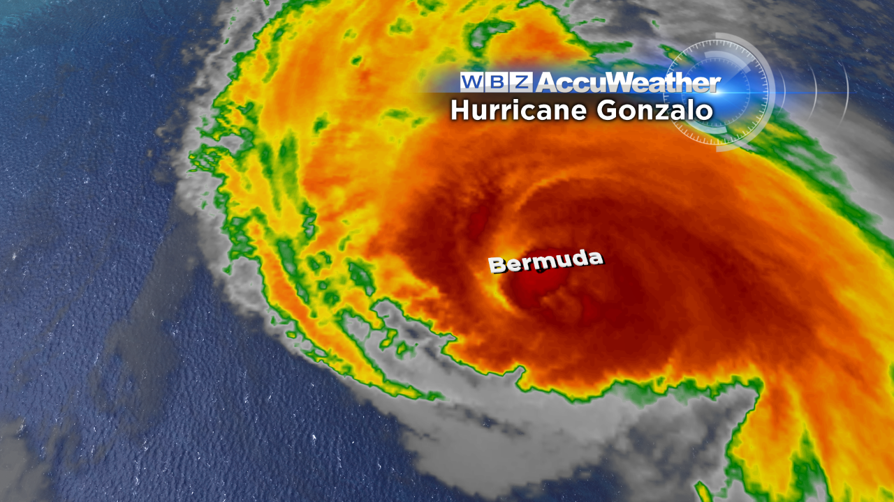
Gonzalo is gone after battering Bermuda with destructive wind, heavy rain, powerful waves and storm surge. Fortunately there are no known fatalities but there is a mess to cleanup in the wake of the Category 2 Hurricane that made landfall around 8:30 PM AST Friday. Wind gusts of 75-100 mph slammed the island as the hurricane approached but the wind dropped off to light speed as the eye crossed right over the island. On the back side, violent winds returned from the west with a sustained wind of 93 mph and a peak gust to 113 mph between 11 PM and midnight at the Bermuda Airport. At St. Davids which is an elevated observing site near the airport, the peak gust was 144 mph!!!
 Thankfully, the weather was cooperative for the 50th Anniversary Of The Great Head Of The Charles Regatta yesterday as most of the scattered showers just bypassed the race course. For today, the weather will be much different with temperatures running 15-20 degrees lower than yesterday. Additionally, the northwesterly wind will freshen to 12-28 mph so it will be much tougher rowing as varying amounts of clouds through midday give way to more and more sunshine as the afternoon evolves. There could be a sprinkle or light shower in the morning but that risk is minimal. Across the rest of the region, high temperatures will only be in the middle 50s with a cooling into the upper 40s well north and west of Boston later in the afternoon.
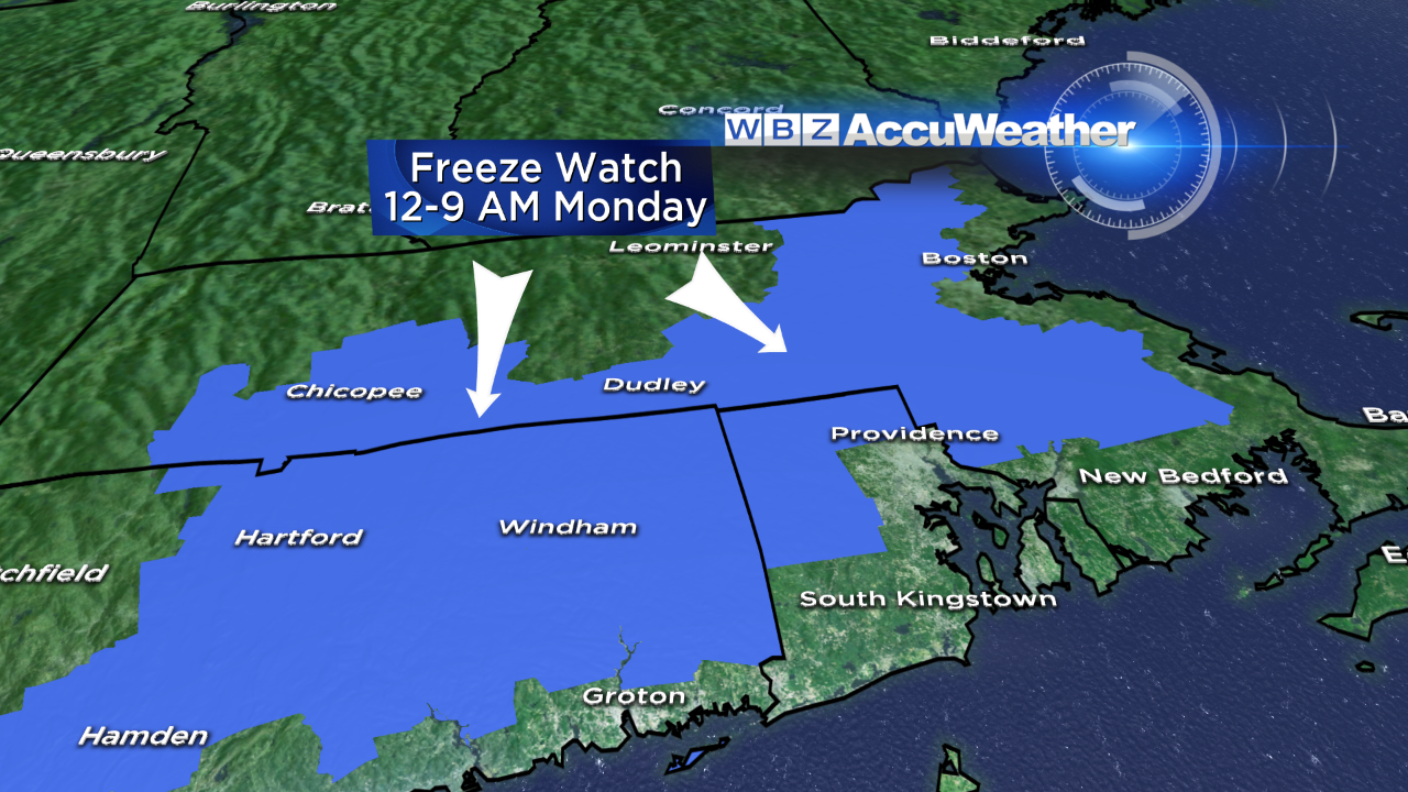 That sets the stage for a nippy weather tonight- cold enough to prompt the National Weather Service in Taunton to post a FREEZE WATCH for the potential of sub-freezing temperatures in the designated light blue area. There will be a recovery on Monday with a warm-up to the middle 50s with less wind as varying amounts of some high and mid-level cloudiness arrive.
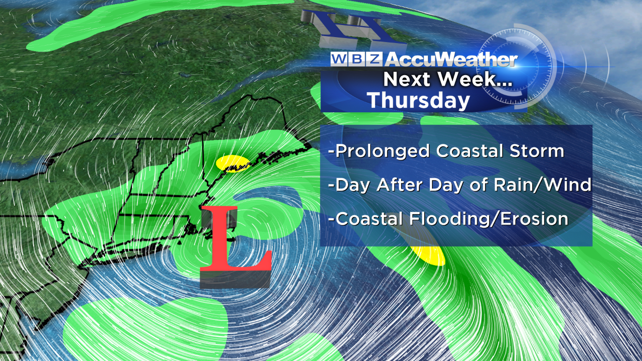 That leads us into a prolonged period of damp weather commencing on Tuesday. Initially, the system will be weak and only capable of releasing patchy mist and light rain. Eventually, as the atmosphere becomes energized and an upper level low pressure system closes off, a much stronger surface storm is anticipated. Its precise location of development and movement will determine where the heaviest rain will occur. It is too premature to be confident of the specifics at this time. There is a threat of some coastal flooding and beach erosion during this siege with the greatest potential on Thursday.
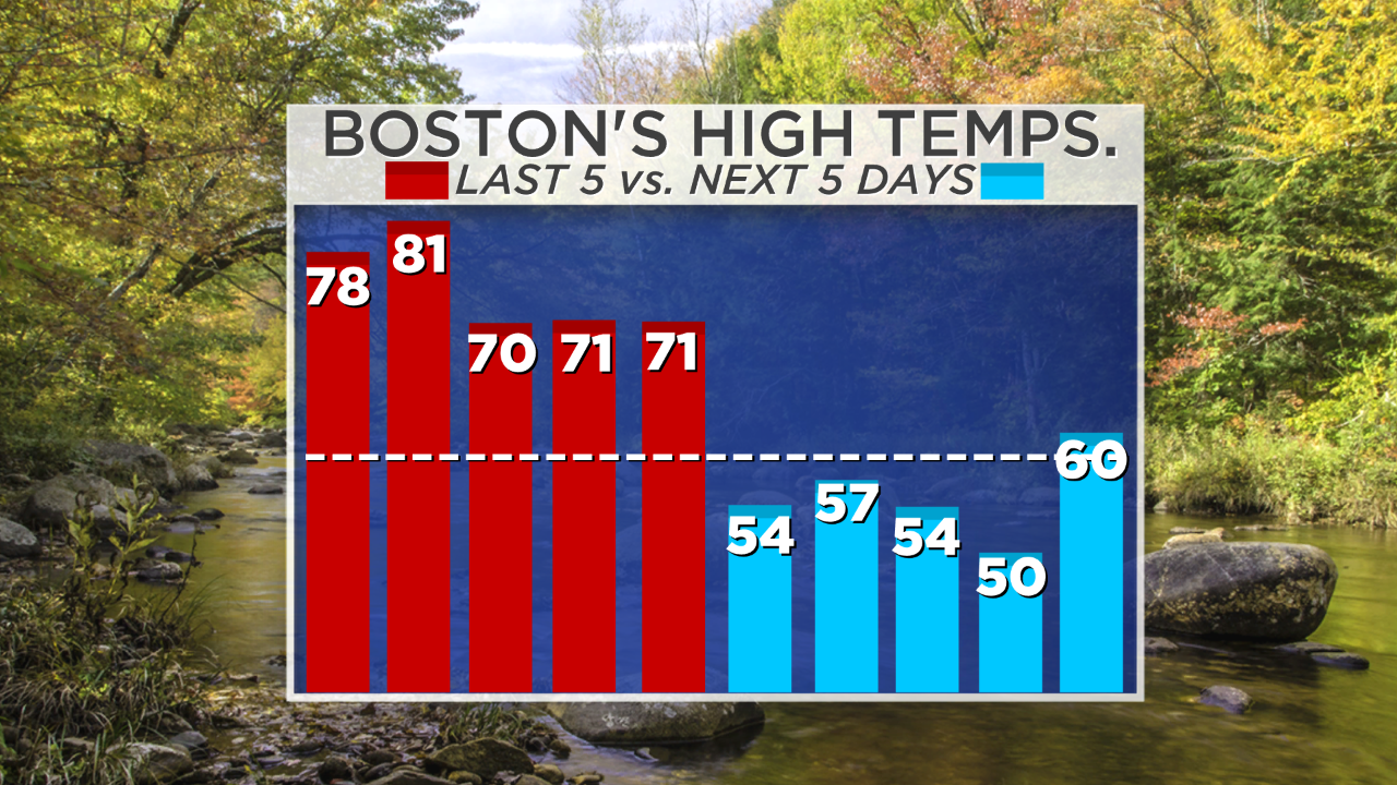 In the meantime, the party is over in terms of the pleasantly warm weather of the last five days. Which set of Boston's high temperatures is your favorite- the last 5 days or the next 5 days?
You can watch the weathercasts of David Epstein on WBZ News through 9 0'clock this morning I will return later today at 6:30 pm and 11pm.
Enjoy the rest of the weekend.