Total Lunar Eclipse In Store For Wednesday Morning
BOSTON (CBS) - There will be a rare cosmic sight early Wednesday morning. Weather permitting, you will be able to see the total eclipse of the moon and the rising sun simultaneously! The name of this phenomenon is selenelion. For more information about this rare event, check out the entire fascinating story of this total lunar eclipse by clicking on all of the links. This upcoming eclipse on October 8 is the second in a so-called total lunar eclipse tetrad which is a series of 4 consecutive eclipses that began on April 15, 2014. The next two occur on April 4, 2015 and September 28, 2015. The partial eclipse begins at 5:14 am with totality starting at 6:25 am. Unfortunately, totality will not last long here because moonset occurs at 6:53 am and that is preceded by sunrise at 6:49 am. Increasing daylight will make this more difficult to see.
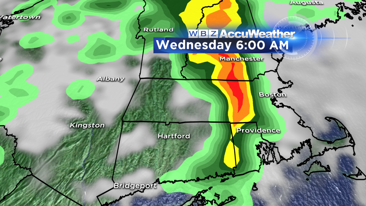
More importantly, a potent upper level impulse will be generating a line of downpours and embedded lightning and thunder and the present timing places the action over our region during the eclipse so we can only hope that there is some change of speed of this squally zone so we might be able to view it. Once the frontal boundary shifts east of the region, drier air will rush in on a brisk westerly wind under a changeable amount of clouds and sunshine. Additional scattered showers may pop up and migrate across mainly northern New England where the air will remain more unstable through Wednesday afternoon. Temperatures will rise into the range of 70-74 both today and tomorrow with cooler air advecting in tomorrow night so Thursday will be closer to 60 and Friday even cooler with a risk of a few showers mainly over southern New England. There will be a period of more humid conditions later tomorrow and tomorrow night as moist air streams in on a brisk southerly wind. It will feel much like it did on this past Saturday evening.
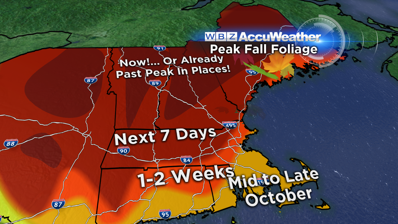 The fall foliage extravaganza rolls on with the color wave progressing south. For the upcoming holiday weekend, you will find some past peak color across portions of the northern mountains with some nice residual vibrant to muted colors. Leaf drop due to rain and wind has already commenced in many locations so you will not view spectacular color everywhere. It will be variable from place to place. For more information, check out the latest from leafpeepers! You will find lots of links and phone numbers for specific routes, etc. The current outlook for the weekend calls for high pressure to build into the Northeast providing cold even frosty nights and cool days warming up to near 60 degrees with ample sunshine. There could be some high cloudiness dimming the sunshine especially over southern New England on Saturday as a wave of low pressure sneaks out to sea. There is a remote risk that a few drops of rain could strike Long Island to Nantucket. Areas farther north should see the brightest weather.
You can watch the weathercasts of Danielle Niles on WBZ News periodically through 9 o'clock this morning and again at noon. Eric Fisher will return from vacation and update the forecasts at 5, 6 and 11pm.
Make it a great day!