Milder Weather On The Way
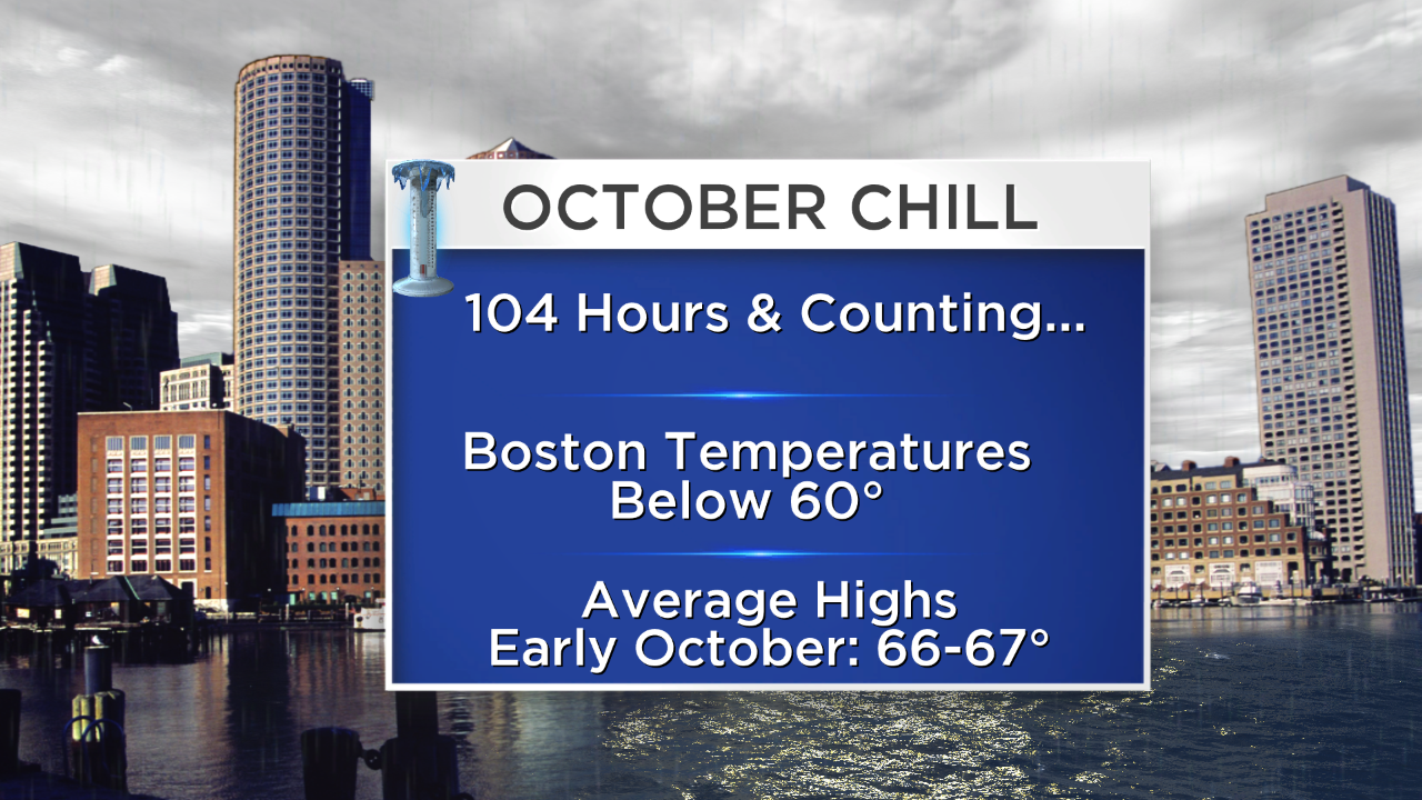
After last weekend's wonderful weather featuring a summery sizzle with even some new record high temperatures in places, Boston has endured 104 consecutive hours of readings below 60 degrees as of 8 o'clock this morning! The air should finally warm a bit above 60 this afternoon as the humidity climbs yielding a dew point destined to reach about 60 by 6pm today. This stretch of October chill will be replaced by milder weather this coming week. In fact, the pendulum will swing the other way to produce temperatures closer to a half-dozen degrees above average in the range of 71-74. The near to above average temperatures may extend beyond this coming week. Last October was very warm until the last week with the monthly mean temperature at 2.7 degrees above average which is substantial. Presently, the array of global factors in alignment with analog years suggest that this winter will deliver below to much below average temperatures overall but I am less confident of any snowfall prediction just yet. There are some cross currents to work out before my comfort index rises on this part of the prognostication.
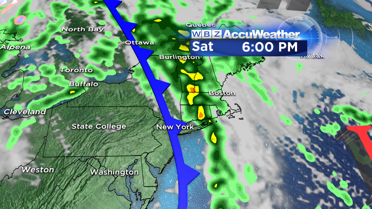
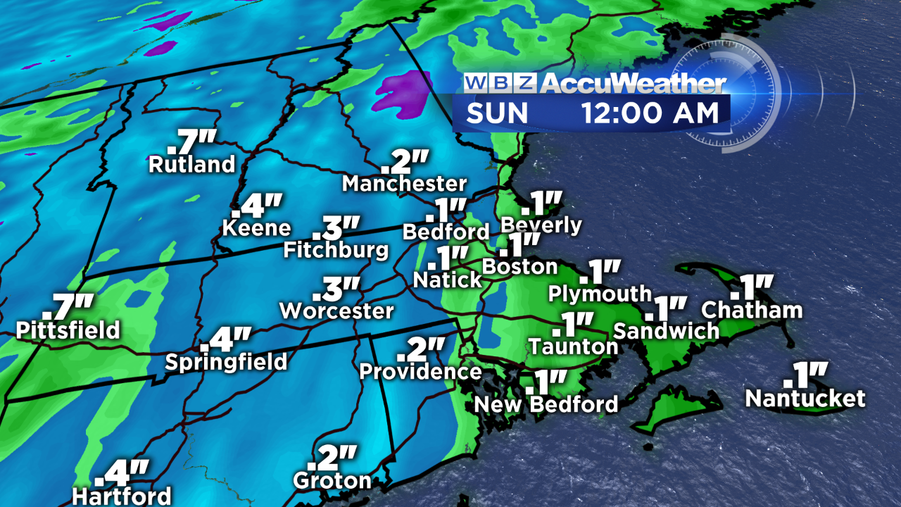 It has been a misty night and it appears that the dank, dreary, drizmal weather will be the theme of this day with droplets blossoming into drops as showery rains approach from the west. The frontal boundary responsible for this moist weather may get beefed up as it is a recipient of a shot of upper level energy late this afternoon into the first half of the evening. This is the period when the rain could be briefly heavy with isolated lightning and thunder. With that said, no excessive rainfall is anticipated that will compare to the amounts generated over southeastern MA and Cape Cod over the past few days when some locations were soaked by 3-5 inches! Instead, I am expecting in the range of a o.1 to 0.2" over southeastern MA up to 0.2 to 0.5" near and west of a Providence to Boston corridor. Additional showery spells are in the works for later Tuesday into Wednesday morning and again late Thursday into Friday. Neither of these events should be too productive.
 Once the frontal boundary shifts offshore near or just after midnight, rapid clearing will ensue and splendid nearly uninterrupted sunshine will brighten your Sunday. It will be a total 180 from today with a very dry mass of air in place and a nice westerly breeze. High pressure will build to the south of the region setting us up for a southerly breeze much of the time this upcoming week so that should ensure much milder conditions rather than the cold moist air flowing in from the Maritimes.
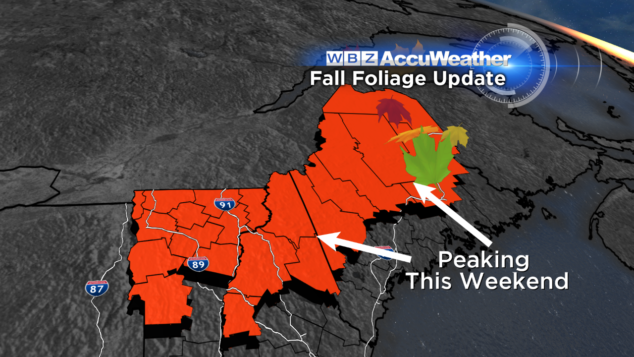 Tomorrow and Monday will be ideal days to check out the fall foliage extravaganza across New England. Some spots over the northern mountains have reached and surpassed absolute peak color but it is still stunning. Just keep in mind that the color isn't painted across the entire landscape. There will be a variability to the palate. For more detailed information, check out Leaf Peepers.
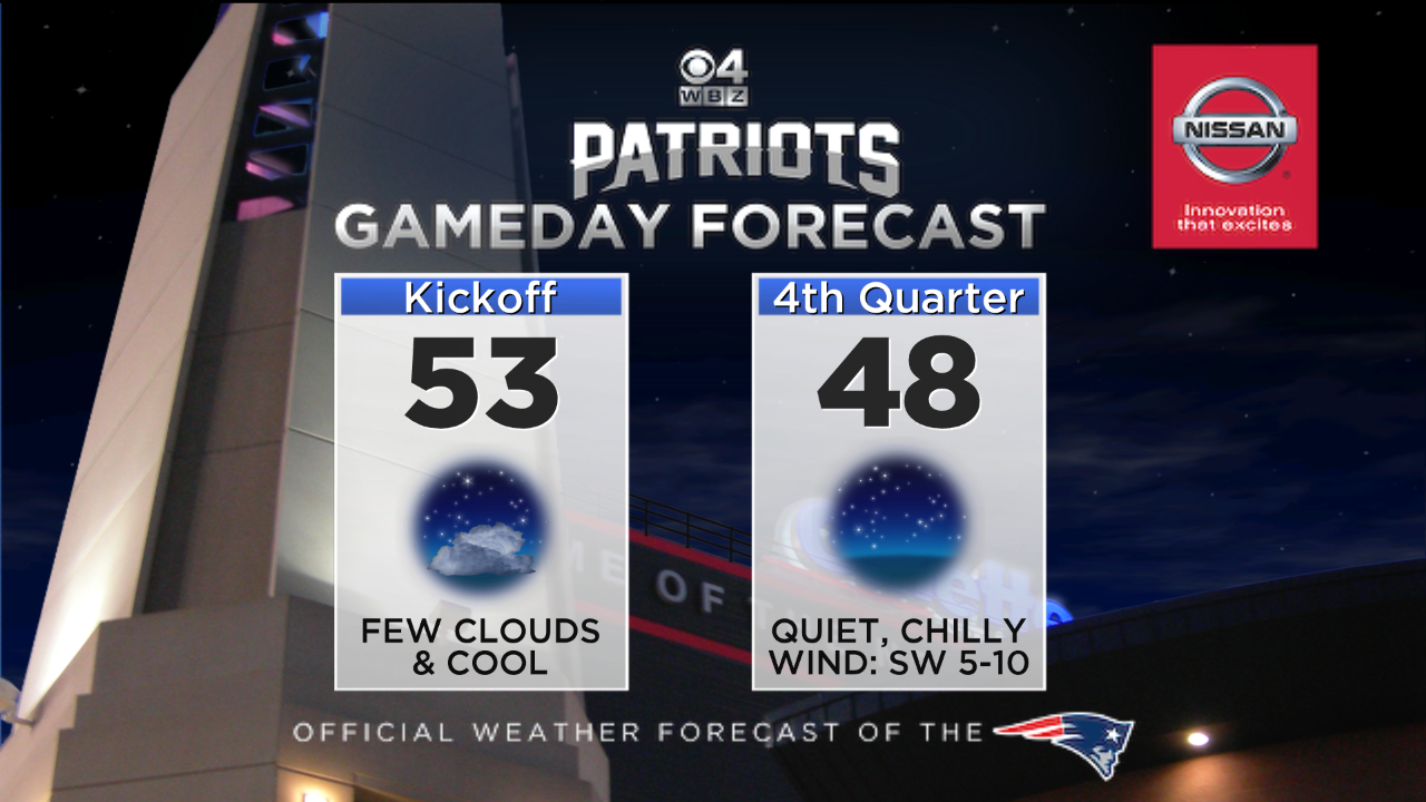 Finally, the weather will be cooperative at Gillette Stadium as the Pats host the Bengals at tomorrow night's game. You'll need a warm jacket as the temperature falls from near 53 at kickoff back down to about 48 in the 4th quarter. We would all love to see a win at this home contest but the Bengals will be tough! GO PATS!!!!
You can watch my weathercasts live on WBZ News tonight on our special Saturday evening time of 7:30PM this fall plus the regular time at 11PM.
Enjoy the weekend!


