From Summer to Seattle
The cleaning crews are here and the lights are being turned out. Was nice to get a little late summer comeback, but I think the party may be officially over.
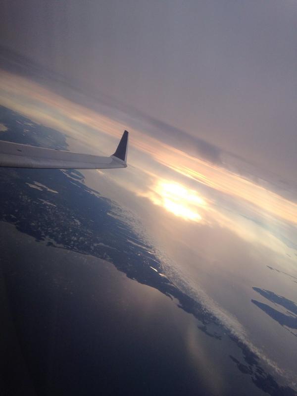
Our final glimpses of sun for a while, captured mid-flight by @wdriscollrh over Cape Cod on Monday
After the blast of record highs all across New England on Sunday you knew there was nowhere to go but down. And from reading some of the comments online, many of you might not mind that! Much cooler air is here to end September and will lead us well into October.
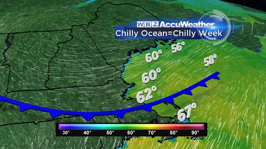
The culprit? Well you probably noticed us going from nice and mild to foggy and chilly with a hint of ocean aroma yesterday. That was your backdoor cold front, so named because they move in from the northeast instead of the more typical western direction. We're now firmly in an onshore flow, and the pattern is not going to move much for the rest of the week. Ocean temps off to our NE are in the upper 50s/low 60s, and that's what we'll be getting for highs.
In fact, pretty much every day through Thursday looks the same this week. Each one will feature a damp air mass coming in off the ocean, mainly cloudy skies, and a few chances for rain. Good weather for naps, coffee, and running. Any rain looks to be spotty, and I think it'll be more drizzle than anything else. Still a good idea to keep the umbrella handy. This is a very similar setup to what we get in April, albeit slightly less painful. That time of year the water temps are in the 40s...let's not rush it!
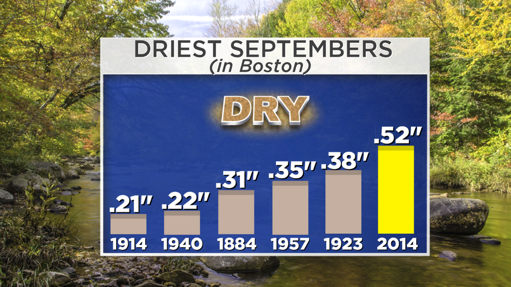
With very little in appreciable rain expected outside of some spotty showers and drizzle, it's looking very likely that Boston will hold on to its current ranking of 6th driest September ever recorded. As you've read on the blog recently, that will make it the driest September since 1957. Seems we can't buy a drop! The only place that's seen any decent rain is the Cape/Islands last week where 1-2" of much-needed rain fell. The search for a nice, long, region-wide soaking continues. I'd put the max total on rain for all of this week combined is around 1/2", and that's *if* a couple towns can get lucky. Highest chance of seeing some actual rainfall would be across far eastern Massachusetts.
By Friday, winds will veer a little more southerly. This should help at least get us into the mid 60s, and perhaps even offer us a little sunshine. It's our best chance at seeing it during the work week. By Saturday another front will be approaching - this one from the west. Models are spitting out a good dose of QPF (rain, essentially) with this front, but I'm very skeptical. This is exactly the type of setup that usually looks good from afar, but is far from good. The energy is directed more toward New York and the eastern Great Lakes, and this is probably where most of the rain will go. For now, thinking that all we'll get on Saturday is a thin band of gusty showers coming through the region - not the strong dose of rain we need.
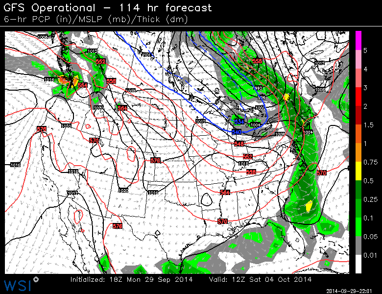
The model output looks good for Saturday - but extremely skeptical. These situations rarely pan out for us. Source: WSI Energycast
The sun will FINALLY return in greater quantity by Sunday, along with a shot of cool and dry air. We may continue to avoid frost though as this cold air looks pretty progressive, so your mums are looking good if they weren't bit by the frost a week and a half ago. It does however look like a more typical, seasonable stretch of temperatures is in the cards for us. I'd say it's fairly likely that the mid/upper 80s we saw on Sunday are the warmest temps we'll be seeing around here until perhaps May next year.


