Cool Times Setting Up Shop
Find Eric Fisher on Twitter and Facebook
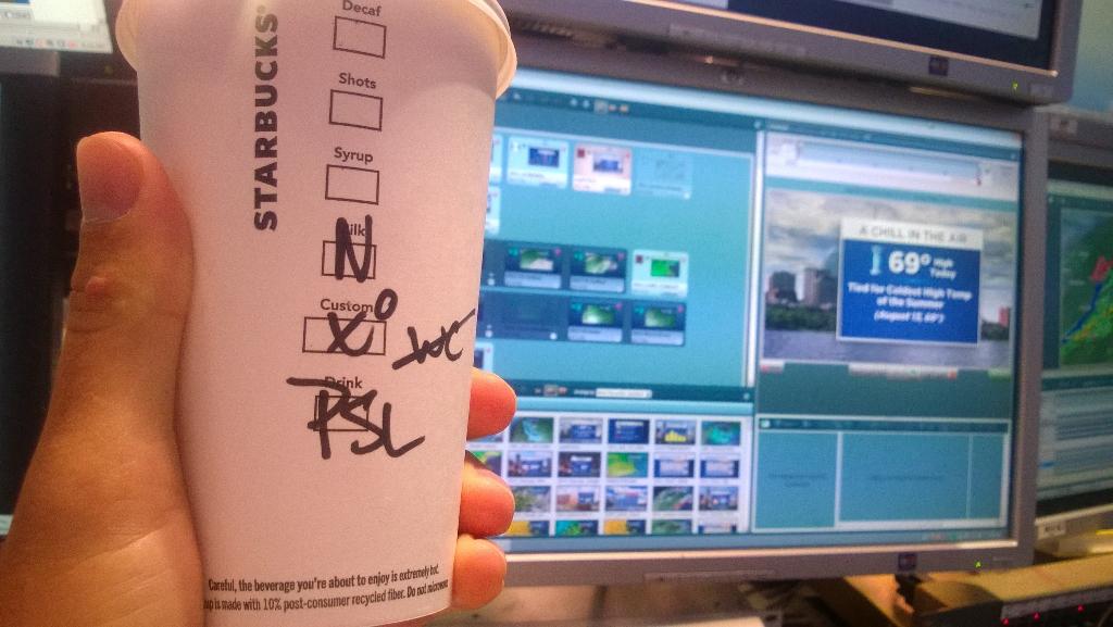
First pumpkin spice latte (PSL for the addicts) of the season. Gotta say...didn't have that same taste I remembered. Years in news turning my taste buds toward black coffee perhaps?
Snow lovers are already salivating about December. Summer lovers are sobbing tears of ice cream and lemonade. And the rest of us? Just happy it isn't too hot or cold out there. Fall weather has decidedly descended upon us here in New England. And while it's nothing unusual, it's a definitive changing of the guard after a scorching start to September. I'm here to tell ya - it's here to stay for a while!
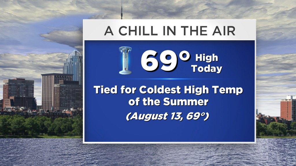
The flow stays onshore today as we stay squished between high pressure to the north and stormy weather to our south. That spot between the two yields highs again in the upper 60s to low 70s, an ENE wind, and variable cloud cover. The farther SE you go, the more clouds which will filter away the sun. The farther NW you go, the brighter the skies will be. Couldn't rule out some stubborn low clouds or patchy fog for the Cape & Islands, especially during the first half of the day. But any significant showers/rain will stay offshore to our south.
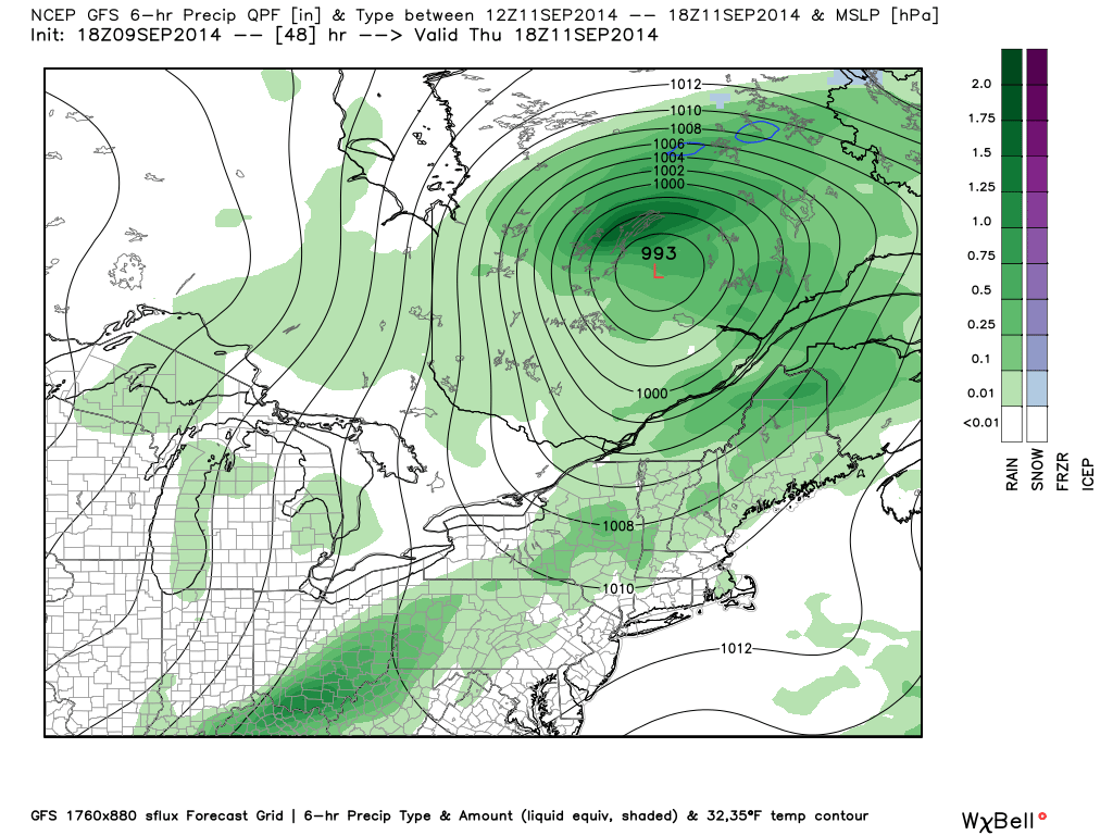
Thursday setup - strongest energy heads off to the north, but cold front should still spark some downpours/few storms.
Not very pumped for all this cool weather? You'll get a brief break on Thursday. Not expecting bright and sunny skies all day, but winds veering around to the south-southwest will help bring some milder and more muggy air back into the region. Some towns could push 80º before showers and a few thunderstorms pop up along a front in the afternoon. This front is responsible for all sorts of mess in the Midwest, but will be losing some of its power by the time it gets to us. The main 'thrust' of energy will be stunted off to our northwest, and the moisture return will be on the meager side. Even still, there should be enough wind shear and instability around to generate a few thunderstorms with locally heavy rain.
By Friday morning this front will have pushed offshore, but not by much. The biggest question mark in the forecast is how far east it makes it, and whether or not it'll stay out to sea through the start of the weekend. Right now I'm thinking we may get a lingering shower early on Friday, but that the majority of the day will be dry. A buckling jet stream should throw another disturbance at us late Saturday, helping to further push this front out to sea. But in terms of the big chilly push that much of the nation will see - I'm not expecting it here. The coolest of the cool should stall out to our NW, not quite making it all the way down into southern New England.
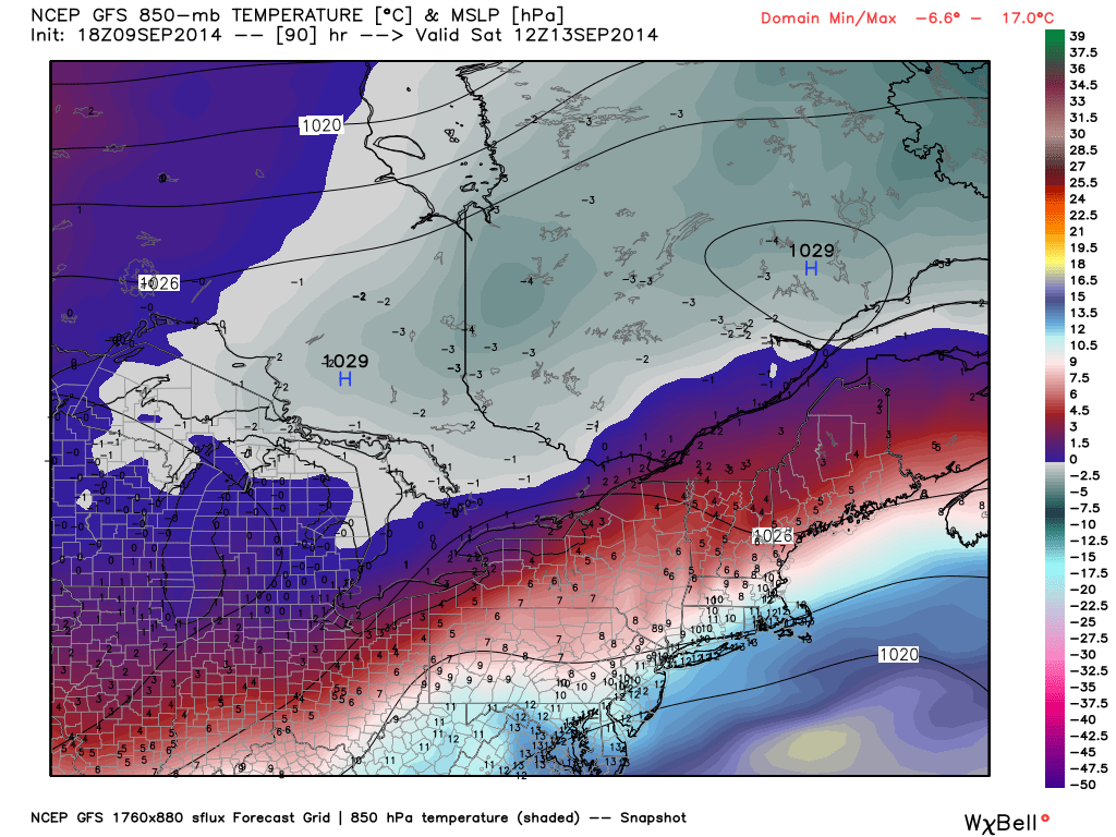
Much like Kramer, the coldest air will likely 'stop short.' Source: WeatherBell
Even though we don't get the deep chill, temps should run below average this upcoming weekend and into the start of next week. We're talking mainly 60s with a few 70s Saturday through Tuesday of next week. Rain chances look highest with Thursday's front, a slight chance Friday, a good chance late Saturday into Saturday night, and then again perhaps late Monday into Tuesday. The exact timing of the weekend and early week disturbances are still a little uncertain, so stay tuned for updates on that front (no pun intended).
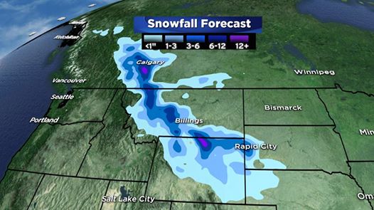
Could be worse? Over a foot of snow will fall over the next 36 hours across the higher peaks of the northern Rockies. This after Alberta Province got thwacked with snow to start the week (especially in the Calgary area).