Spectacular Summer Day Thursday
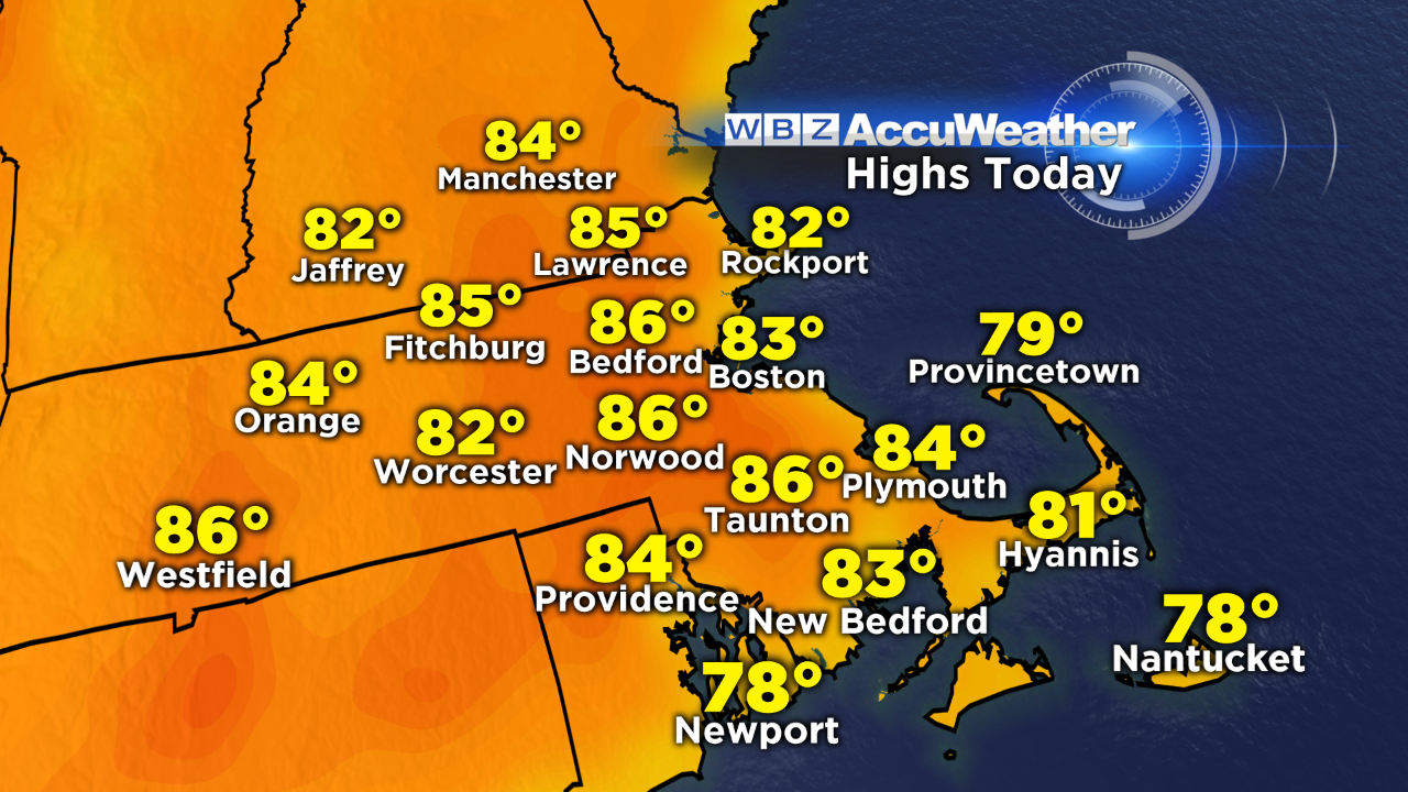
It's been a spectacular start to our Thursday out there – a cloudless sky, comfortable temperatures and dry air in place. With high pressure in control, we'll see another splendid summer afternoon with highs climbing into the mid 80s inland and low 80s at the coast with light sea breezes kicking in later on.
Tomorrow, that fair weather dome shifts farther east, ushering the return of humid air. It won't be as oppressive as it was on Tuesday, or as hot – but we will approach the 90 degree mark in many communities.
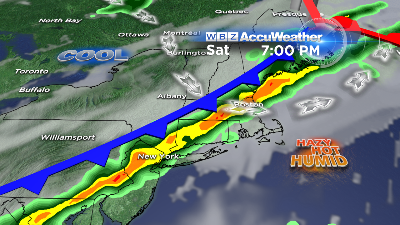
In terms of any wet weather, Saturday will feature scattered thunderstorms as a cold front sweeps through the region. We'll monitor the timing of the front closely these next couple days – but right now it looks like the timeframe of biggest concern would be 2-10 PM from the interior to eastern MA, respectively. Strong to severe storms will be a possibility with localized damaging wind gusts being the highest threat. This weather boundary marks the leading edge of cooler, drier air that will arrive to New England on Sunday and stick around for the start of next week.
Hope everyone is having a great week!
Danielle


