Labor Day Weekend! OUCH!
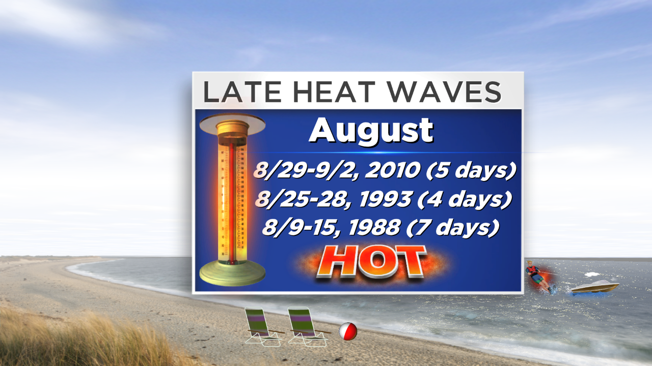
Boston's 91 degrees on Wednesday is the 5th day this year that the temperature has eclipsed the 90 degree mark which is way below the average. Based upon records over the past 140 years, 2014 is in 17th place for the least number of such hot days. Before Wednesday, the city was tied in 10th place with 7 other years for the least number of 90-degree days. There still has not been one heat wave in the Boston area this year which is quite remarkable. August, on average, delivers 3 days over 90 but 4 years ago, we got a 5-day heat wave commencing on August 29th and ending on September 2. As the jet stream shifts farther south in September, heat waves are rare for the month. There have been only 3 in 140 years. Remember that heat waves are comprised of 3 consecutive days at 90 or higher. The last heat wave for September occurred more than 30 years ago in 1983 with a minimal 3-day heat wave from the 5th through the 7th. On average, September features one day at 90. Last year, there was one really hot day as the temperature spiked to 97 on 9/11!
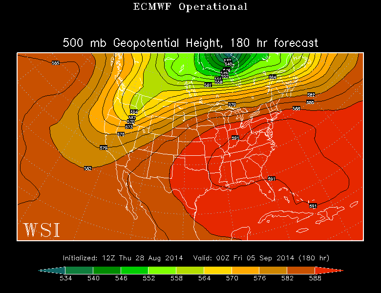 We are not done with the heat this summer. Despite the conclusion of meteorological summer this Sunday, August 31, there is a shot that the temperature could make a run for 90 degrees again. Furthermore, this latest upper air map( Courtesy: WSI Energycast) shows that a building high pressure system over the eastern USA next week suggests that a summery week is in store with the possibility of another 1 or 2 days nudging 90 degrees sometime during the week say Wednesday or Thursday. Eventually, surface high pressure building across Canada could produce a backdoor frontal passage with cooler air flowing in from the ocean at low levels. We shall see. For now, it seems reasonable to predict that the first week of September will be warmer to much warmer than the first week of August was.
Before that happens, it will be cool today and tonight with temperatures rising only to the middle 70s away from the ocean with 70 degrees at the beaches today. A ramp up to near 80 is expected tomorrow except it will be cooler at especially south-facing coastal areas. The air will be nice and dry through tomorrow then become quite humid Sunday into next week. Near 90 is possible on Sunday with 85-90 degrees daily much of the week. Overnight lows will rise up from the 50s tonight to the lower 60s tomorrow night to the upper 60s to near 70 for several following nights.
 High Surf Advisory is still posted through much of today primarily for the beaches of the South Coast from RI to the outer Cape. Seas will subside from 6-12 feet early in the day to 3-6 feet later in the day with smaller swells on the east coast and over Cape Cod Bay. Be cautious of the high rip current danger through today with a lower risk over the weekend. High tides will occur from mid-late afternoon through this holiday weekend. Ocean temperatures continue to be high at 67-73 degrees. For boaters, the visibility will be good through most of tomorrow then lower in haze on Sunday with just a chance of some fog patches over the ocean Sunday into Monday. The wind will veer from easterly at 6-12 mph today to southeast to southerly at 10-15 mph tomorrow and south-southwesterly 10-20 mph on Sunday into Monday.
The approaching cold front will trigger some scattered showers and boomers over northern New England Sunday afternoon and some of that action may stray into MA well north and west of Boston by late afternoon. The showers and boomers may spread out over the region Sunday night into Monday but there should be some breaks of sunshine on Labor Day.
You can watch Danielle Niles on WBZ News through 9 o'clock this morning as she periodically delivers her weathercasts and I shall update the information later today at 5, 6 and 11pm.
Have a happy and safe holiday weekend!