3 Soggy Ones!
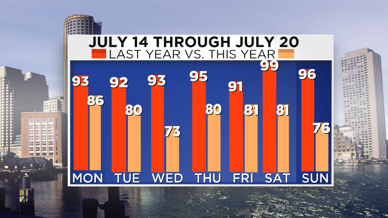 Here is a hindcast/forecast chart that I prepared yesterday which shows the July 14-20 high temperatures of last year vs. my WBZ AccuWeather Forecast for the same days this year which is this week. Was last July hot or what? That was one of Boston's longer heat waves on record lasting 7 days and climaxed by the 99 degrees on the 19th of July. After that sizzling July, there were no days at 90 or higher last August. I expect about 3 or so such days this August. These same 7 days this year will be much cooler than last year but closer to or somewhat below average for the dates. The coolest of the next 7 days will be Wednesday at almost 10 degrees below average followed by Sunday at 7 degrees below average. The humidity will be high to oppressive today and tomorrow decreasing to moderate Wednesday morning then low Thursday and Friday.
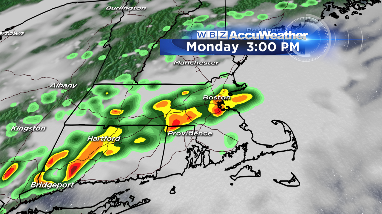 The atmosphere is primed to deliver spells of showers and storms now into Wednesday. They can occur at anytime not just the afternoon hours. Amidst this muggy air, plan on drenching downpours in places causing street and urban flooding especially in poor drainage areas. Most of today's action will pop up mainly this afternoon then episodes of showers and storms will occur through Tuesday. Some of the boomers will contain some nasty cloud to ground lightning plus potential strong wind gusts and hail. There could be a few splashes of sunshine but the clouds will tend to rule through midweek. With a gigantic blocking high pressure system over the western Atlantic, a cold frontal boundary will be floundering along the eastern seaboard. Eventually, it will shift eastward so the axis of action will move offshore. The final impulse will traverse the front on Wednesday .
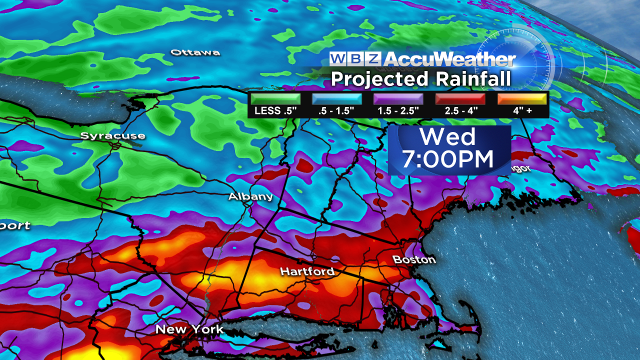 This is one model solution depicting the potential copious amounts of rain for the region ending later Wednesday afternoon. It looks like 2 up to 4 inches will soak the landscape. The next zone of high pressure will ridge in from the Great Lakes and Midwest to provide some more delightful weather on Thursday through Saturday. Temperatures will return closer to the average and sunshine will be prevalent. There is a slight risk of an isolated shower Thursday from a few patches of clouds but the air will be much drier and Friday will be the best day of the week. The next frontal boundary may arrive early enough to foul up next Sunday with some showers.
Todd Gutner is back from vacation and you can watch his weathercasts on WBZ News through 9 o'clock this morning and at noon with Eric Fisher presenting the evening forecasts at 5, 6 and 11pm. Make it a great week!