Tropical Storm Arthur Could Washout 4th Of July Fireworks In Boston
BOSTON (CBS) - The forecast for the next few days, including the 4th of July, is coming into better focus.
Download: CBS Boston Weather App
There is a severe thunderstorm watch until 9 p.m. Wednesday for all areas north and west of Boston. These storms may contain hail, lightning, damaging winds, and downpours.
As for Tropical Storm Arthur, it appears as though it will strengthen into a hurricane at some point Wednesday night.
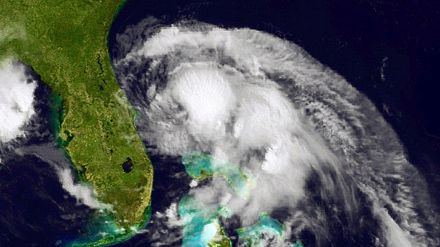
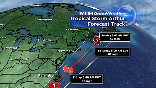
It will make its closest pass by southern New England Friday night.
The current forecast track is between 50-to-100 miles east of Cape Cod and Nantucket.
This would almost assure us of a washout in most of eastern New England Friday afternoon and night. While there is still some wiggle room with the track of Arthur, the window is shrinking fast.
Check: Tracking Maps | Current Conditions | Interactive Radar | WBZ Weather Blog | Forecast Maps
Here's a timeline of what to expect:
THURSDAY
Morning:
We get a surge of tropical-like air early in the day, which could produce a quick shower or downpour. The air gets a real soupy feeling, as temperatures in the morning will be in the 70's, rising into the 80's by midday. Other than that early shower threat, we should stay dry.
Afternoon:
Partly sunny, hot and very humid, with temperatures in the upper 80's. I expect most of the showers and thunderstorms to develop well to the north and west of Boston in central and western Mass. As the afternoon wears on, the thunderstorm coverage and intensity will increase and many will begin to drift into central and perhaps eastern Massachusetts.
Evening:
Heavy downpours and potential severe thunderstorms continue. We still expect the heaviest rain to fall north and west of Boston, however the threat in eastern Mass. does increase during the late evening and overnight hours.
FRIDAY
Morning:
A "PRE" will likely set up somewhere near or just west of Boston. This is short for "predecessor rain event" and it's common before tropical storms.
Essentially, a band of very heavy rain is likely to form and dump copious amounts of moisture somewhere in southern New England. It's hard to pinpoint an exact location, but the best guess would be just west of Boston in central Mass. We cannot rule out showers and downpours right in Boston as early as Friday morning.
Afternoon:
Heavy outer rain band from Hurricane Arthur will likely shift eastward into the Boston area. The weather models today nearly all agree that Friday afternoon will be wet in eastern Mass.
Evening:
Arthur will make its closest approach to southern New England, but it will still be 50-to-100 miles or more away from Nantucket. The heaviest rain will be over southeastern Massachusetts, Cape Cod and the Islands. BUT there will likely be some spiral rain bands which reach as far north as Boston and perhaps even to Worcester.
IF the current track for Arthur holds and does not shift farther east, I would expect Friday evening to be very wet for most of eastern Massachusetts.
There may be as much as 3-to-5 inches or more of rain in southeastern sections.
Check: Fireworks Displays | Pops Concert Webcast | Esplanade Guide
NO DIRECT HIT
Thankfully, I think we can all but rule out a direct hit from Arthur in southern New England. The winds will be minimal, perhaps just Nantucket or the very outer Cape may get into the outer edge of the tropical storm force gusts, around 40 mph.
The rain is the biggest threat, with some inland flooding possible from the tropical downpours Thursday and Friday.
Coastal flooding does not appear to be a concern, however the seas will rise quickly on Friday and likely stay rough through at least Saturday.
Those planning on spending time in the ocean on Friday or Saturday should heed all warnings and perhaps reconsider their plans.
Again I would stress staying tuned to updated forecasts throughout Wednesday, Thursday, and Friday.
Follow Terry on Twitter @TerryWBZ
MORE LOCAL NEWS FROM CBS BOSTON