Annoying Arthur
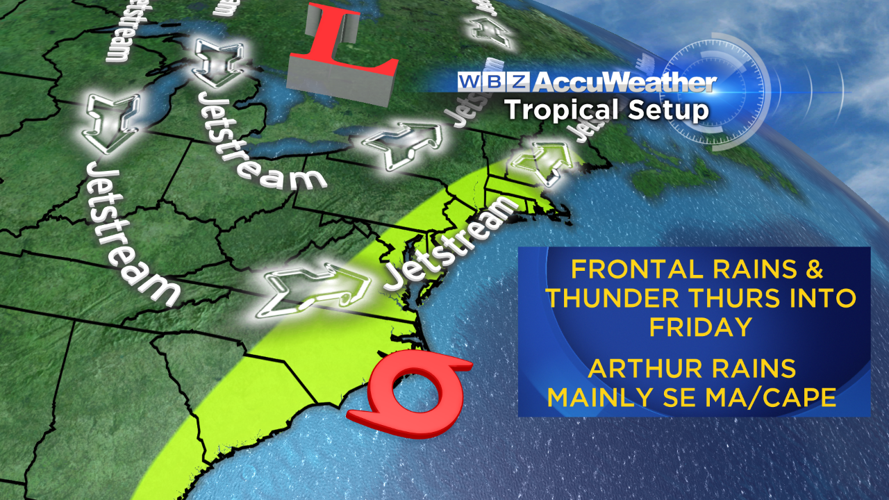 Can you believe that June is over? It is rather sad because it was really beautiful this year. We enjoyed many sunny, warm days and comfortably cool nights. The humidity was low much of the time with only a few brief spells of muggy weather. Now it's July and sticky and we're tracking a tropical storm which is rather rare for this early in the season in this area. It is particularly annoying to deal with it around the 4th of July when we all want to celebrate Independence Day with delightful summer weather. In my opinion, the evolving pattern indicates that a progressive trough of low pressure approaching from the Ohio Valley and Great Lakes will kick Tropical Storm Arthur off the North Carolina coast and out to sea probably at least 150 miles south of Nantucket. Most of our badly needed rain will be triggered from a frontal boundary associated with that trough. With tropical air in place, some tropical downpours are possible in an axis of action which will shift southeastward across the region Thursday and Thursday night.
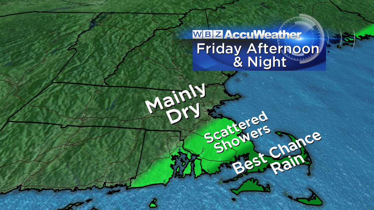 The real uncertainty is tied up with the timing and strength of that frontal boundary as it settles into southeastern MA and Cape Cod on Friday. Will additional elements of rain keep firing and working up along the front and maintain soggy weather over Boston or will the northern fringe/back edge move out of the city in time for the concert and fireworks on the Esplanade? I am cautiously optimistic that drier conditions will arrive to save the day but it is not completely etched in stone just yet. It could rain over Cape Cod into much of Friday night so festivities are destined to be dampened down there. Once Arthur accelerates beyond our longitude, refreshing air will be drawn over the region for another splendid weekend. Saturday will feature abundant sunshine and a brisk northwest to westerly wind with highs near 82. Sunday will be sunny with a warmup to near 88 with low humidity.
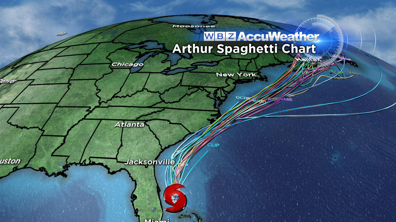 The forecast tracks from a myriad of tropical models depict the closest shave with North Carolina later Thursday. By then, Arthur may be a Category 1 Hurricane with winds to 80 mph on the Outer Banks. At that point, a critical turn is necessary to prevent a nasty blow to New England. The most reliable non-tropical model has been steadfast in turning Arthur more sharply out to sea due to the advancing kicker system. I am not buying the model which tucks the storm much closer to the coast all the way up past New England. Presently, I predict that the core of strongest winds will stay well south of the region but it cannot be ruled out that Cape Cod receives a spell of 20-40 mph northeast to northerly winds later Friday night into early Saturday. That is the period when the northwestern fringe of the envelope of rain from Arthur could stream over that area. With the passage of Arthur, larger waves will thrill the body and board surfers this weekend but dangerous rip currents will exist.
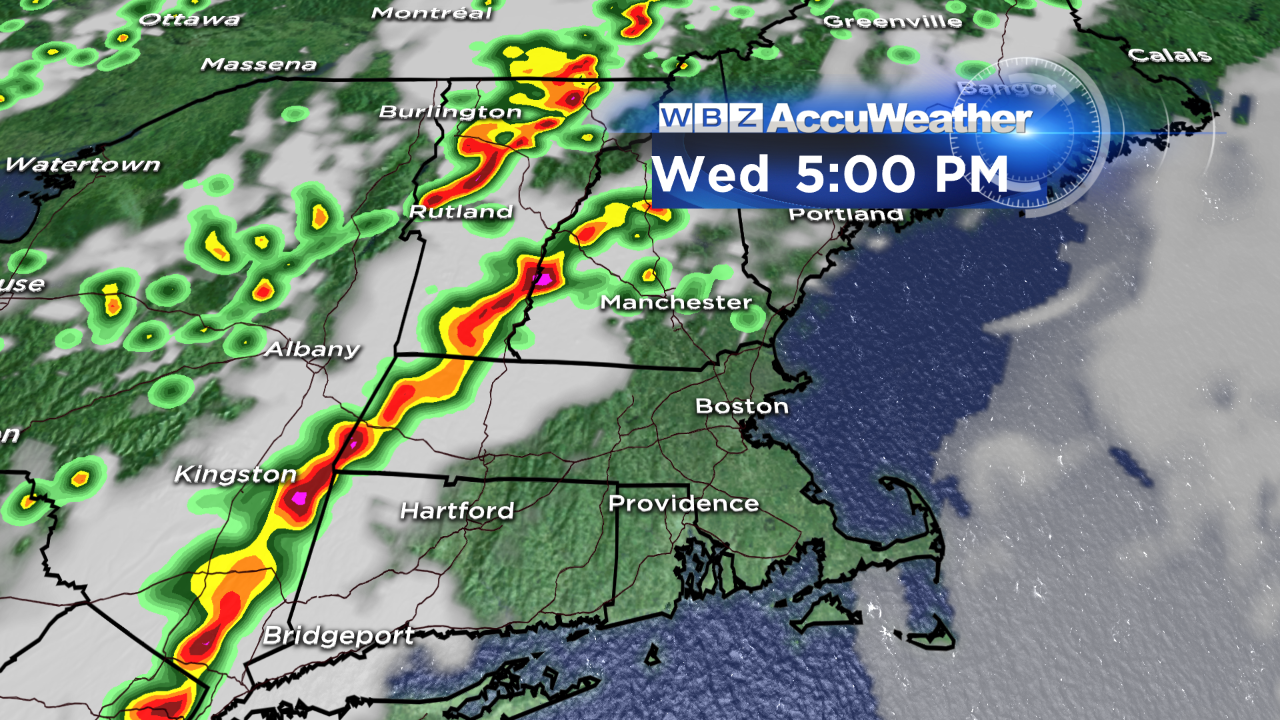 In the meantime, today will be another steamer with high temperatures at or slightly exceeding 90 degrees mainly in places northwest of Boston. Yesterday, it reached 89-93 in much of that area and Boston failed to reach 90 again. We'll give it another shot today for Boston's first 90 degree day of the season but a more southerly component to the wind may squash it again. It will be close. Anyway, south-facing beaches will be closer to 79-82 while east-facing beaches north of Boston will be nudging 90 as the tide is high at mid-afternoon. The humidity will be bordering on oppressive. As the first of two frontal boundaries approaches from the west, the potential exists for scattered showers and boomers to break out over northern and western New England. They will weaken eastward tomorrow evening.
Todd Gutner delivers his weathercasts on WBZ News through 9 o'clock this morning and again at noon followed by Eric Fisher at 5, 6 and 11 this evening.
Make it a great day!