Watching The Tropics
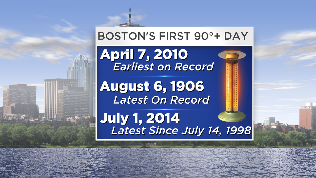 While the temperature peaked at 90 in several communities north and west of Boston yesterday, the city came up short by 1 degree again. I am quite confident that Boston will have its first 90 degrees of the season today. The latest on record occurred way back on August 6, 1906. Over the past 25 years, the latest was on July 14, 1998 which is 16 years ago! I am predicting 91 for the city which is 7 degrees under the record for the date of 98 set in 1963. The air will be modified by the brisk wind blowing from the south-southwest so there will be some natural air conditioning over Cape Cod, the New England South Coast and outer Cape Ann plus parts of the NH Seacoast and Downeast ME. In these areas, middle 70s to lower 80s will be more common. It will not fall below 70 in most places over the next few nights with daytime highs exceeding 90 mainly in areas northwest and west of Boston tomorrow.
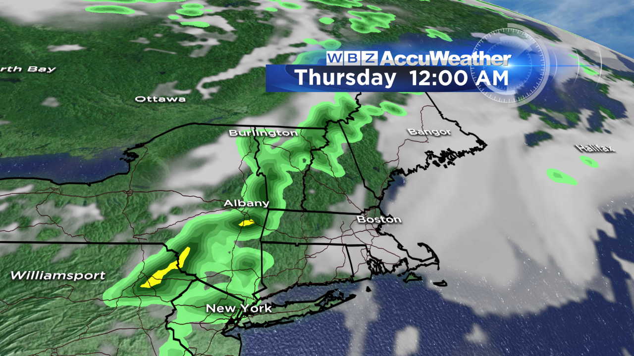 There has been a gradual increase in humidity over the past 24 hours and it will continue to rise into the high category today then border on oppressive tomorrow followed by pure tropical air yielding dewpoints of 70-74 on Thursday into Friday. That sticky air will lead to some scattered thunderstorms breaking out mainly associated with an approaching frontal boundary well north and west of Boston later tomorrow. As this boundary slowly shifts into eastern New England Thursday, there could be an axis of tropical downpours producing flooding in poor drainage areas. That axis gradually drifts into southeastern MA Friday morning so the ribbon of possible copious rainfall may be poised in that region with decreasing showers north and west of Boston. This is all highly dependent upon the precise track of the first tropical storm of the season which will be born today and named "Arthur".
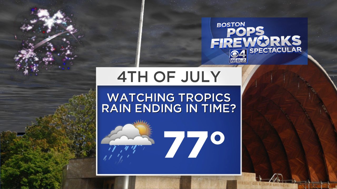
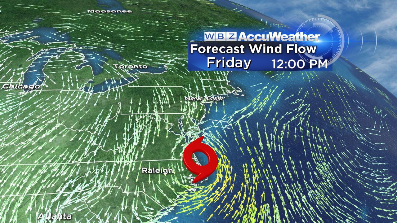 The present prognosis places the center of Arthur over extreme eastern NC around midday Friday. Most guidance from the various models steers the storm which might turn into a hurricane northeast then east on a path a few hundred miles south of New England. The speed of this system is also paramount in determining when clearing develops over New England. Presently, the timing suggests some rain would be lingering over southeastern New England Friday afternoon. With some acceleration, we would be more optimistic about the weather for the huge July 4th celebration at the Hatch Shell and Esplanade. It bears watching but it appears that the chance of a direct hit on New England is quite low. Waves will be building so the body and board surfers will be happy but the danger of rip currents will exist through the upcoming weekend especially around Cape Cod.
 As Arthur pulls away, a mass of nice dry air will be captured and yanked into the Northeast so I am very confident that Saturday and Sunday will be exquisite days featuring plentiful sunshine with a brisk northwest to westerly wind and highs near 80 degrees on Saturday followed by a southwesterly breeze and closer to 85 on Sunday.
You can watch Todd Gutner's weathercasts on WBZ News through 9 o'clock this morning and noon and check out my updates at 5, 6 & 11pm.
Make it a great day and stay cool!