Hot Stuff Coming!
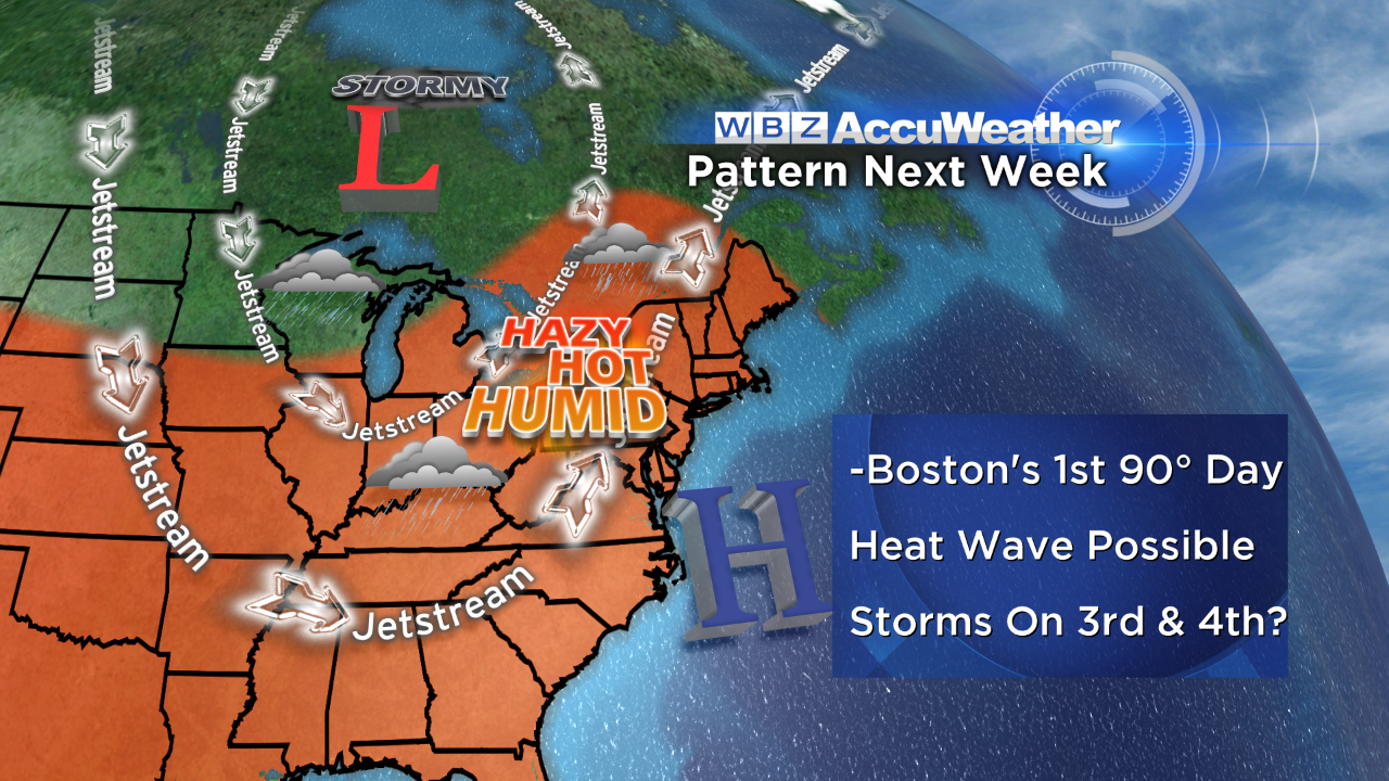
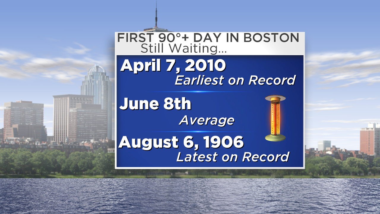 It is another spectacular weekend in New England. The humidity is low but the air is not bone dry like last weekend. Nevertheless, it is still quite comfortable despite the gradual rise in temperatures by 2-3 degrees in each succeeding day and that trend will continue as June concludes on Monday and July commences on Tuesday. It has been a delightful month of June featuring many nice warm days and comfortably cool nights for sleeping. I remain amazed that 90 degrees has not happened yet in much of the area including Boston. It should happen this week. Over the last 25 years, the latest 90 degrees in the city occurred on July 14, 1998. The latest ever on record fell on August 6, 1906. Last year, our first heat wave meaning 3 consecutive days at 90 or higher occurred on June 23-25. That was followed by a sizzling 5-day heat wave on July 3-7 then a stifling, horrible 7-day heat wave on July 14-20 yielding a 99 on the 19th! The potential exists for our first heat wave this year on July 1-3.
 First things first and that is today's weather which will be splendid with high temperatures in the middle to upper 80s except closer to or just under 80 at many of the beaches especially those that face south as a southerly wind picks up to 15 or so mph. The tide will be high around 1:30 in the afternoon with seas remaining slight and disappointing for all of the surfers. There will be some streamers of high thin cloudiness but the puffy clouds will be more noticeable across parts of the northern mountains where an isolated shower could pop up. The humidity will rise slightly but not really be noticeable until later Monday and definitely on Tuesday.
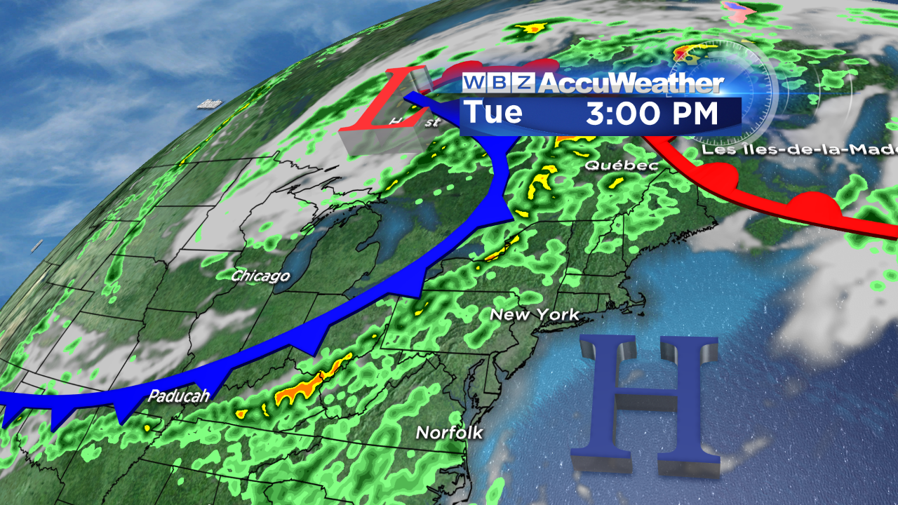 Despite the burst of heavy showers mainly one early morning last week, we need more rain for the landscape. The lawns and gardens are getting thirsty and it is becoming too costly for many of us to irrigate. It is certainly not a good thing to mow lawns too short this time of the year with the strength of the summer sun. Looking at the charts, the threat of thunderstorms increases a bit as the humidity spikes in the days ahead but, presently, it appears that the highest probability of scattered boomers would be across northern and western New England on the afternoons of Tuesday and Wednesday. This action will slowly shift eastward later Thursday and unless some acceleration takes place, the threat of additional showers and storms will linger into the 4th of July. A frontal boundary will be sluggishly moving offshore and a chunk of drier, more refreshing air should arrive late on the 4th or perhaps delayed until the 5th. We'll also be watching a suspicious low pressure system off the South Carolina coast. There is the potential for it to develop into a tropical depression and possibly a storm later in the week.
On WBZ News, you can watch the weathercasts of Danielle Niles through 9 o'clock this morning and my weathercasts at 6:30 and 11 o'clock this evening. Enjoy the rest of this summer weekend!