The Week Ahead
 I hope your Father's Day was a great one. Mine was outstanding. The weather certainly cooperated by delivering perfection in my opinion. The combo of sunshine, low humidity and temperatures near 80 made everybody happy to be outside enjoying a variety of activities. Would you like another day just like that? You got it and it happens today. While the air will still be nice and dry and the sun will shine, there will be some slight differences such as all locations away from the ocean should be a couple or degrees higher while most of the beaches will be about a half-dozen degrees lower due to the wind direction. Yesterday, there was a brisk northwesterly wind at times but today there will be an onshore breeze at 5-15 mph which will keep the beaches a bit cooler. The high tide occurs just after 2:30 pm and the ocean temperatures are close to 60. The UV Index is HIGH so apply that sunscreen!
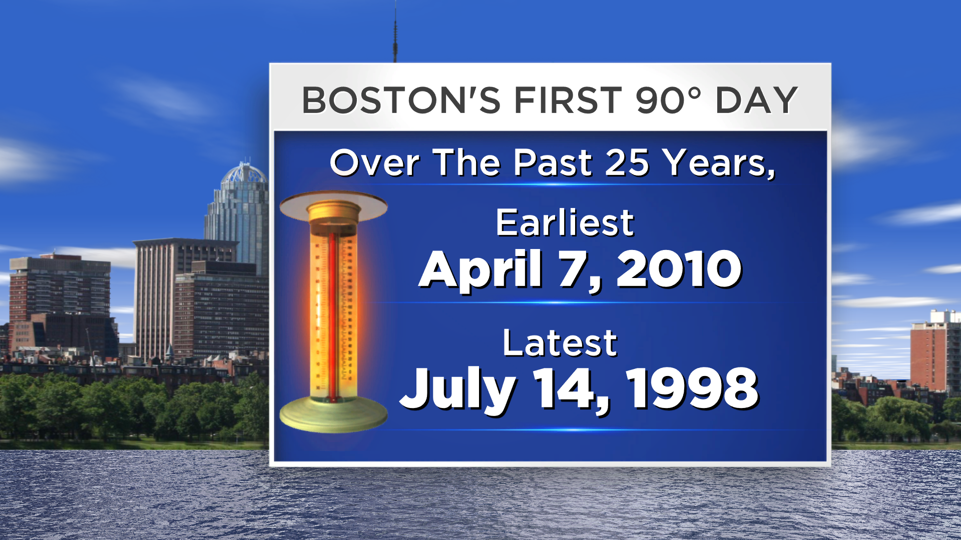 A warm front will be approaching tomorrow night into Tuesday and that feature may trigger a few showers and possible thunder. The air will become noticeably more humid on Tuesday as the temperatures rise into the lower to middle 80s. For those of you who have been wondering where the heat is and if it is really late this year, check out this study I did a couple of nights ago. Over the past 25 years, Boston's first 90 degrees has occurred 3 days in April, 8 days in May, 13 days in June and once in July. The earliest was on April 7, 2010 and the latest was on July 14, 1998. The last week of March 1998 was very warm with 3 record high temperatures including the 89 on March 31 but then it never got to 90 or more until July 14! This year, I am predicting that the city will have its first day at 90 or higher this Wednesday, June 18.
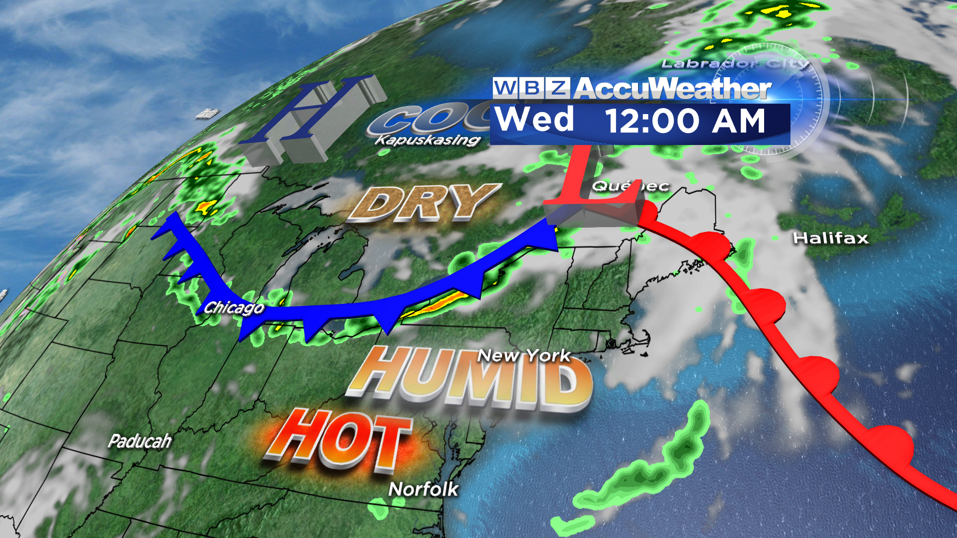 On that day, the wind should be blowing from the west as a cold front moves into the region so the beaches will be hot as well except on theouter Cape. There could be scattered boomers if the front is delayed from passing through until mid-afternoon. In any event, it will be humid but not truly tropical and the temperatures should max out in the upper 80s to lower 90s except on Cape Cod where upper 70s to lower 80s are likely. After the cold frontal passage, high pressure in central Canada will be ridging into the Northeast with more refreshing air as the belt of showers and storms is pushed into the Mid-Atlantic States. Friday will be the coolest day with very low humidity and highs near 75. With summer beginning on the solstice at 6:21 am Saturday, the weather should be pleasant for the weekend with highs in the upper 70s to near 80.
You can watch the weathercasts of Danielle Niles on WBZ News through 9 o'clock this morning and at noon then Todd Gutner follows with the evening shows. Make it a great week!