Bring On The Weekend (And June!)
A beautiful day, and all is forgotten? Probably not in a lot of people's minds.

View from a golf course in Watertown on Thursday. Credit: Eric Fisher
But yesterday was what the doctor ordered. Blue skies, warmer temperatures, and a great day to hit the links or do whatever it is that puts you in a good mood outside. Certainly a pretty stark contrast to the absurdly cold mid-week weather we endured. There's some give and take in the forecast as we head into the weekend, which should be a big one for parties, graduations, weddings, and concerts. Here we go...
Friday - Tracking Showers & Storms
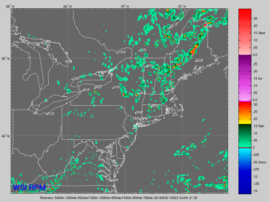
WSI's RPM showing a smattering of showers and storms developing Friday afternoon.
The day should be off to a pleasant and cool start, but ahead of an approaching front the clouds will start to build up as we head into late morning. If you want to hit the beach and have some time off, I think you could still manage it along the South Coast, Cape, Islands, and South Shore. Won't be warm, but it should be bright! Once we hit lunchtime, the showers should have begun to pop across New Hampshire. They'll continue to develop and head toward northern Massachusetts, eventually reaching the Boston area by mid to late afternoon. The highest probability of seeing some rain is NW of Boston during the afternoon, and some rumbles could be mixed in too. Instability/shear doesn't look terribly impressive, so we're likely not going to be talking severe storms. However, just like with any thunderstorms, some locally heavy downpours, small hail, and gusty winds are possible. A lot of these will have a tough time holding together near the South Shore and coastal towns, with a bit of a sea breeze knocking them down.
Probably not going to be enough to lead to any big delays or a postponement at Fenway Friday night, but if a good shower or storm survives and passes over Yawkey Way there could be a brief weather delay. Definitely bring some rain gear to the park to play it safe. These showers should be able to hold together into the evening and overnight, continuing their march to the southeast. High temps will mainly range in the mid/upper 60s.
Saturday: An Ocean Storm Keeps Us Cool
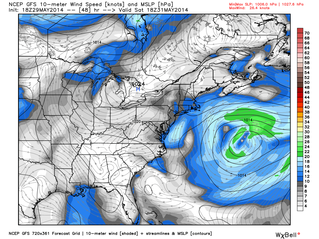
GFS showing large circulation in the Atlantic on Saturday, with a pretty big wind field to boot. This should end up creating some significant surf along our coast for those brave enough to jump in and give them a ride. Source: WeatherBell
The main focus for Saturday's forecast is a large ocean storm that will be swirling hundreds of miles away. While it won't bring us bands of rain and miserable weather, it will be close enough to keep us cool and keep clouds in play. The NE flow coming in off the ocean around it will cap highs in the upper 50s to mid 60s, with the coolest air at the coastline and 'mildest' across Worcester County and southern NH. Not exactly a great beach day. In terms of clouds - right now it looks partly to mostly cloudy. I *DO* think there could be a good deal of sunshine making its way through for many towns, although confidence is low on exactly where. The best bet looks to be around MetroWest, while low clouds may be persistent near the water and another batch of moisture may bring extra cloud cover/showers to western New England.
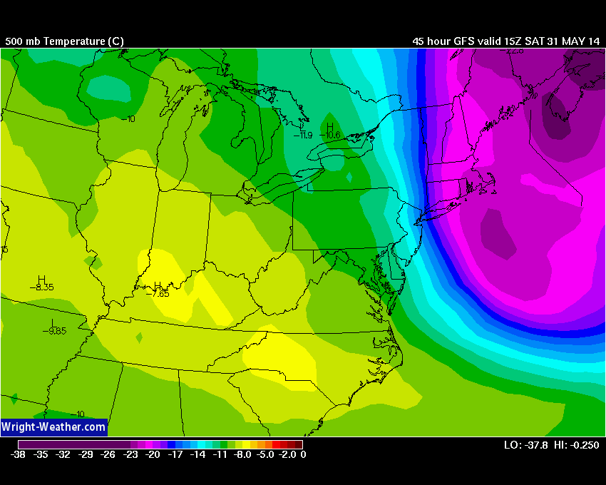
500mb Temperatures on Saturday show a cold pocket of air still in place as it starts to slide away to the east. Temps around -23ºC are enough to produce an unstable atmosphere. Source: Wright-Weather.com
It definitely doesn't look like a washout, but there will be a chance of rain. A very cold pocket of air aloft will still be in place, along with some low level moisture. That cold pocket of air leads to steep mid-level lapse rates (in other words, air will want to rise) and so some scattered showers, maybe even a few rumbles, may pop up. This will be especially true in places where sun comes out.
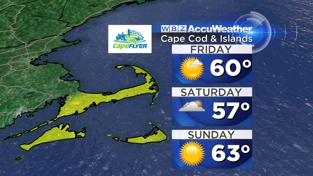
Sunday: Pick Of The Weekend!
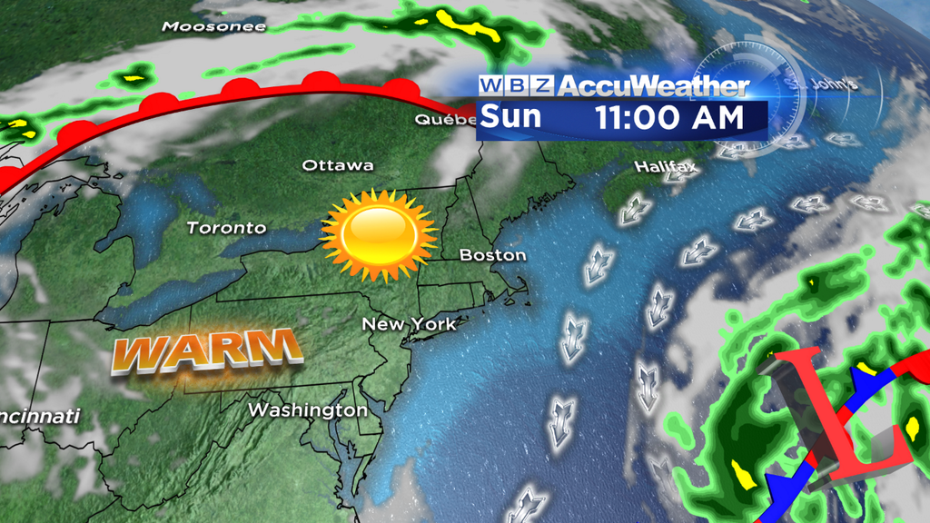
The ocean storm moves a little farther east on Sunday, high pressure builds in, and we are in business! It easily looks like the pick of the weekend right now, with lots of sunshine and warming temperatures. There is one caveat - with a weak pressure gradient, sea breezes will develop. That means a trip to the beach, while bright, will still not be very warm. Highs near the coast should reach the 59-64 range, before falling back a few more degrees during the afternoon. To beat the sea breeze, enjoy the sand and sun in the morning. Much warmer temperatures are expected inland, with highs 67-74 as you get away from the water. A fantastic first day of June!
Next Week - Rollercoaster Weather & Uncertainty
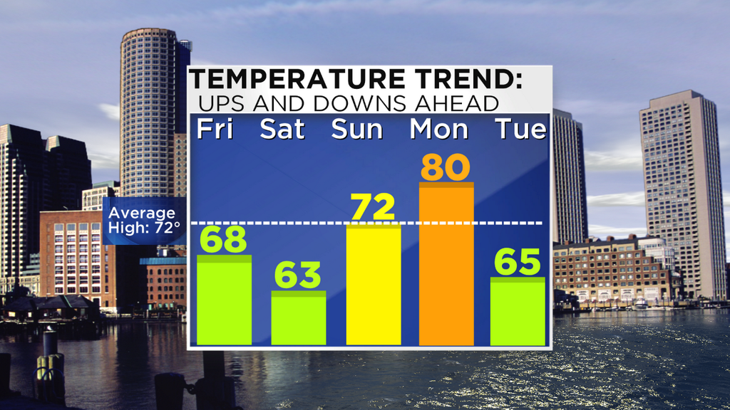
With a nice southwesterly return flow on Monday, we may be able to see some legit summertime warmth get its way into Southern New England. 850mb temps around forecast to be near +12C, and a good amount of sunshine should produce highs in the 77-83º range for most (Cooler S. Coast/Cape/Islands). Not a bad way to kick off the week! Clouds should start to increase throughout the day as a warm front approaches.
There's some uncertainty still as to how Tuesday-Thursday may pan out. The GFS blasts a warm front through and keeps us warm, while the ECMWF holds the front back to our southwest and brings in a cool flow off the water. The trend is your friend - I'm going cool for now. Why buck what's been consistently the case until proven otherwise? So I'd think we'll see highs in the upper 50s to mid 60s on Tuesday, perhaps a little colder on Wednesday - both days with a shower risk. At least this time the flow should be more southeasterly with much milder air aloft, instead of the frigid northeast flow we had on Wednesday this week. The source of the air should keep it from getting that cold again. This system should manage to pass by Thursday, bringing the sun back out.
Find Eric Fisher on Twitter and Facebook