Timing The Rain & Sun This Weekend
Find Eric Fisher on Twitter and Facebook
Alright no beating around the bush tonight! It's a big weekend. There are many Commencements going on across the region. Proms hang in the balance. Brides stare grimly at their weather apps. Red Sox ticket holders hold a poncho in one hand and a summer ale in the other. Serious business this time of year when it comes to weekend weather, so here's a look at the details.
Friday Night:
We've been fully engulfed in a deep south-southeasterly flow for the past couple of days, and this has lead to a whole lot of water vapor hanging around. Precipitable water values (essentially a measure of how much water vapor is above your noggin right now) are way up there, around 1.5-2" with a tropical air mass in place. Dew points at the surface aren't oppressive, but they're squarely in the 'muggy' category. So we've got the first ingredient for rain in place. Now we just need something to lift that soggy air, and we've got that swinging in. A cold front will help focus a band of heavy rain across the region, particularly after midnight.
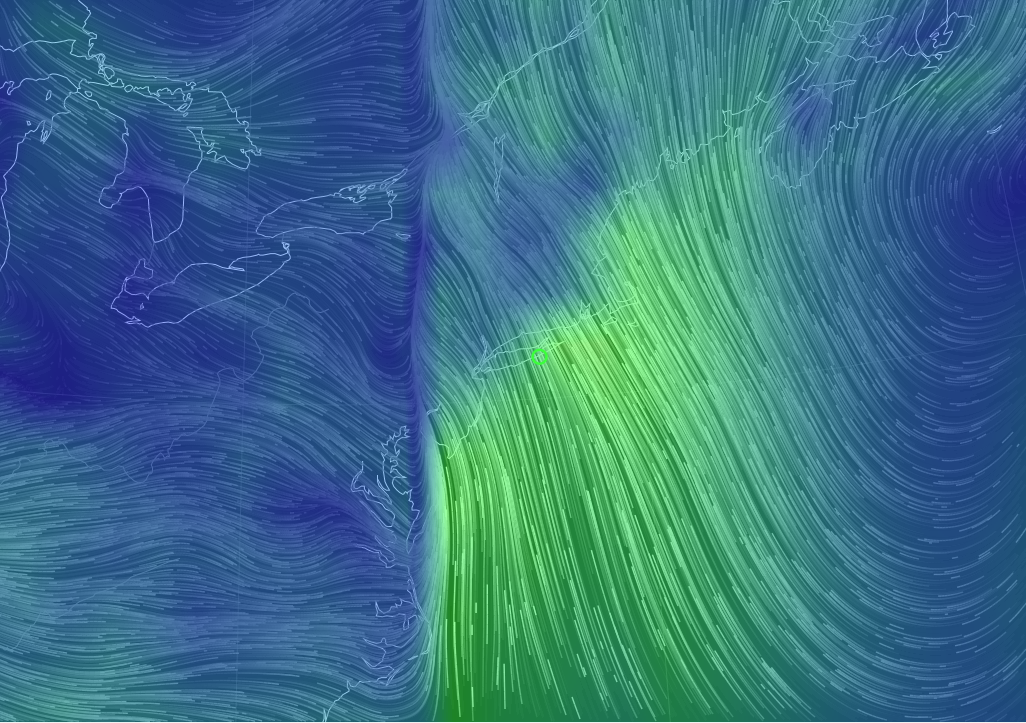
Check out the wind map today from Earth.Nullschool! This shows surface winds/strength. The more lines/brighter colors, the stronger the wind speeds. Don't need to be a Meteorologist to spot this front. You can see a wall of SE winds blasting into it, lined up just west of the Hudson Valley down to the Outer Banks of North Carolina.
Scattered showers and brief downpours will persist through the evening until that steadier rain arrives. It's going to be a very thin line of heavy rain, but due to all that water vapor when it rains, it'll pour. Again, most of this comes in after midnight when many are home and off the roads. Just be careful if you plan on driving around later than that with slick roads and lower visibility.
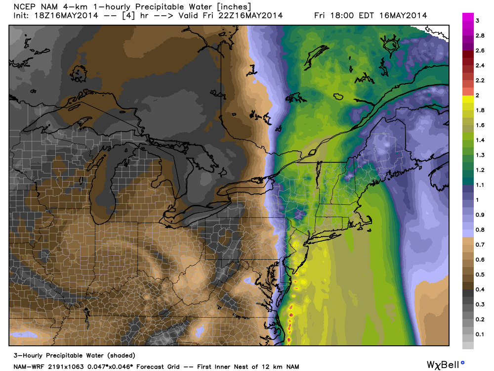
Precipitable water values for Friday evening. A plume of moisture-rich air, which extends all the way back to the tropical Pacific. Source: WeatherBell.com
Saturday:
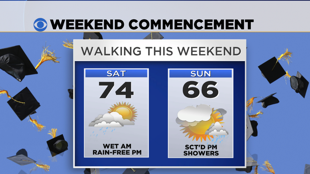
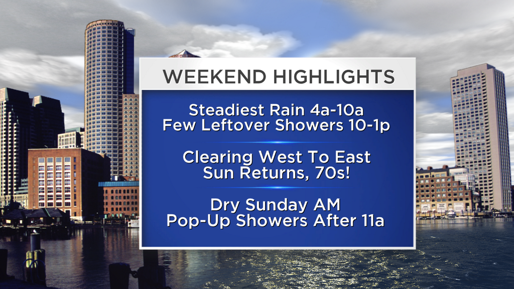
The band of heavy rain that will produce most of our totals for this event will be moving through 4am-10am. In particular, I'd say the risk for heaviest rain looks to be centered in the 5a-7a time frame. It should exit central MA by 8am, Boston by about 10a, and the Cape by noon. Behind the rain is drier air, so the sun will start to break out from west to east and the humidity will say buh-bye. Rain totals for this event should be in the 0.40"-1" range here in eastern MA. Enough to water your lawn and garden, but not enough to raise any flood concerns.
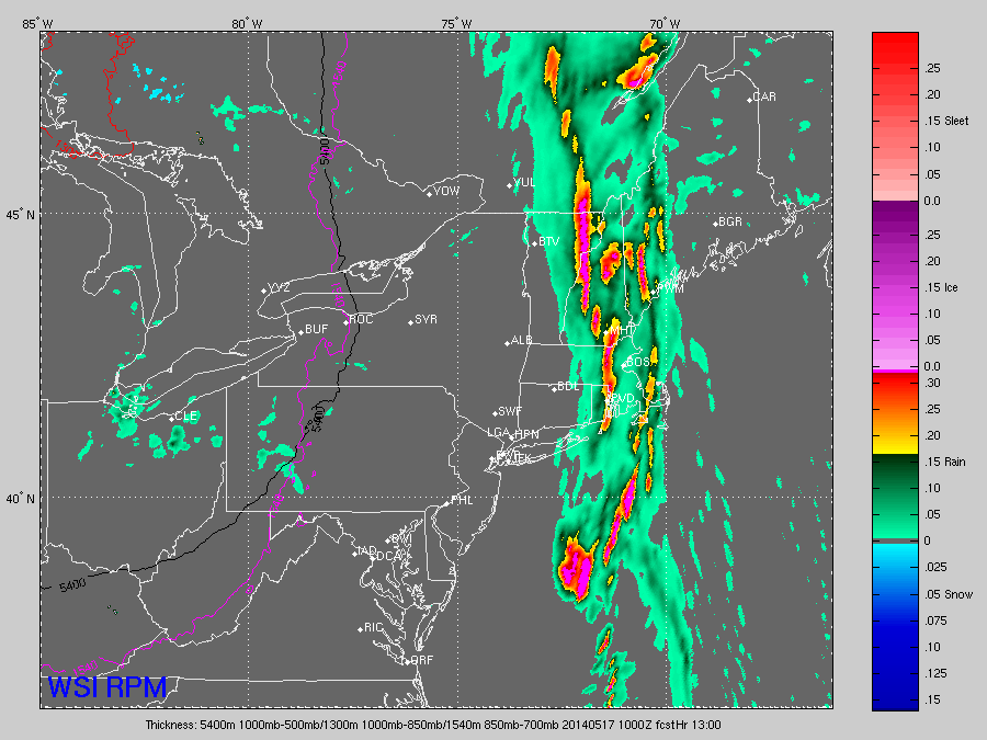
WSI's RPM - showing band of heavy rain at 6am
Most of the afternoon/evening looks excellent with brighter skies, less humidity, and highs in the 70s. So while graduations may be soggy early in the morning, the BBQs afterwards are in good shape. I'm guessing most weddings are during the afternoon as well, so this should play nicely for all those nervous brides and grooms. Plus, Saturday night's Red Sox game should be the most comfortable of the weekend.
Congrats to all walking this weekend!
Sunday:
A bit of reversal for Sunday, compared to the Saturday forecast. The morning looks excellent with lots of sunshine and comfortable temperatures. As the morning wears on we should have some clouds starting to fill in, with scattered rain showers popping up from midday through the evening. Not every town will see a rain shower, and many of them will be brief. There's an outside chance there could be a little lightning, too. So while it's not a washout of a day by any stretch, just plan on having some rain gear handy. Highs should range from the mid 60s to low 70s.
Next Week:
Unsettled, but not altogether bad weather is the main idea for next week. On Monday and Tuesday a cold pool of air will be aloft over New England. Combined with the strong mid-May sun, this should help produce instability showers/storms both days. Highs should be in the 60s, perfectly seasonable for this time of year. A few towns may manage to reach 70 both days.
The pattern gets a little more complex after that. A ridge will building in the middle of the country, but we'll be on the NE slope of that ridge. That means we don't really get into the heat, and we'll have to monitor any thunderstorm clusters that form along the top of the ridge and slide toward us. The models look a little funky for Wednesday-Thursday with an area of low pressure forming in Ontario and sliding down over us. That doesn't seem to make a ton of sense to me at the moment...it may just be picking up on these storm complexes that will be sliding down. In any case, a trough should carve up the Northeast by late week and bring cool/unsettled weather. I'm hopeful at the moment that this will be progressive, and will head eastward by the start of Memorial Day Weekend. Of course that's still a long ways out so we'll have updates as we get closer!


