Evasive Sunshine Ahead
Find Eric Fisher on Twitter and Facebook
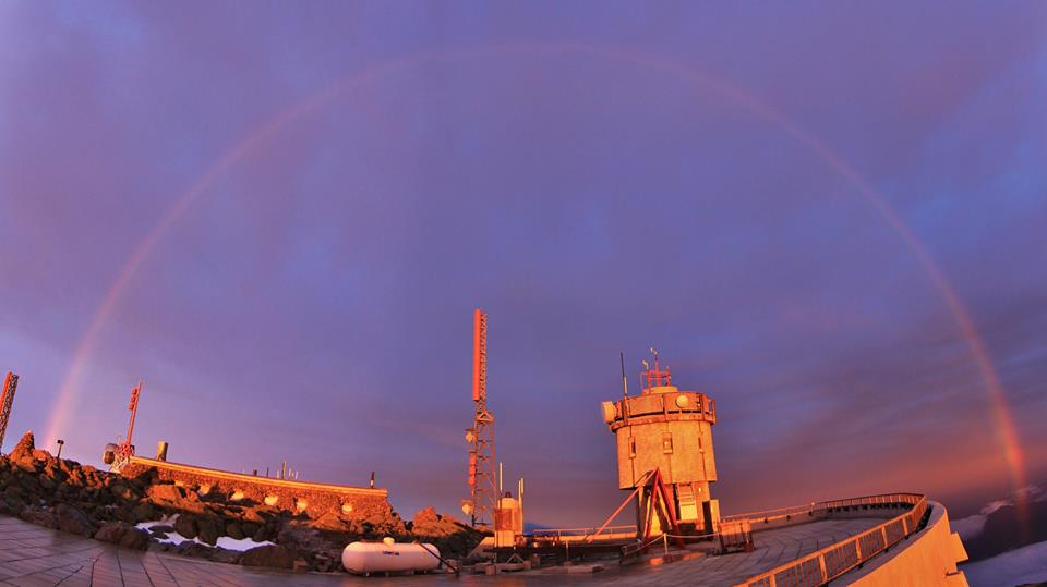
Courtesy: Ryan Knapp - Observer, Mount Washington Observatory
It wasn't ALL bad on Tuesday. I'll give you some pros. Firstly, this beautiful rainbow that graced the summit of Mt. Washington during sunrise. You can't do much better than that. Secondly, as a runner I really appreciated the cool-down. Much more comfortable running around town in the low 50s than the upper 80s! And thirdly, at least our water temps have risen up to near 50º just offshore. A month ago, a flow of air off the water like we saw on Tuesday would heave meant 40º, tops. Color me an optimist, but you can't fight the weather. Just have to roll with it.
That being said, we'll all need our optimist shoes for the next 7-10 days. The pattern that is laid out ahead of us is not one full of beach days and sunshine. Quite the opposite, in fact. While temperatures will manage to creep back up to warmer levels, the sunshine is going to prove pretty hard to come by.
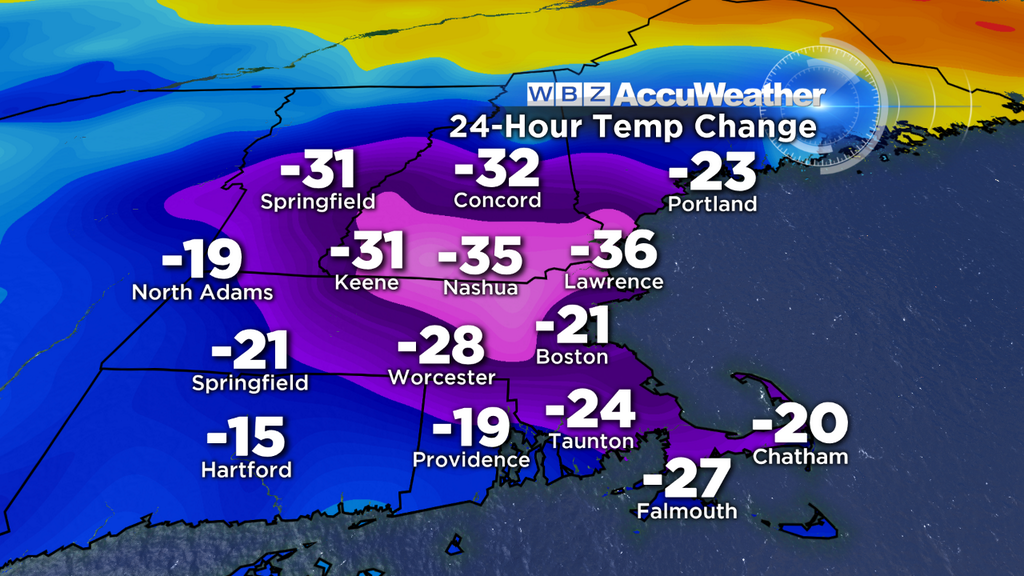
24-hour temperature change from Monday afternoon to Tuesday afternoon.
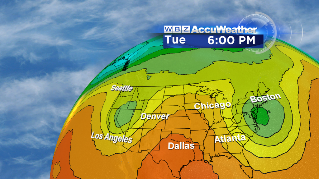
Let's start at the beginning, as milder air returns today. It'd be pretty tough not to warm up. Look at the 24-hour temperature changes we saw from Monday afternoon to Tuesday afternoon! A massive drop, most of it coming within just a 2-hour time frame during the middle of Monday night. While our winds will start out east-southeast, they should gradually turn more southerly as the day wears on. While coastal areas will likely stay in the 50s, most inland towns (especially northern Worcester/Merrimack Counties and into southern NH/VT) should jump into the 60s. If we get enough sunny breaks, that could easily be the low 70s during the afternoon. The sky cover is definitely the trickiest part of the Wednesday forecast, and there should be many more clouds than periods of sun. But it won't take much to warm us right up.
For Thursday and Friday, a warm front lifts well north of the region and a strong/persistent southerly flow will take over. Not only does this bring milder air, but very humid air. Dew points should soar into the 60s for Thursday and Friday, and that humid air should help generate a lot of low clouds, spotty drizzle on Thursday, and a scattering of showers on Friday. Fog may be an issue near the coast, but a gusty breeze, especially Friday, should keep it from getting too dense in most spots.
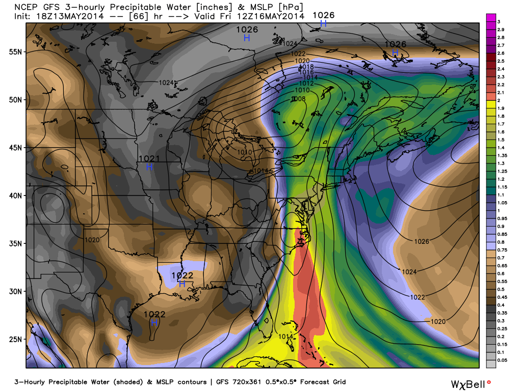
Courtesy: WeatherBell Precipitable water forecast by Friday, with a plume of deep moisture being drawn up from the tropics.
By the end of the week, we'll be tracking a plume of moist air getting drawn straight up the East Coast as if through a straw. At the same time, a barely moving storm system will be heading in our direction, helping to focus this moisture along a front. And then to top it all off, a wave of low pressure should form along that front to enhance lift in the atmosphere. So we have the stage set for a pretty hefty dose of rain.
 Eastern U.S. Water Vapor Loop
An easier way to track this moisture is by taking a peek at water vapor imagery! You can see this front, which is very stretched out from Canada to Mexico, moving slowly eastbound. By the time this reaches us it should be Friday night and the band of rain itself will be very thin. But since it won't be passing through quickly, we should see a very wet Friday night/Saturday with a 1-3" rain event looking likely. Not exactly ideal for a mid-May weekend. Should something change with this setup in regard to speed/intensity, we'll have to keep a close eye on it as a flood threat.
The front heads east by Saturday night, but then we have a new problem on our hands. 'Blocking' develops over the North Atlantic (where were you during winter?!), an upper-level low breaks off from this system, and then proceeds to get caught over New England without any jet stream winds to push it away. Along with this upper-level low comes very chilly air aloft, which means instability, a lot of clouds, and numerous chances for rain for several days on end.
Here's what it looks like via 500mb heights. Weird? Yes. Look like a Great Horned Owl? I think so. Basically you're looking at 2 upper-level lows spinning...the deeper one south of us, and another across the West Coast. It looks like this setup should persist through at least Wednesday, if not longer. The cold pool aloft should also help produce some thunderstorms, and we'll have to keep an eye on the cumulative effect of rain. If we get a good soaking on Saturday, a saturated ground might end up more susceptible to flash flooding if we get downpours. But I'll end this with one more positive thought - hopefully we can get all this out of the way before Memorial Day Weekend!