The Week Ahead
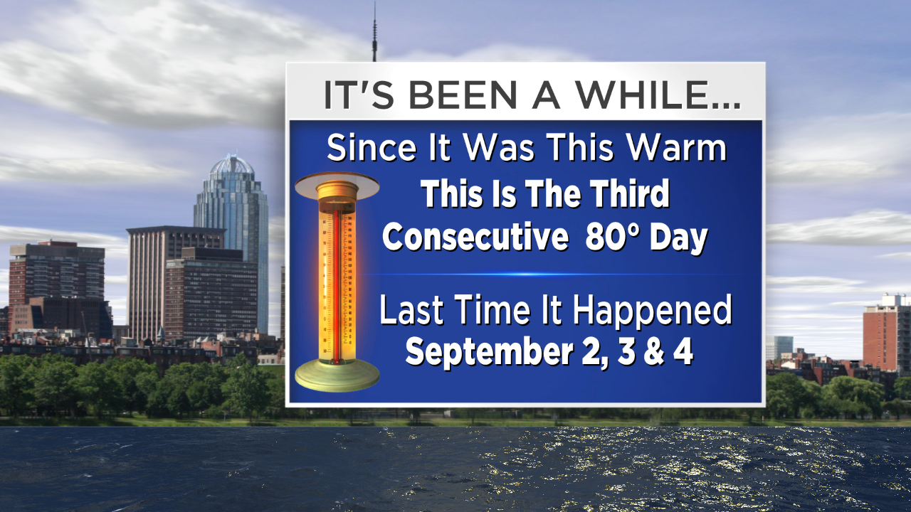 It just doesn't get any better than yesterday for Mother's Day. How could the weather be any nicer? Nearly unlimited sunshine, low humidity and splendid temperatures made it close to perfection. The only downside was the very high pollen count amidst the brisk westerly breeze. It warmed up to about 80 degrees in most locations except Cape Cod where it was a bit cooler. With the expected maximum readings in the lower 80s today, that will make 3 consecutive days at 80 degrees or slightly higher and that hasn't happened in Boston since September 2, 3 and 4. The air will stay nice and dry again today with sunshine yielding to patchy clouds but it now looks like there will be no showers or storms late in the day. There will be a cold front gaining momentum in ME. It will slip down the coast as a backdoor front and introduce some chilly, raw maritime air for Tuesday.
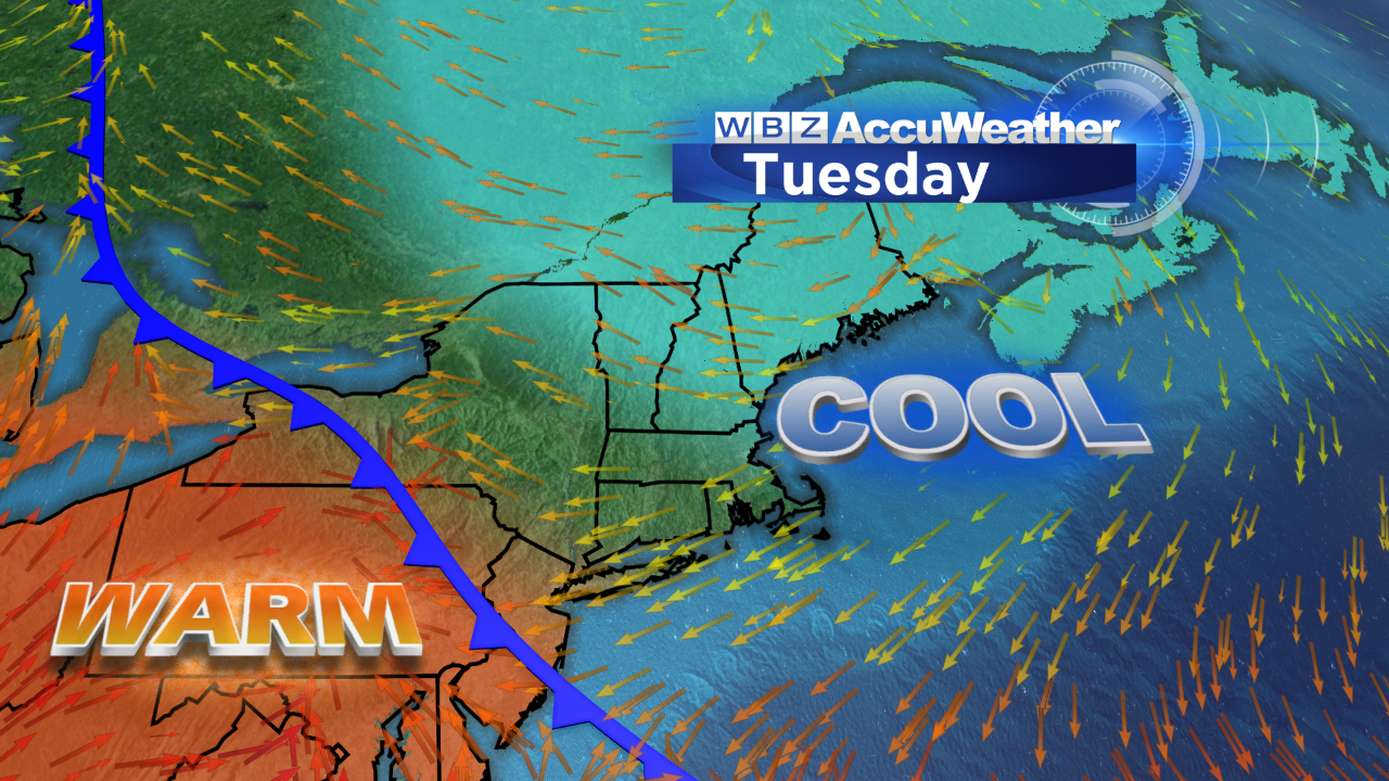 The wind direction can make all the difference in the world. With the flow of air in from the cold ocean, plan on temperatures falling to near 50 by dawn Tuesday then failing to rise out of the lower 50s at the coastline to the middle to possibly upper 50s well inland. A layer of lower clouds will probably be generally solid with a slight risk of some spotty mist or a couple of sprinkles. As a bubble of high pressure builds down across ME, it could become partly cloudy up there but it is unclear if sufficient drying will work into portions of eastern MA later Tuesday. At this point, I will lean toward a cloudier solution and that sky condition may linger much of the rest of the week although it should turn warmer as the zone of high pressure sets up farther offshore. A return southeast to southerly flow will escort milder and more moist, humid air into New England Wednesday and Thursday.
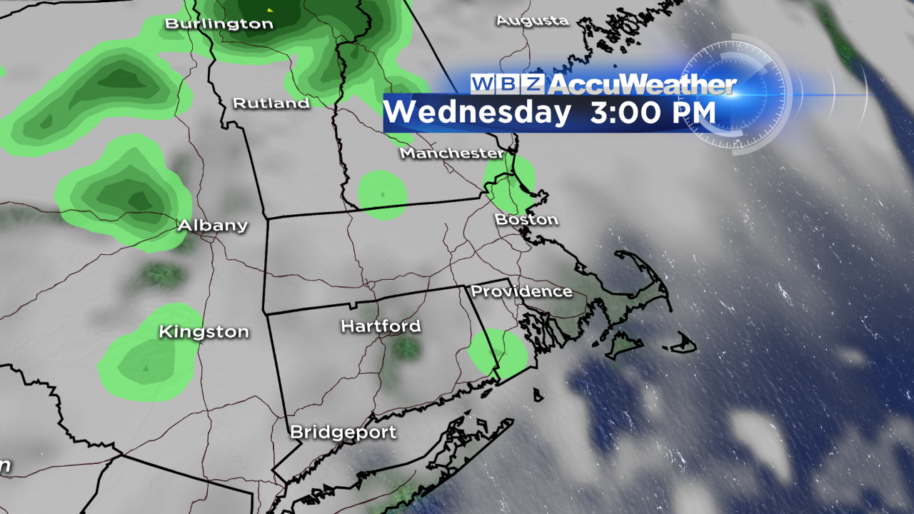 I cannot rule out some spotty drizzle and showers on Wednesday and the risk of rain rises on Thursday as showers become a bit more widespread. Showery rains are projected to be quite likely on Friday into Saturday. With a potential weather block unfolding, the swath of rain could stall over especially eastern New England next weekend. It is too premature to be highly confident of that solution just yet. In the meantime, expect muggier conditions the second half of this week as southerly winds freshen.
Todd Gutner is updating the forecast on WBZ News this morning and midday and Eric Fisher follows later in the day. You can hear my latest forecast on WBZ NewsRadio 1030 at midday.
Make it a great week!


