Getting Better For Now
 The second half of the weekend featured some improvement as brightening episodes revealed some patches of blue sky and spokes of sunshine. Combine this with some migrating small showers and we got some beautiful rainbows in many communities. I want to thank everyone for sending in pictures of the interesting sky yesterday. With high pressure ridging into the region, I am expecting sunnier conditions today but there are still going to be some clouds developing during the day with another bank of clouds threatening to back in from the east during the later half of the afternoon. The risk of any rain will be minimal today as temperatures rise closer to or just past 60 away from the ocean. The northeast to easterly wind of 6-12 mph will restrict the readings to the upper 40s to about 50 along the coast. It's a tough call regarding the amount of clouds here on Tuesday but it appears that conditions favor a mostly cloudy sky with a brisk northeasterly wind keeping much of the area in the middle to upper 40s. Rain will be nudging into southwestern New England on Wednesday but its leading edge will likely dry up as it attempts to push into eastern sections. Once the rain arrives later Wednesday, there could be a decent dose of an inch or more Wednesday night into Thursday.
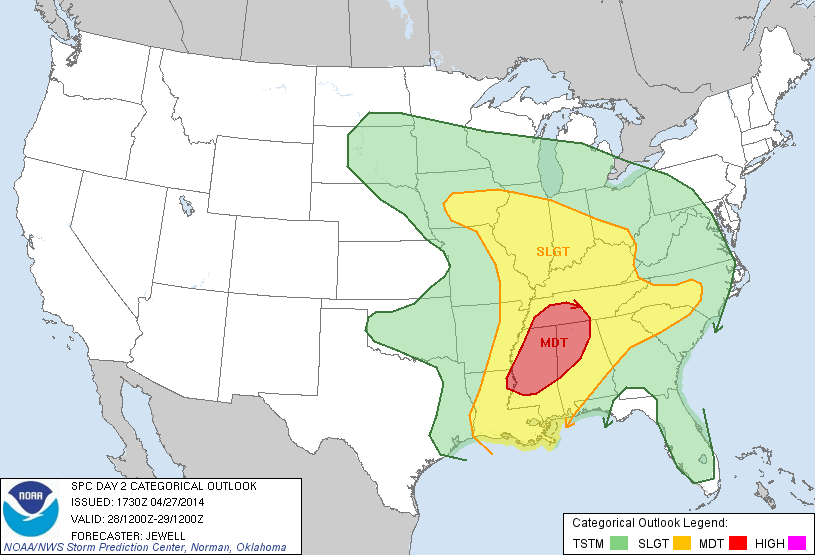 It had been a peaceful tornado season so far until last evening when some deadly twisters struck KS, OK and AR, etc. There wasn't a huge number of tornadoes but massive devastation was produced by a few. Hardest hit areas of Mayflower and Vilonia Arkansas will be searching through the rubble in the days ahead for missing people. As a surge of very warm and humid air is pinched by a clash of cooler and drier air from the west in association with a strong cold front and upper level disturbance, more severe weather is predicted by the experts at the Storm Prediction Center in Norman, OK. Check the map out for the convective outlook for today. Prime areas for a moderate risk of severe thunderstorms and possible tornadoes shifts to western TN, central MS into northwestern AL. After today, the risk diminishes to slight and shifts into the southeastern states except FL. The weather maker that is creating this threat will only trigger plain rain here late Wednesday into Thursday. Warmer air will finally arrive on Thursday, the first day of May. This warmth should exist through the upcoming weekend with a few more scattered showers especially north and west of Boston.
Make it a great day!

