Better But Not Best
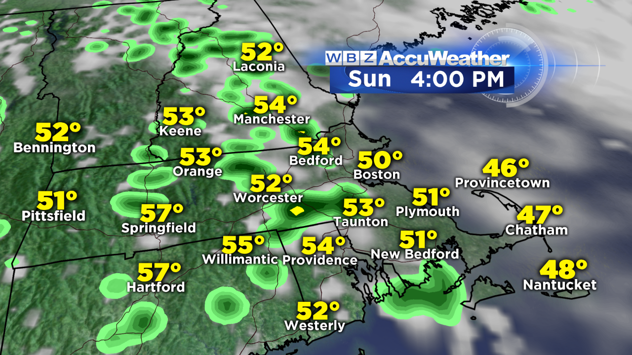 Saturday's dreary weather only produced a few tenths of an inch of rain with a few spotty brief downpours as a couple of disturbances passed across the region. Despite their passage, residual moisture on the western flank of an offshore circulation suggests that today's sky will still be ruled by lots of clouds yielding some scattered showers. There is hope, however, for slight improvement over yesterday as some splashes of sunshine occur between the passing clouds. This will enable a higher climb to the temperatures closer to the lower to middle 50s especially away from the coastline. As a ridge of high pressure noses down from eastern Canada, the conditions should be more favorable for sunnier weather on Monday. As a rseult, expect a bump up to at least 60 to 64 inland but a cool sea breeze will restrict the rise beyond the upper 40s to near 50 at the coast. Eventually, more clouds will roll in from the ocean as a freshening flow of cool air is repeated on Tuesday and Wednesday. That means middle 40s along the coast to lower 50s well inland both of those days. Meantime, the next storm shifting eastward across the country will press into the region with some sprinkles and drizzle possible Wednesday followed by heavier rain later Wednesday into early Thursday. Warmer weather with scattered showers are on tap for next Friday and Saturday.
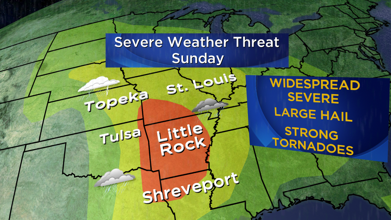 Nationally, the wonderful news is that the weather has been peaceful in terms of severe storms so far this season and this follows the quietest tornado season on record in 2013. I wish they would completely vanish but, of course, that isn't going to happen. As a matter of fact, there is likely to be an eruption of severe thunderstorms and tornadoes today in the eastern Plains and Mississippi Valley States. That zone will shift eastward into the Tennessee Valley to Gulf Coast States on Monday. There will be a wedge of warm and humid air surging northward and clashing with a potent cold front and strong upper level disturbance coming in from the west. This will be the weather maker that will produce our next batch of widespread heavier rain later Wednesday.
Danielle Niles will update the forecast through 9 o'clock this morning on WBZ-TV and I shall follow on the 6:30 pm and 11 pm newscasts.
Enjoy the rest of your weekend.