Winter? Thought We Left You In March...
Find Eric Fisher on Twitter and Facebook
When you got home from work last night, it was around 60º. This morning? 20s and low 30s. Snow on the ground in some communities. Icy spots where the incoming cold froze up yesterday's rain. And highs will barely get above 40º today. Uplifting? Perhaps not, unless you are a SERIOUS fan of winter! The mild start to April is about to get balanced out in a big way by a cold stretch of weather.
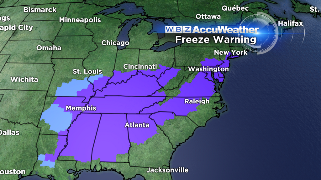
This front has brought a flurry (no pun intended) of record lows across the central/eastern U.S., helped some cities like Detroit reach their snowiest season ever recorded, and potentially will cause damage to vegetation across the Southeast. Temperatures there have been warm enough to allow the region to bloom, so subfreezing air this time of year can be a big concern. There's a massive area of Freeze Warnings up for this reason. The only reason we don't have here, is because our growing season hasn't technically begun yet. The closest warnings extend across the NYC Metro and coastal CT.
Source: NOAA
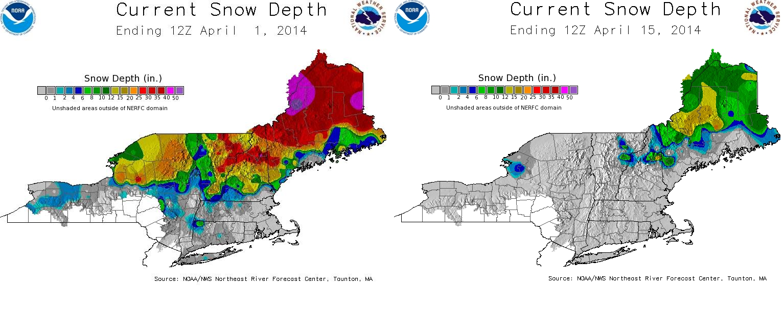
It has also lead to some major snowmelt across the Northeast. Check out the comparison between the start of the month and the middle of the month. Some areas of Maine had over 50" of snow on April 1st! Now, the only snow left is mainly across the highest terrain. This latest update was from Tuesday morning, so there's actually a lot less left now after the 60s and rainfall these areas saw. A lot of water has been released from the snowpack, and with the rain there are numerous road closures and significant river flooding ongoing. You've heard it before and we'll say it again....Turn Around, Don't Drown! Trying to navigate through these waters can be extremely treacherous. All the latest Flood Warnings and Watches can be found using this link. All this water is of course headed downstream, so the Connecticut and Merrimack Rivers will be rising through the end of this week. Expect many of the typical spring flood plains to fill up to at least 'Moderate Flood Stage.'
TEMPERATURES - STAYING CHILLY
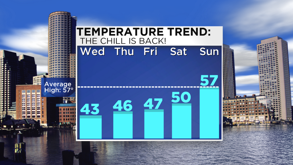
While 850mb temps will be around -6C this afternoon (typically equating to around the upper 40s to near 50 for highs at the surface) - the cold air coming in is very shallow. The coldest of it will sit near the surface, below the typical levels we'd look at for forecasting highs. So long story short, it's going to be really cold out for mid-April. Some of the higher terrain may barely, if at all, get to 40. The history of this front has been to keep highs in the 30s after its passage, so I'm going to tend to lean that way since not much has changed with the synoptic setup as it has moved east. Thinking we'll be in the 38-45º range, 13-18º or so below average for the date. We should see at least partial clearing, and the wind, albeit still gusty through early afternoon, won't be as bad as the last couple of days. Early gusts could reach the 20-35mph range. As winds calm down by the evening, temps will drop to near record low levels. Expecting widespread 20s Wednesday night, with some low 30s near the coast. It's a good thing we haven't had enough warm weather to get our fruit trees blooming yet!
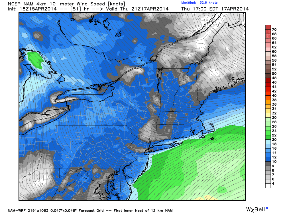
So far as I'm concerned, the only downside living near the Atlantic. ENE wind in spring is the supreme squasher of mild days. Source: WeatherBell
Heading into Thursday, a strong ridge of high pressure will build just to our north over SE Canada. This high will set up a stiff onshore flow out of the ENE, and that ocean water is still awfully cold (low 40s). With not a whole lot of difference between the air temp moving over that water and the SSTs themselves, we should see plenty of sunshine on Thursday. We always have to keep an eye out for a low-level stratus bank lurking with a setup like this, but for now we'll stay optimistic. The sun won't help much however, with highs in the low/mid 40s.
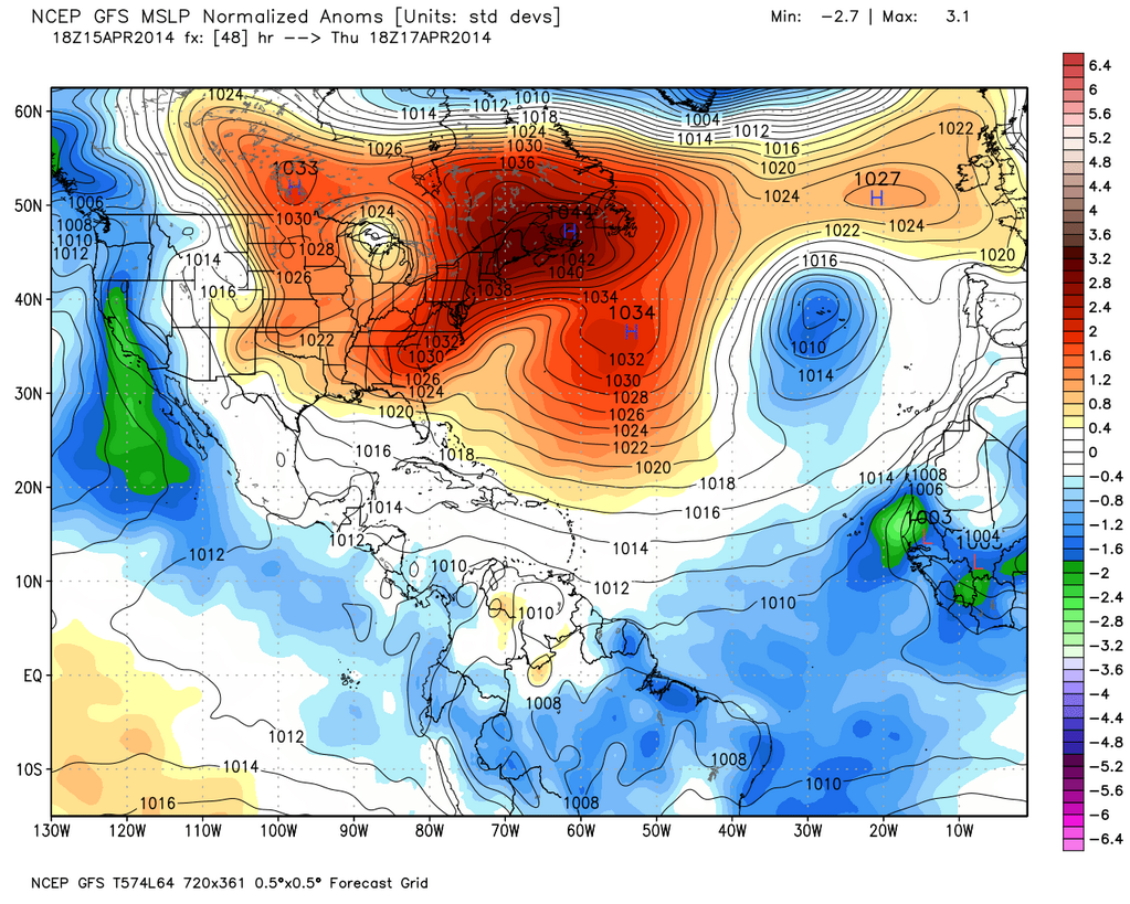
Mega-ridge develops over Nova Scotia by Thursday. Will result in a chilly onshore flow all down the East Coast. Source: WeatherBell
On Friday, the air aloft will be much miler. Some moisture swirling off the coast will approach, and this should allow for a lot more cloud cover to develop. Between the clouds and the continued onshore flow, highs again should stay stuck in the 40s. There's a chance it will manage to be brighter across central and western MA, where highs could get into the 50s.
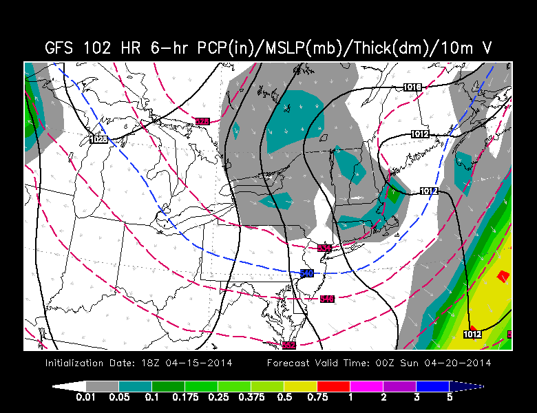
A shot at some Saturday evening snow showers in New England. Source: WSI EnergyCast
And on Saturday, yet more cool air to track. An area of low pressure will develop and head off to our SE as a trough digs in across the Northeast associated with the northern stream of the jet. It doesn't look like a washout at the moment, but after highs reach around 50 the cold will plunge back in and any rain showers may actually change to snow showers! Again! It just goes on and on, folks. Not thinking any significant accumulation.
EASTER SUNDAY AND MARATHON MONDAY
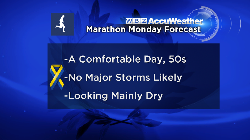
Right now, feeling fairly optimistic. We know how our fickle weather can change, but it looks like a window of mainly dry and seasonable weather may sneak in for the two holidays. A cool northerly flow will keep us in the 50s on Sunday, but not too far from average. Looking into Monday, a milder southwest flow may start to kick in. The next weather system isn't expected to arrive until Tuesday, so we may just indeed get a perfect Marathon Monday for the 36,000 runners and their supporters along the race route. The forecast, sitting 6 days out, looks to feature temps in the 50s to near 60 and a dry day. We'll be updating that outlook every day this week, or as needed. Let's keep our fingers crossed for a great day not just in terms of weather but in triumph over adversity and progress for our great city.


