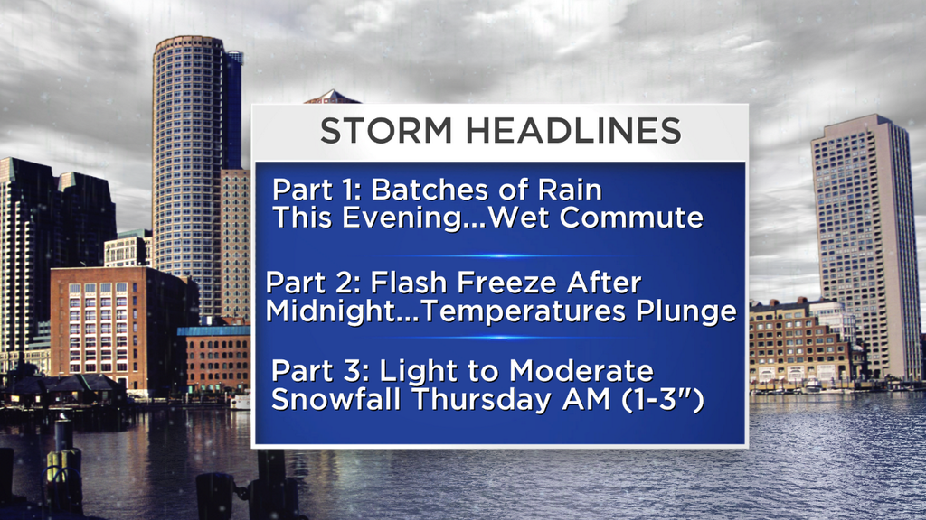
Temperature Crash & An Icy Morning Drive
Find Eric Fisher on Twitter and Facebook
Well, I will say this. At least we have truly transitioned now from winter to spring. During the heart of winter it just stayed cold. Now we move from bitter cold to a break and back to cold. It's a start! This may not cheer you up much as you look at a frigid Thursday forecast, but keep in mind we'll be complaining about the heat or storms or hurricanes before you know it.
Tonight's Setup:
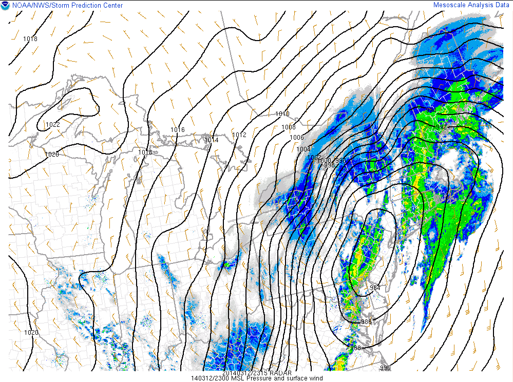
We've got a powerful area of low pressure deepening to our west, and it will track right over the top of us by about midnight. If you've got a barometer in the house keep an eye on it - it'll be one of the lower readings you'll see around here without a tropical system. By the time it passes on top of Southern New England the lowest pressure should be around 978mb. Not too shabby! May lead to a few creaky joints around the region. This low is traveling along a well-defined area of convergence, where cold air from the north is meeting up with mild air to the south. This boundary hasn't budged much all day, with highs in the 30s to near for across northern MA and 50s to near 60 across SE Mass.
A low center tracking over us isn't ideal for snow lovers. The best ascent and forcing in the atmosphere is to the north of it, and they've already seen over a foot in parts of New York and Vermont with plenty of snow still to come!

Precipitation Type:
We'll stay rain here in MA and for much of southern NH through the 10pm time frame. Once the center passes, cold air will plunge southward both aloft and at the surface. There may be a brief period of sleet/freezing rain before we change completely over the snowflakes from north to south. The latest HRRR suggests the 3-9am time frame will be best for potential flakes. Not expecting huge totals, with generally 1-3" in our viewing zone. But the snow combined with the falling temps (which should drop, in some locations, 25 degrees in less than 8 hours) will produce a flash freeze and some dangerous travel on untreated surfaces. This would be disastrous if it was going to start around 8am instead of overnight with many more drivers on the roads! If you must head out, use extreme caution as this drop will happen almost instantly. The snow showers should taper to flurries by mid to late morning.
Temperature Rollercoaster:
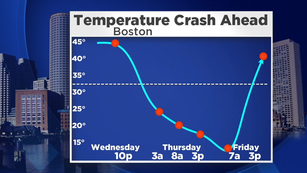
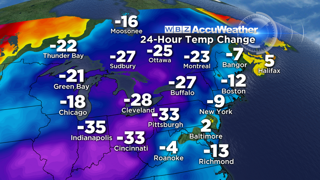
Some were near 60 today, but by the morning rush everyone will be at or below freezing. Our actual high temperatures for the date will be around midnight, which will keep us out of 'record low maximum' territory. But all day we'll hover in the 10s and 20s, before hitting rock bottom in the single digits Friday morning. Nearly a 60º drop in 36 hours, not too shabby! But March is up to its usual tricks. By Friday afternoon we'll rebound into the upper 30s/low 40s, and by Saturday many towns should top 50. Then on Sunday it's back to the 30s/near 40, and highs only near freezing for Monday and Tuesday. You'll have plenty of chances to mix up your wardrobe.
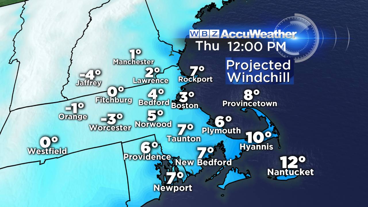
Wind & A Frigid Feel:
As soon as the storm heads to our east, strong northwest winds will kick up. And with a hefty does of cold air advection ( CAA) tomorrow, a well-mixed atmosphere will keep those gusts in the 30-50mph range all day. I usually try to look for a silver-lining for all forecasts, but in all honesty tomorrow just looks awful. Wind chill values may even go subzero at times, which is quite a feat for mid-March during daylight hours. In general it will feel like the single digits all day.
The Weekend:
Looking like an almost mirror-image of last weekend, right down to the last detail. A cold front will cross on Saturday, but it'll be mild enough aloft during the day to get us into the upper 40s to mid 50s. Like last Saturday there may be some intervals of clouds and perhaps a couple rain showers, but otherwise a pretty nice start to the weekend! The cooler air filters in Saturday night, which will keep Sunday in the 30s to low 40s with a frisky breeze. Like I said, repeat performance! While it won't be balmy out, the weather should pose no threats to any St. Patrick's Day shenanigans taking place on Sunday. Slainte!
Next Storm Potential:
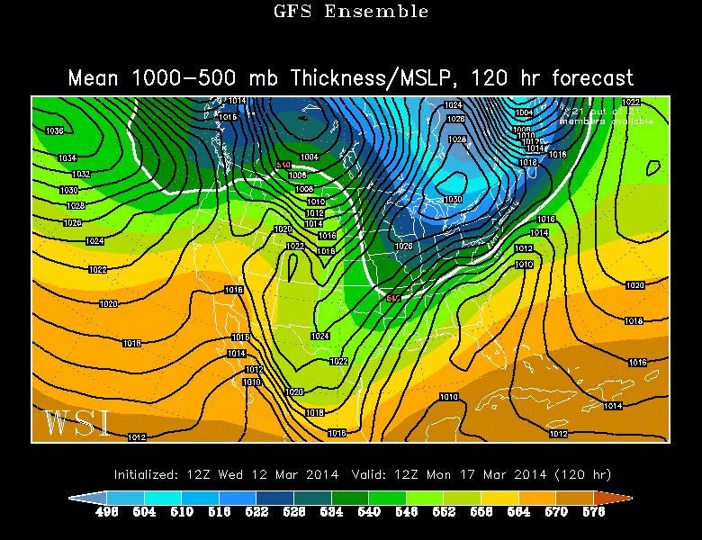
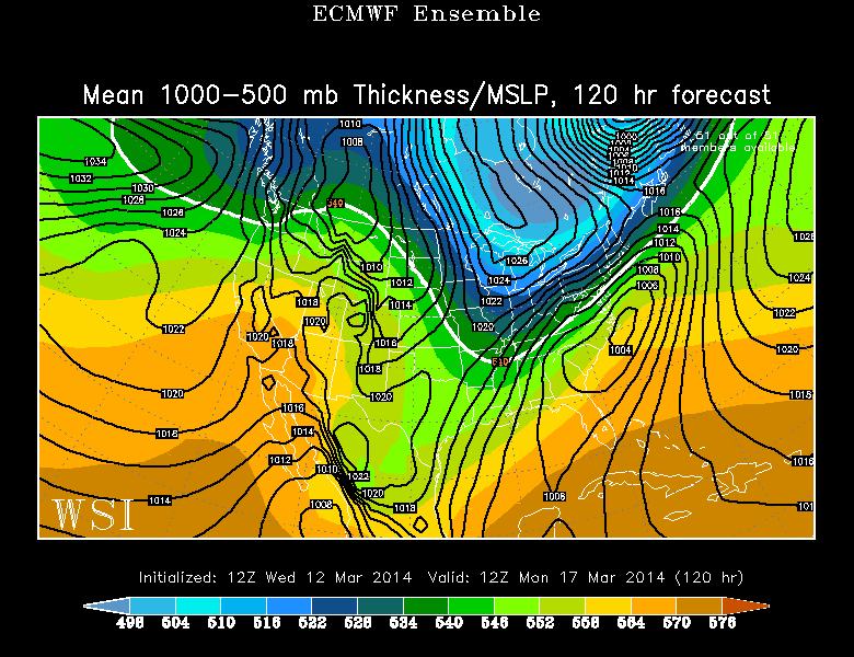
Yup, already some chatter about the next potential. A common them amongst all the data we look at is storminess off/around the East Coast. But the big question is - how strong will high pressure and a push of Arctic air be across New England? And how far south with a lobe of the polar vortex dip down toward the U.S.? If that high is strong and dry enough, it'll keep the storm out over the fishes. A little weaker or positioned more to the west and this one may be able to slide up the coast and bring us more snow. The biggest threat area this far out is SE Mass and RI, but of course tons will change before we get there. The model breakdown is that the GEM and ECMWF are on board for snow, the GFS is out to sea, and the ensemble means of both the GFS and ECMWF are pretty far out to sea too. But spaghetti charts reveal a massive amount of uncertainty, some members offering a much deeper East Coast trough and others with a flatter, more progressive flow.
Source: WSI EnergyCast
What we know for sure right now is that it'll be cold. Highs should stay in the 30s both Monday and Tuesday, perhaps even staying in the 20s if things pan out just right. Being St. Patrick's Day, I say that calls for an extra glass of whiskey to keep us warm.


