Subzero Wind Chill. In March.
Find Eric Fisher on Twitter and Facebook
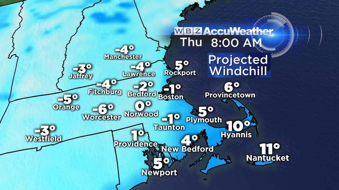
The freezer door is still open, and the Canadians refuse to close it. A few of you may have checked the calendar today to confirm that it is indeed March. The month when daylight rapidly increases, temperatures frequently jump into the 50s, grass begins to reveal itself again, and the crocus poke out of the ground. Well tonight, as a gusty north wind picks up, wind chill values will drop back into the single digits and even subzero territory! We're pretty well practiced at this by now, but c'mon. That's some pretty brutal air for this point in the season. In fact, today's high of 29º in Boston was the first high below 30º in March since 2011, and yesterday Providence and Windsor Locks had their first sub-30 highs since 2009! So yes, this isn't exactly a common occurrence.
 Unusually cold air at 850mb continues to pour in. Tonight cold enough for ocean-effect snow showers/clouds.
That very cold air moving in aloft, combined with relatively warmer ocean water, will lead to continued ocean-effect clouds and snow showers through the overnight and into much of tomorrow morning across Cape Cod and the Islands, as far north as up toward Plymouth or so. Everyone else will see clearing skies and bitterly cold temps in the single digits for most. For a whole lot of us, the snow piles in our yards have become glaciers. Concord, NH has seen overnight lows at or below zero for 6 out of the past 7 nights, and the next two will certainly follow suit. Most towns west of Boston will see similar readings. The persistence of this kind of cold has been remarkable over the past several months.
Highs on Thursday will again stay well below the average, which is in the mid 40s this time of year! Most stay in the 20s, a few poke up around 30 during the afternoon. While the morning will be extremely difficult to find motivation, at least high pressure shifting overhead will help the wind calm down during the afternoon/evening. And abundant sunshine, however ineffective it may be, will help take a little bite out of the air. Thursday night looks ideal for radiational cooling with calm winds and clear skies, so except another round of temps in the -8 to 10º range across the area.
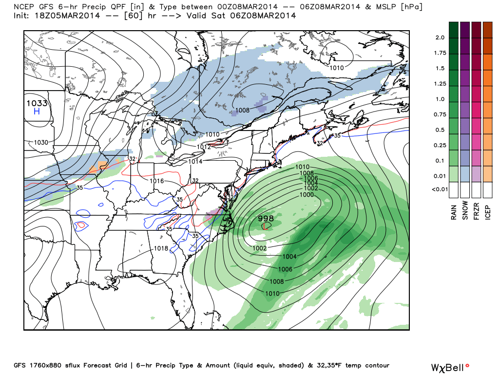
Friday night setup. Some models are a bit farther north, others a bit farther south. I think some cloud cover and a few rain/snow showers are the best bet at this point, all gone by Saturday am. Source: WeatherBell
On Friday an bit batch of moisture and storminess will be off the Southeast coast, and will be trying its best to move northward. For most of the day our high pressure will help fend this storm off, allowing for just some cloudiness. But as that shifts east overnight the storm may come far enough in our direction to bring some rain/snow showers Friday night. If this happens, it's all overnight and a 'kicker' cold front gradually moving east will help guide it out to sea, allowing for a mainly dry Saturday.
As temps aloft moderate, we should manage the 40s on Saturday. There's an outside shot a town or two may hit 50 before the clouds roll back in during the afternoon/evening. While it's only average and certainly nothing spectacular, relatively speaking it should feel great! A round of sct'd rain/snow showers may push across Saturday night, bringing a new shot of chilly air in behind them on Sunday. A gusty breeze and highs in the 30s/low40s are expected to end out the weekend.
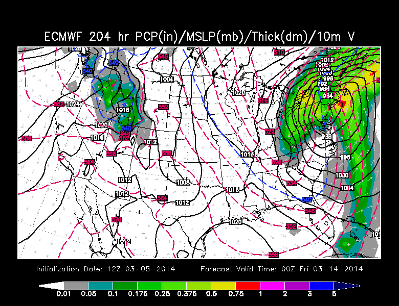
ECMWF forecast for next Thursday. The usual caveats apply here (just one run, a long way out, energy still way out in data void of Pacific, expect things to change). Source: WSI Energycast
Another fast-moving shortwave is expected to push through on Monday, bringing sct'd rain/snow showers again. We take a breather on Tuesday before more stormy forces gather to our southeast for Wednesday/Thursday. There are some pretty wide differences in the models for the mid/late part of next week, but this is the focus for our next potential storm. The ECMWF wants to go gangbusters with a large coastal system, and is faster than the GFS which doesn't ramp things up until very late in the week. That's not too surprising this far out, and nothing to get too excited about yet. But that's the next piece of energy we're keeping tabs on for potentially disruptive weather. Stay tuned!
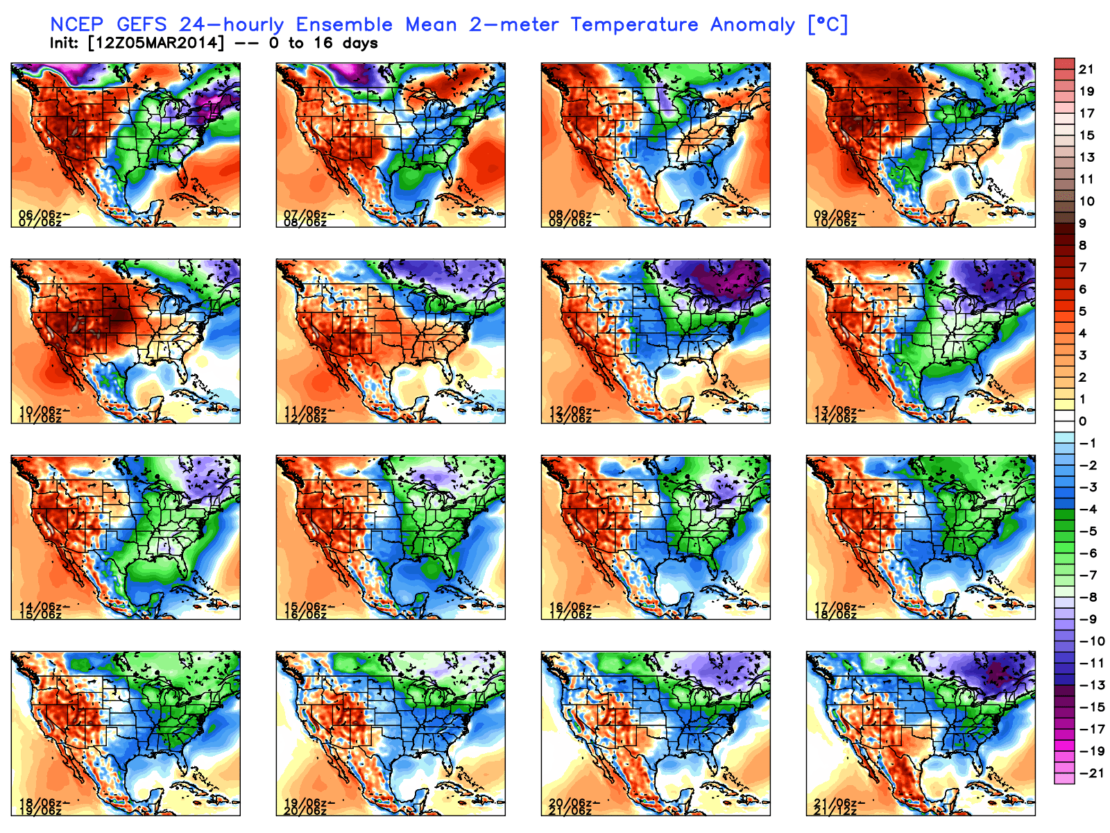
GFS ensemble mean for 2m temperature anomalies through March 21st. Almost every single 24-hr period below average! Arg. Source: WeatherBell
As for the temperatures, there is very little relief in sight for what oculd be the rest of March. Yes, temperatures on the average will start to get a little milder and it looks like we can expect more days in the 30s/40s than the 20s we've dealt with recently. But opportunities for 50s/60s look extremely few and far between. Ensemble means for both the GFS and ECMWF show persistent floods of cold air coming down into the Northeast throughout the remainder of the month. So while we may get a break or two, the overall idea is for more below-average air to keep spring in check.
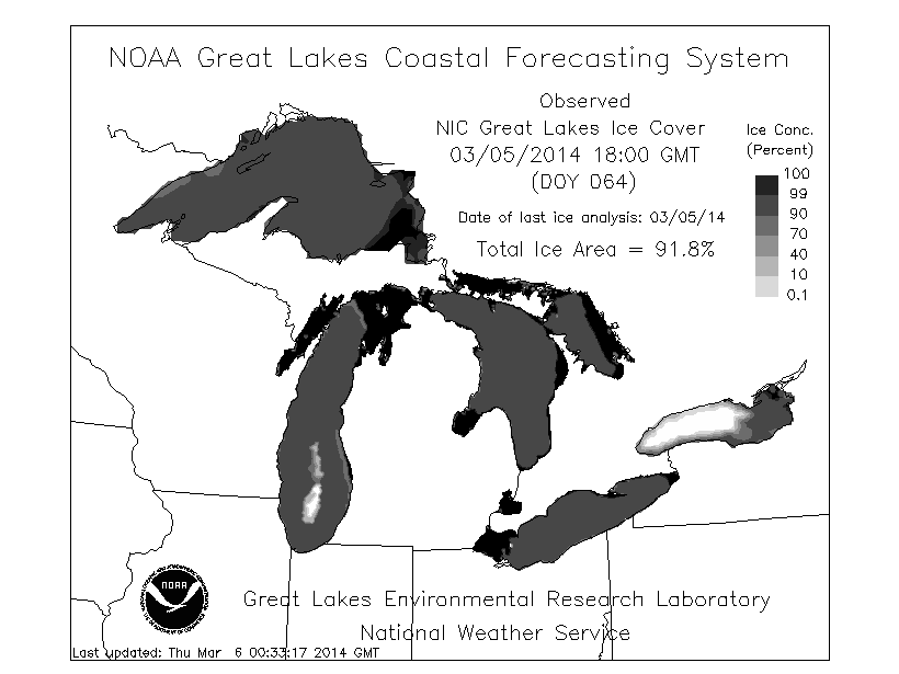
Source: GLERL
It has been so cold over the past few months that the Great Lakes are approaching a very impressive record. As of today's update, the entire Great Lakes system is 91.8% covered in ice! That's the 2nd highest coverage ever recorded for the Great Lakes, and is just shy of the ALL-TIME record of 94.7% set in February of 1979. There's a decent shot they'll be able to reach the record before this week is done. The main holdout right now is Ontario, which is a deep lake and situated in a slightly milder area than its counterparts to the west. In any case, this is a great example of how stunningly cold the air coming down into the Midwest has been recently, without letup.
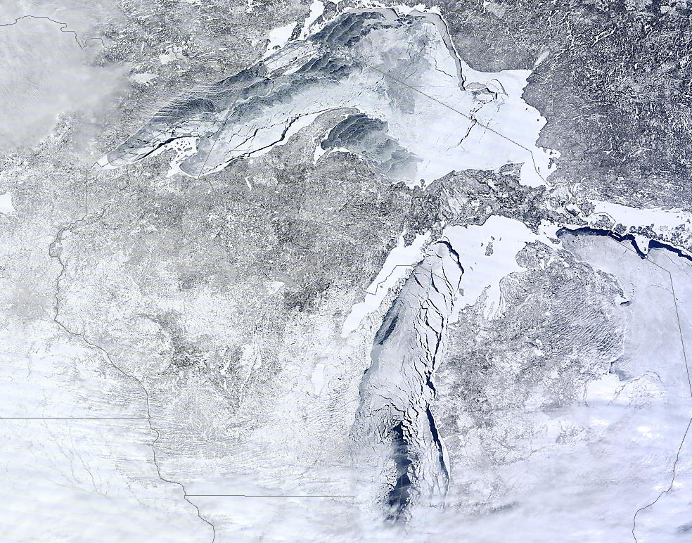
MODIS Terra pass on Wednesday, March 5th. Notice the incredible ice coverage on Superior and Michigan. Source: NOAA