Out of the Freezer: Warming Trend Ahead
Find Eric Fisher on Twitter and Facebook
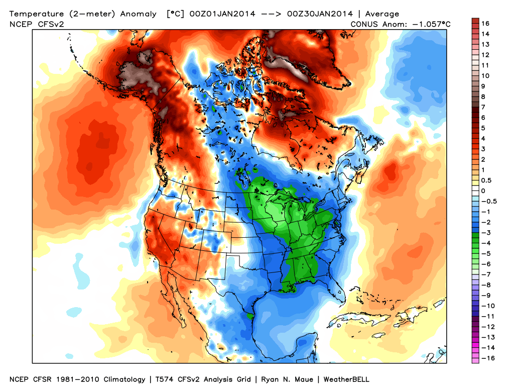
Surface temperature anomalies month-to-date. Core of the below-average cold has just missed us to the west, centering from the Upper Midwest down into the Deep South. Meanwhile, a great winter to live in Alaska! Source: WeatherBell
Only a few hours left in January 2014, and the year has been off to a cold start. For places like Indianapolis, Chicago, Minneapolis, and International Falls (and of course all the towns between) a pace for coldest winter in 2-3 decades is underway with one month of Meteorological Winter to go. Interestingly, there have been no monthly record lows set during this January, anywhere. There have been plenty of monthly record highs, though (in the west and Alaska). Which paints an interesting comparison. The heat has covered a smaller area geographically in the U.S., but has been more anomalous. The cold, however, has been more widespread and extremely persistent. That drags down the monthly averages, and is why the winter in general is off to a very cold pace.
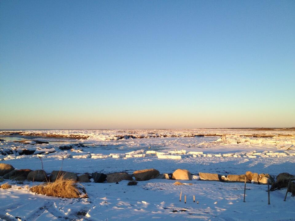
Beautiful shot of Cape Cod Bay today from @CapeCodWeather on Twitter
Here in New England, we've been at the fringe of all these extremes. January will finish up 1-2º below average in terms of temperature. Certainly colder than recent winters where we were essentially handed a free pass, but nothing too staggering in the overall scheme of records here. The highs have been high, and the lows have been low! Fitting that the final day of the month will be a 'typical' late January day.
The next weather-maker is a clipper-like system bringing snow across the Great Lakes tonight. It won't have much moisture with it when it visits us, so just an increase in cloud cover after 10pm tonight and generally gray but still bright skies on Friday. There may be just enough moisture for a flake or sprinkle late on Friday, but nothing major to impact the final day of January. Highs will be seasonable, 30s to near 40, although I wish that came with a little more brilliant sunshine like we enjoyed today!
For the weekend - this front will lay out across our area and keep the clouds as a persistent part of the forecast. I do think they will be able to split apart for a while on Saturday, and overall it's a fine start to the weekend. 30s to around 40, maybe a few flakes in Southern NH/northern MA. The one thing I'd keep an eye out for is any light precip early on Saturday could freeze on contact and in a few areas lead to some icy conditions. That'll be something to further assess Friday night/early Saturday. Most of the lift from this boundary will be focused to our north, which is some nice news for ski areas. They should get a thump of snow Saturday into Saturday night. Unfortunately, a mild push of air may change that snow over to a mix Saturday night into Sunday, particularly for the central/southern NH & VT ski areas. Here in MA, we should all jump into the mild sector by Sunday morning.
Sunday itself is certainly the warmest day of the forecast. If the front doesn't pass until early afternoon, we're probably talking 40s to near 50. Great for long Boston Marathon runs, which are really starting to ramp up. This front doesn't look too spectacular in terms of rainfall. There should be some scattered showers about and lots of clouds, but that's about it. We'll tend toward drier conditions by Sunday evening.
The Superbowl looks BORING. I think all of us weather geeks were pretty pumped at the prospect of some adverse conditions for the first open-air Superbowl. But alas, Mother Nature is not delivering. Nothing of interest for East Rutherford, NJ this Sunday. Just a few rain showers around, lots of clouds, highs near 50, and then falling back near 40 by kickoff. C'mon, man!
Looking ahead, next week is interesting. February likes to get active on us, and it looks like the switch will be flipped right away. Storm #1 currently looks quite close to our coastline on Monday, but not a hit just yet. However, much like what we just saw on Wednesday, this is the type of system to keep a wary eye on. If it jogs farther north, like the ECMWF is suggesting, we're back into some snowfall on Monday (particularly of interest to the South Coast, Cape, & Islands again). So stay tuned on this wave...
Storm #2 is a much more likely hit, and arrives late Tuesday into Wednesday. It'll have plenty of moisture to work with and will take a track either right at us or just to the northwest of us. As it stands now (still 5 days out) this one looks like a trickier forecast than the past few. We'll have p-type issues (snow, rain, sleet, ice) to deal with. Whenever you've got a scenario like that, we're going to need to be closer to the event itself to figure out exactly where those lines will be drawn. But plan on some potentially nasty weather Tuesday night through Wednesday.
Then there's storm #3. Nearly every model is sniffing out a coastal storm by the weekend. We're talking 10 days out, so no mass panic just yet. But just a sign that the changing pattern is an active one, and we should have quite a bit to keep us busy here in the weather office.