Eye On Several Systems
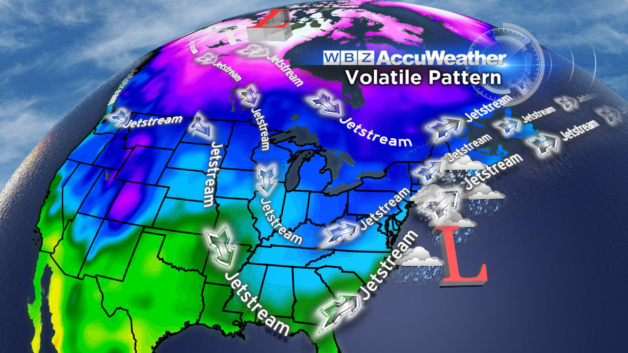 Based upon statistics, the coldest part of the winter, on average, occurs during the period of January 20-25. Checking the last 5 years, that is exactly what happened in January of 2013, 2011 and 2009. Will that happen this January? Well, with the exception of the 6th, we've already experienced arctic air on January 2-9 so the big question is whether there will be a sequel this month. Current global indicators point to a high risk of more blasts of arctic air revisiting the nation especially across the Great Lakes and the Northeast after we enjoy a longer thaw this week. Last week, there was a mini-thaw lasting less than 24 hours on Monday with a surge in warmth returning yesterday morning leading to late afternoon and early evening high temperatures within a few degrees of record highs over 60 degrees! In the days ahead, high temperatures will be above average by about 15 degrees tomorrow, 10 degrees Tuesday, 6 degrees on Wednesday then close to average the second half of the week. Frigid air has retreated into Canada and is in the process of reloading for new invasions commencing perhaps late next Sunday as the jet stream pattern repeats its previous configuration. Consequently, we could indeed have to endure some very cold air periodically during January 20-25 and possibly longer to the end of the month. Furthermore, with multiple strong short waves dropping into the long wave trough becoming established over the eastern portion of North America, we will be monitoring the potential for storm development close to the coast or just offshore. This could result in several close calls through the rest of January.
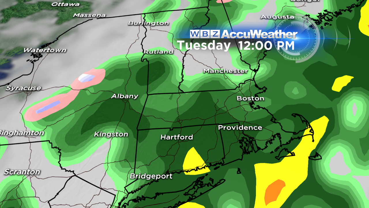 In the short-term, after today's cooler, blustery conditions with temperatures in the middle to upper 40s, there will be a spring feel to the air tomorrow. It will not seem warm and humid like yesterday and last evening but the thermometer will reveal 50-52 degrees many areas early tomorrow afternoon. The southwesterly breeze will pump the milder air back into the region as sunshine yields to some increasing afternoon high cloudiness. Moisture over the western Gulf of Mexico will be captured as the steering currents dig southward. The disturbance will ride northeastward so a swath of rain will blossom into the Mid-Atlantic area then into New England releasing some rain here on Tuesday. This will only turn into a wave of low pressure that only has support to drop less than a half-inch of rain. After that feature exits late Tuesday, the next piece of energy in the trough will arrive from the west on Wednesday. Presently, it looks like only a couple of rain showers are possible that afternoon with snow showers across western and northern New England. Interestingly, while this is happening, another bundle of energy in the jet stream will intensify as it digs southeastward over GA and SC. This will ignite a deepening storm off the coast and that bears watching as it lifts northeastward. Presently, the odds favor the bulk of the energy and moisture remaining out over the ocean but it is possible that the northwestern flank of this system will strike at least southeastern New England with some rain Thursday afternoon and evening. If this weather maker strengthens more rapidly, a closer path would lead to stormier conditions late Thursday. Beyond that, clearing will ensue early Friday to be followed by the next bundle of energy deepening the long wave trough and potentially creating a snowy scenario for the region part of Saturday. After that, we'll be watching a strong cold front rushing southeastward later Sunday with snow showers and some nasty snow squalls. Slight changes in the timing of these various perturbations could produce different solutions later in the week. In summation, I am just saying that we have to keep an eye on several systems this week, through the MLK holiday weekend and into next week.
Todd Gutner posts his thoughts tomorrow morning and Eric Fisher follows later in the day.
Make it a great week!


