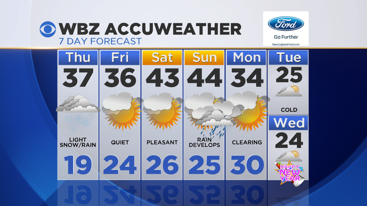
Some Light Snow Today
As a disturbance from the Great Lakes tracks overhead today, I'm expecting bursts of light snow to develop through late morning in southern New England. Temperatures will gradually rise through the day, causing the snow to mix with and changeover to areas of light rain along the south coast, Cape Cod and South Shore. Even where it doesn't changeover, precipitation won't be all that organized and temperatures will generally be above 32…meaning little impact on the roads. Watch out for a few slick spots on anything untreated and briefly reduced visibility in the areas of light snow this afternoon. Accumulations should be limited to a coating to an inch for many, with a couple inches possible in the hilly terrain of central MA stretching into southern NH.
As the storm slides out over the ocean, drier air will work in on the backside, allowing for partial clearing this evening and overnight. Temperatures will drop into the 20s for most of us overnight, so watch out for some patchy black ice in the AM.
Otherwise our weather pattern remains pretty quiet through the start of the weekend with a bit of a warming trend too. Sunday a developing storm to our south and energy coming in from the northwest will bring a period of rain to southern New England late Sunday and Sunday night…which may end as just a touch of snow depending on how quickly the cold air comes in.
After that quick pulses of energy on Tuesday and Wednesday may cause some flurries and snow showers…something to keep an eye on. For now, no "big" storms in the forecast, but plenty of cold as we kick off the New Year!
-Danielle