Cold & Quiet Christmas Day
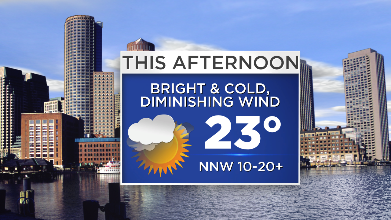
It's a cold start to Christmas Day and the wind is adding insult to injury - gusting past 20 mph in many communities this morning making it feel like it's in the single digits both above and below zero! The good news is that the wind will gradually diminish through the day as high pressure builds overhead. Don't get me wrong, it'll still be cold (highs in the low 20s) but at least it won't be as breezy. Otherwise expect lots of sunshine and some ocean effect clouds/flurries adding some ambiance on Cape Cod.
Tomorrow, an approaching disturbance from the Great Lakes will cause snow and rain showers to develop in the afternoon and linger into the evening.
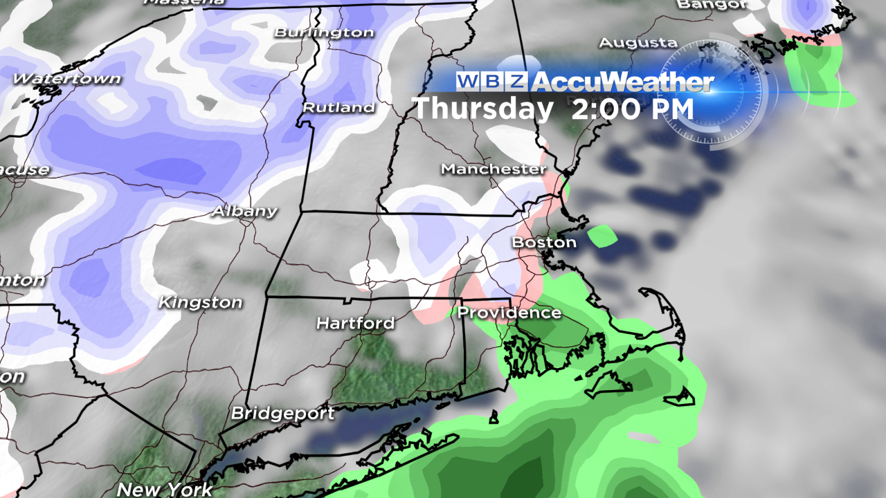
Surfaces temperatures should warm enough to cause any snow to change to rain in eastern MA. In turn, this "event" will be a minor one, with a general coating to 1" of accumulation possible, mainly outside of 128…perhaps 2" in the hilly terrain of Worcester county and southwest NH.
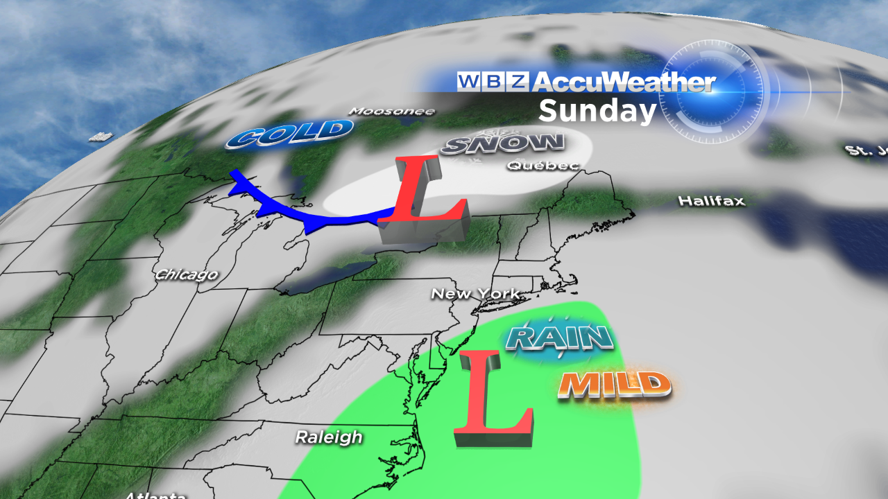
The storm will strengthen as it pulls away from the Northeast Thursday night as a new dome of high pressure builds into the region. That means fair weather will round out the week with moderating temperatures too. In fact, we'll be slightly above average by this weekend…in the low to mid 40s.
On Sunday, a storm coming up the coastline and energy coming in from the Northwest will have to be monitored closely. At this point, it looks like we may see a period of rain late Sunday and Sunday night before sharply colder air arrives for the last couple days of 2013!
Wishing you & yours a wonderful Christmas Day filled with joy, peace & love!
-Danielle