Freezing Rain Advisory
Freezing Rain Advisories are posted for Worcester, Middlesex and Essex counties in MA and all of southern New Hampshire until 11 AM tomorrow morning. While most of us will see a chilly rain from this event…enough cold air has drained down from northern and central New England that some communities are hovering either side of that magical 32 degree mark. Pockets of light freezing rain and freezing drizzle will develop overnight and continue through mid-morning tomorrow.
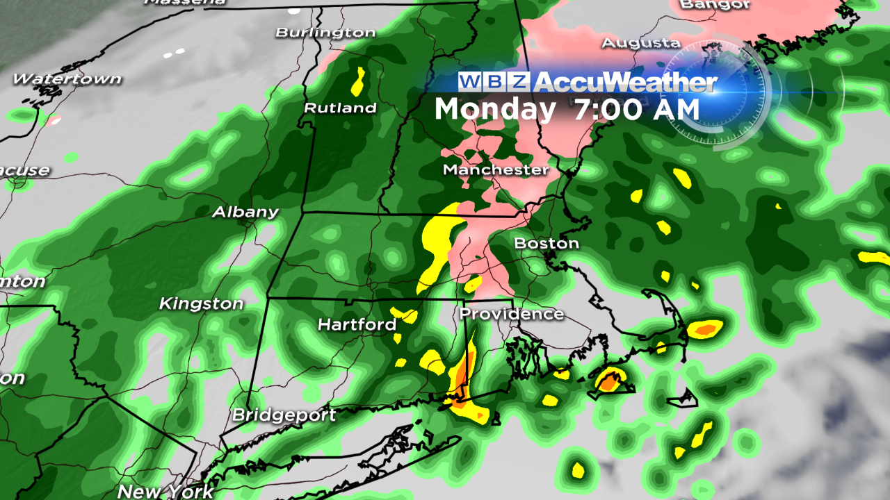
While only a trace of ice is expected – that's all it takes to create slippery travel, especially on untreated surfaces. A word of advice? Keep an eye on your car thermometer. If it's reading around 32, just be mindful of changing road conditions. The greatest risk of freezing rain is from central MA into southern NH…more specifically, along the Rt 2 corridor, 495 belt and Merrimack Valley.
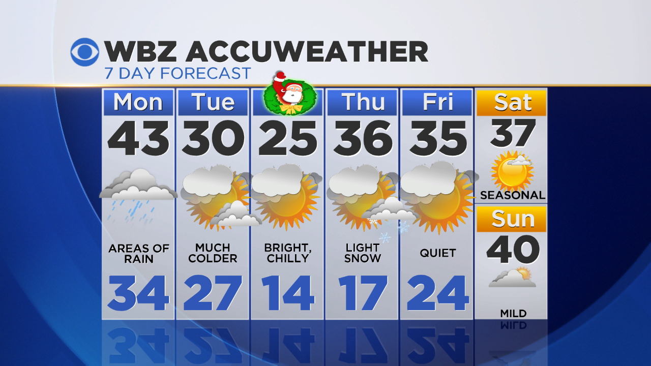
It's straight up rain for the afternoon and evening with many communities picking up 0.5" to 1" when all's said and done. The rain may actually end as a touch of snow on Nantucket and the outer Cape Tuesday as the front pulls away from the coastline.
High pressure will build into the region after that…providing relatively quiet but cold temps for midweek (mid 20s on Xmas!) with a few flurries possible late Thursday as the next disturbance comes overhead.
Be sure to check in with Todd Gutner in the morning for a live look at the radar and the very latest forecast!
-Danielle