Mild Weather Hangs Around For The Weekend
Find Eric Fisher on Twitter and Facebook
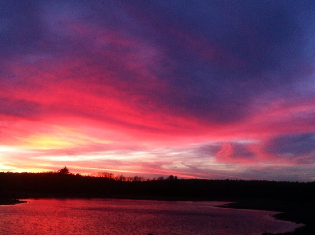
Courtesy: Jim in Paxton, MA
Pretty sure it was 5/5 this week on sunsets. The good times keep rolling here in New England this fall, with a stellar Friday that saw some towns reaching 60º. If you're a fan of the mild stuff, we're going to keep it around for the upcoming weekend. In fact, it's all above-average temperatures until Tuesday next week.
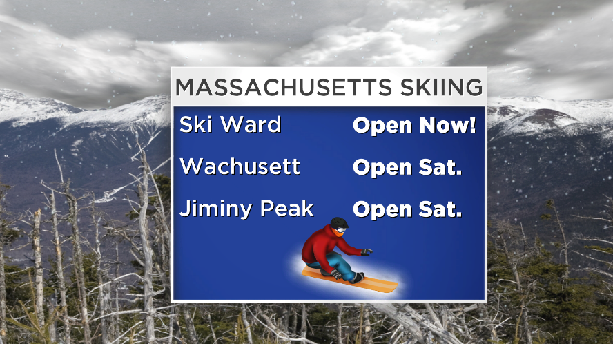
First off, the recent bouts of cold air have been enough to get the juices flowing for skiers and snowboarders. Believe it or not, technology has become so efficient that the snow guns have draped Massachusetts slopes in snowfall already. There are 3 ski areas you can check out this weekend, but honors for 'first to open in MA' go to Ski Ward, which opened up a trail on Friday evening. Many others are also opening up significant terrain across VT, NH, and ME.
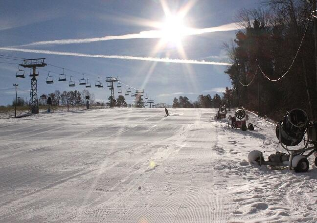
Courtesy: @SkiWardMA
The Boston Ski & Snowboard Expo will continue through the weekend at the Seaport World Trade Center, and you can swing on by and say hello. A couple members of our team will be down there (I think Barry on Saturday), the Mobile AccuWeather Lab is parked inside the expo, and you can compete in our annual snowfall forecasting contest to win some sweet prizes.
Alright - now onward to the actual forecast. While the temperature part of it is pretty simple, the sky cover is a bit trickier. A short-wave impulse will quickly cross the area tonight and into the early hours of Saturday. Dew points are extremely low right now (single digits) so rainfall looks to be out of the question. There will be a blanket of clouds, however, that should linger from about midnight through midday on Saturday. So we're expecting a pretty gray start, followed by increasing sunshine from west to east. Everyone should be seeing bright skies by early afternoon, with the Cape & Islands last to see the sun.
Highs on Saturday will bounce into the mid/upper 50s, making for a pleasant afternoon with minimal wind. Good for yard work or stringing up the holiday lights while it's comfortable! We'll stay mainly clear on Saturday night, with cool temps back into the 30s.
Sunday is the opposite of Saturday - meaning that we'll start out bright (after a little am fog) and then see increasing clouds during the second half of the day. This is in advance of a strong storm developing south of the Great Lakes, drawing southerly winds into our neck of the woods. Some drizzle may start to hang in the air along the South Coast areas by late Sunday afternoon as moisture increases. Highs again will be in the mid/upper 50s.
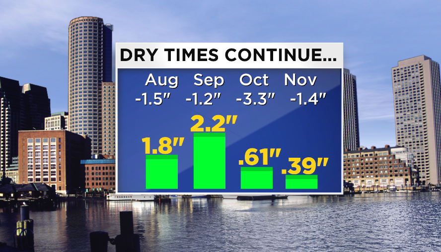
As you can see, we could really use some rain from this storm. We're running a >7" deficit since the start of August in the Boston area. While crops aren't growing anymore, there is still a heightened risk of brush fires due to all the dry conditions (we're listed in 'Moderate Drought' in the latest drought monitor report).
It looks like a similar setup to November 1st, when mild air surged north, we had plenty of moisture, but the forcing missed us to the NW. That being said, it looks like we may be able to pick up .25 - .75" of rain from this front as it swings through, mainly in the form of squally downpours and showers. Winds will be gusty out of the south, and highs will reach the low 60s early in the day before falling rapidly once the front passes. So not a drought buster, but we'll take it!
The rest of next week looks chilly and quiet. Highs will stay below average Tuesday-Thursday, before rebounding on Friday. Most of the days look bright and dry. Not much fanfare leading into next weekend.
Have a great weekend!
E