Kicking Out The Cold!
Find Eric Fisher on Twitter and Facebook
We love to talk about the weather here in New England. And I'm pretty sure there was plenty of dialogue today, especially during the frigid morning where many towns dipped all the way back into the 10s! Colorful language may or may not have been included in those conversations, but I gotta say that it didn't feel too bad out there for the folks (like myself) who don't mind some wintry chill. On Twitter, it wasn't all haterade when asking if anyone was enjoying the taste of January.
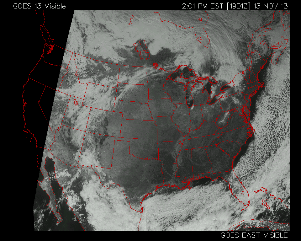
Well when all was said and done, Boston did in fact dip into the 20s for the first time since March 22nd, and the max temp stayed in the 30s for the first time since March 21st. Worcester only reached the freezing mark, 32º, making it the coldest November 13th in over 50 years. In short, it's baaaaaaaack. I was also struck by the massive area of subsidence (sinking air) under a gigantic high pressure system. This high topped out around 1048mb, already in mid-winter form! As air sinks underneath it, clouds are suppressed and you're left with blue skies as far as the eye can see. At one point, I counted 20 completely cloudless states!
Only a short bit of cold weather to go though before we're on the mend. Tonight dew points are in the single digits/10s, skies are clear, and wind will be light enough to let temperatures fall back into the 10s NW of Boston and low 20s for most other locations. So it'll be another tough one to get out of bed on Thursday morning. But here's the good news - we're well up into the 40s tomorrow afternoon, if not the low 50s across eastern MA. That comes along with nearly full sunshine, so compared to the past couple of days it should feel quite nice, even with a frisky westerly breeze.
Friday will be even better, with highs in the mid/upper 50s as a Canadian air mass continues to moderate. I've got my tee-time ready to go - golf season ain't dead yet! But whatever your plans are, it should feel quite nice with a mix of sunshine and a deck of cirrus clouds passing by.
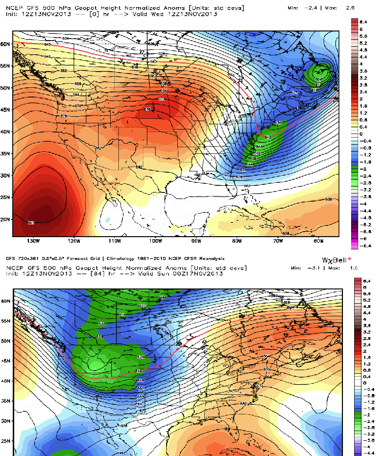
As we head into the weekend, a complete pattern flop for the U.S. A big trough will dig in across the west, lifting a ridge across the east. In short, everyone's sensible weather will change for Saturday and Sunday. That trough will help to pump up a big storm system, which eventually will wind up across the Great Lakes and funnel mild air up the eastern seaboard to start next week.
If your 'honey-do list' includes raking a mountain of leaves in the yard this weekend, I'm sorry to say you're going to have ample opportunity to be holding a rake. Winds look generally light this weekend, especially on Saturday, so it'll be a perfect one for yard work. If you have more exciting plans outside, then that's all good, too. Saturday looks like the pick at the moment, with the chance for some increasing cloudiness on Sunday. Any way you slice it, the weather will be pretty cooperative for this time of year.
The next 'interesting' weather event is Monday into Tuesday. The aforementioned storm passing through the Great Lakes will push temperatures into the 60s on Monday, along with much more humid air. We've still got some days to work out the timing, but it looks like the heaviest rain will be late Monday through early Tuesday for our area. Many models are hinting at >1" potential, which would be fantastic with our current -4.28" rainfall deficit (that's for the year, but the fall has been particularly dry). Some gusty winds would accompany that rain as it comes through.
Behind it, you guessed it, another arctic blast. And believe it or not, this one looks even colder than the one we're coming out of. Below is a look at the progged GFS 850mb temps by Wednesday morning. Readings of -16ºC translate to possible highs in the 20s! Again, that's day 7 of the forecast so we've got some time to figure out the exact numbers. But a blast of cold air looks unavoidable for next week.

Hey at least it'll get you in the skiing or snowboarding spirit, which is really picking up lately. Ski areas locally have been pumping out snow and also seeing fresh powder, and several are already open on the weekends. There's also the Ski and Snowboard Expo coming to town Thursday through Sunday in Boston, and at least 1 member of our team will be down there each day.
And finally - a space weather note! Comet ISON is drawing closer, and in fact is now close enough for you to spot it with a small telescope or good pair of binoculars low in the predawn eastern sky. It will make its closest approach to the sun on Thanksgiving night, November 28th. You can read all the details about it here.

Courtesy: NASA