Early November Rollercoaster
Find Eric Fisher on Facebook and Twitter
I had to chuckle walking around town this morning. New Englanders are known to be a stubborn group, and I'm pretty sure we all decided 'It's November and it's supposed to be cold, so I'm dressing for cold.' Everyone was walking around in pants, hoodies, and jackets...even though it was in the 70s! Definitely not typical, but not quite record breaking either (the record high for November 1st is 77º).
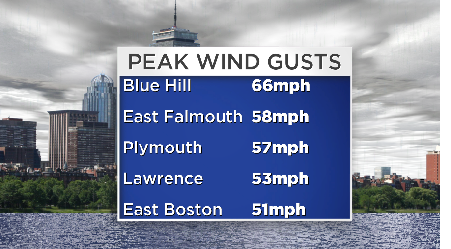
Of course the wind was a different matter, with gusts ranging from 50-66mph in most towns. Those winds brought down some trees, which with leaves still on them have decent 'sails' to catch the wind energy. Spotty property damage and outages were found around the state, too. Those winds will die down tonight and be light by Saturday morning.
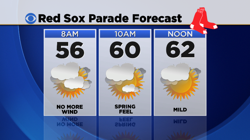
We've got about 24 hours of mild weather to go before the pattern swings to pour cold back into the region. Temperatures will stay in the 50s to upper 40s overnight, so with diminishing winds a delightful Friday night. If you're headed out to the Rolling Rally through Boston in the morning, you'll barely need a jacket. Temps should be in the 50s to low 60s by the end of the parade - perfect!
However, not everyone will be high and dry. A wave of low pressure will form along the front that moved through today, but has no intentions of quickly heading out to sea. That will bring clouds back across SE Mass, with showers also possible late Friday night through midday Saturday. I think those showers will stay southeast of Boston and the Red Sox parade, but will lead to a mild and damp Saturday morning for the Cape & Islands. Any rain associated with that system should head offshore by mid-afternoon.
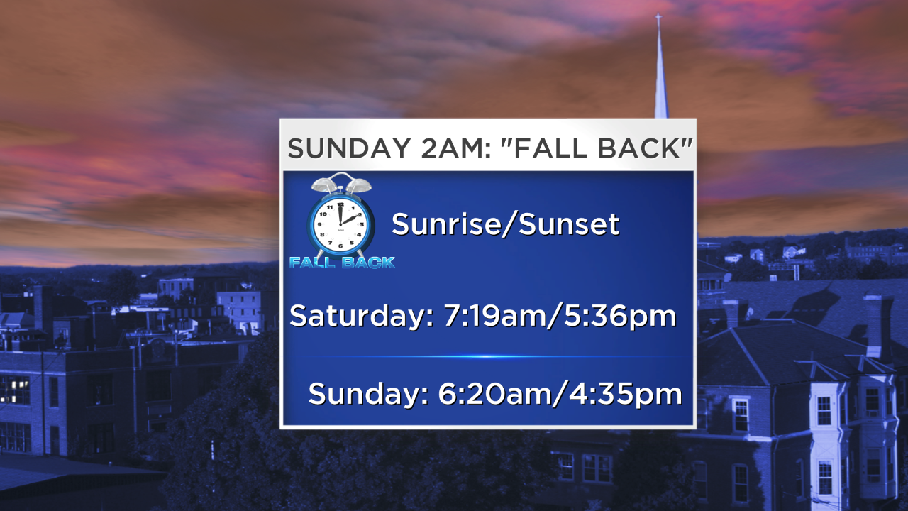
After that storm heads out, another trough of low pressure will swing in from the west Saturday night. For those heading out in the evening, clouds may move back in and by late a couple showers could pop up. Those scattered showers will linger into Sunday morning, as well as the cloud clover. Behind the action is cold Canadian air which will pour in during the day on Sunday. It'll be quite the 180 from Friday...highs from 72 down to 47!. Those cold temps will be joined by a gusty north wind, plus a very early sunset. We set the clocks back an hour at 2am Sunday, so it's the good and the bad. Shorter days, but an hour of extra sleep! Sunset on Sunday is 4:35pm.
Sunday night should end up as the coldest night of the season so far, with the first freeze expected in Boston. That's right on average climatologically, as the average first frost date in downtown Boston is November 4th! The week will start off cold with highs in the low/mid 40s, albeit with sunshine. Seasonably cool and bright weather on Tuesday, with milder air coming back in Wednesday. For Thursday and Friday a storm will form that will act almost identically to this most recent one. We'll be on the gusty and mild side, with limited rain.
In fact, the long range doesn't hold much hope for significant rainfall. As expected we didn't end up with much on Friday (generally .15-.60"), and I don't see much coming for at least the next 2 weeks. While there will be some cold outbreaks, there should end up with even more days that turn out mild. Fairly quiet weather continues!