One More Day, Then...
Find Eric Fisher on Twitter and Facebook
The party is almost over people. We've been quite spoiled this fall with perfect weather, but we knew reality had to set in sometime. And we'll definitely feel it by Wednesday. October is a month that's all about change, when anything from hurricanes to snowstorms can strike. So when the weather starts to get a little funky, it's not too unexpected!
There's one more mild day to come before we get to the chill. Tuesday will feature a mix of sun and quite a few mid-level clouds that will filter the sunshine. But with a breezy southwesterly wind, temperatures will still manage the mid/upper 60s. This is the final hurrah of warmth, so enjoy it while it lasts! An approaching cold front will be starved for moisture and lift, and so any rain showers will be few and far between. A couple of them may wet the ground around and to the northwest of Boston during the afternoon, but that's about it.

NAM MSLP forecast and precipitation. Just a few showers north of Boston Tuesday afternoon.
Then, the winds of change. Cooler air will start to filter in on blustery west winds Wednesday night. But at the same time, we'll be watching the coast. A clipper-like system will develop south of Long Island and head just off our shores. The pattern overall has turned more progressive, and so the storm will be a fast-mover and be unable to deepen too dramatically. But what it will do is drag in more cold air, bring generally overcast skies, and also some chilly rain. Models aren't in great agreement about the placement of this low, but the highest chance of significant/steady rain will be across southeastern MA. This includes the Boston area and down to the South Coast, Cape & Islands. Areas outside of Metro-West will see showers, but are not likely to pick up significant amounts of rain. With the clouds and rain, most towns will stay stuck in the 40s!
SNOW? Yeah, I said it. Not totally out of the question as rain ends Wednesday evening. Colder air will be rushing in, and it will be plenty cold aloft. Temperatures at 850mb will dive to the -2 to -4C range, and it will definitely be snowing above our heads. The issue is that the flakes will melt on the way down. Air near the surface will still be well above freezing. I'd say 44-48º at sea level, and that 'warm' layer will extend up a good 1,000-2,000 feet. So it would have to be coming down pretty heavily to bring snowflakes to the surface. The best shot at this happening will be across the hills of northeastern CT, northern RI, the Worcester Hills, and the Monadnock region (if the storm travels inland enough). If fat wet flakes do manage to hit the ground, it will be a novelty event at best. The ground will be much too warm for anything to stick, and the same goes for any paved areas. But what a thrill that could be...big wet flakes falling at Fenway Park right before the start of the World Series! We shall see.
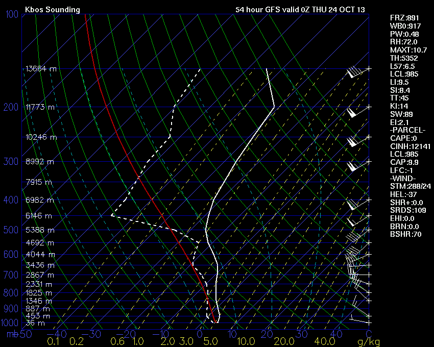
GFS forecast sounding of the atmosphere for Wednesday evening. Note the above-freezing temps at the surface, with below-freezing temperatures not too far above the ground.
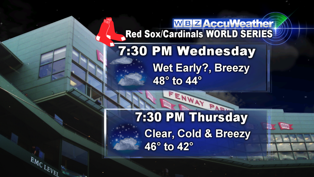
Speaking of the game, we're talkin' October weather at its finest. 40s, wind chill in the 30s, and rain ending. Lovely. But hey, what do you expect with Halloween around the corner? Baseballs won't want to travel too far with a cold, dense air mass in place and gusty winds. Definitely bring the warm weather gear...I'm sure Red Sox snuggies will be in high demand. But any precipitation should be gone by first pitch.
Thursday & Friday are blustery and chilly with a below-average air mass entrenched across the eastern U.S. In fact, 20s could reach all the way down into Georgia! Pretty much every state east of the Rockies will be in the deep late-October chill. Our highs will stick around 50 with overnight lows in the 20s/30s. Widespread frost will be likely Friday and Saturday mornings in particular, with a killing freeze across most towns. It's been a wonderful growing season, so the impact of this will probably be pretty minimal. The average first frost date in Boston is November 4th, and the last time we saw 32º at Boston Logan was April 7th.
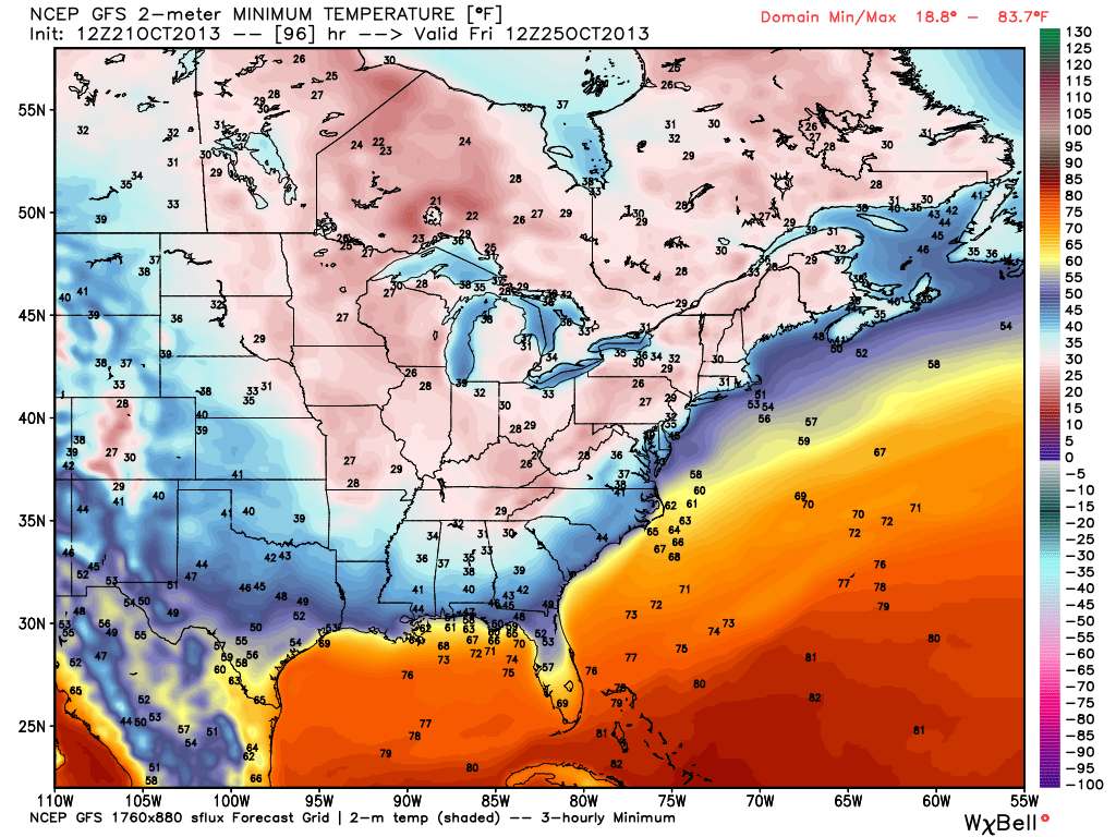
GFS forecast lows for Friday morning
Clouds will move back in by late Saturday as a deep short-wave disturbance heads into New England. This will bring snow showers to the mountains of New York and New England Saturday night and Sunday! A little early excitement for the ski areas. We'd likely just see rain showers locally, with more cool temperatures. The cool air will moderate as we head into next week.
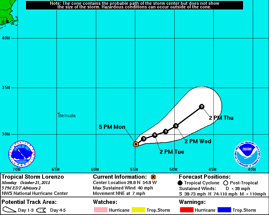
And in the tropics, we have our 12th named storm of the year. Lorenzo is WAY out to sea, and will impact no land. Another weak tropical system with minimal effects. That's what we like to see! The basin that's most active is the Western Pacific, which features 2 typhoons (Francisco and Lekima).
 Western Pacific Satellite Loop