After A Spectacular Week, Rain Returns
Find Eric Fisher on Twitter and Facebook
It's one of those weeks where I could have come in on Monday, recorded a forecast, and let it run all week long. Just an unbelievable stretch of beautiful weather, as we can see when the tropics aren't a factor in September. We've got a little more of this weather heaven to go, before changes move in for the weekend.
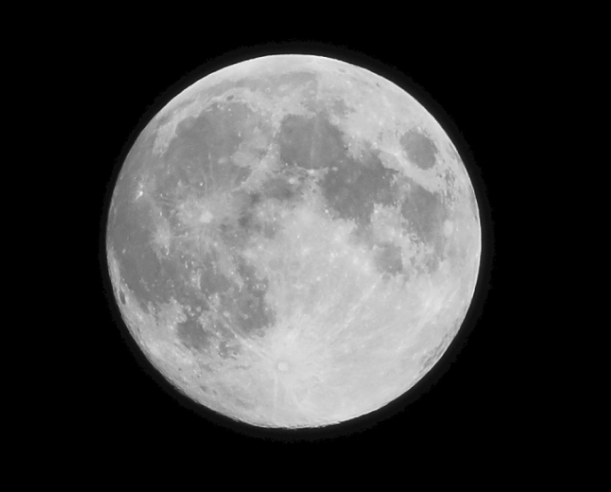
All you need to know about tonight is that you should get a camera for 6:40-7p. A nearly full Harvest Moon will come up almost in exact conjunction with sunset, which means it'll be a photographer's dream. Here's one great shot from Michael in Haverhill last night.
After some patchy morning fog, tomorrow looks fantastic once again. Abundant sunshine will help boost temperatures into the upper 70s to near 80, with somewhat cooler temperatures at the coast with light sea breezes developing. Whether you're going for a hike, a stroll along the water, round of golf, or just sitting in a chair - Friday will be a day to soak in. One of those 'top ten' New England days!
Then comes the weekend. The main story will be a cold front slowly pushing in. Saturday may start off with some low-level cloudiness, which will break apart heading into the day. Then our attention will be the rain pushing across New York State and western New England. As of now, the timing looks to bring these showers in just a touch after sunset. In any case, rain chances with this slow-mover will be highest between 10p Saturday and Noon Sunday. Instability looks fairly limited, so lightning and thunder won't be a major concern.
For the Patriots, tailgating may indeed be wet. There's a decent chance that the rain will head east by kickoff, but stay tuned for updates on that timing. By the evening the whole region will be clearing out and drying out. By the way, that Patriot's game will end at about the same time as summer! The autumnal equinox will take place at 4:44pm EDT on Sunday. So when you go to bed, there will be no more excuses left for summer. Meteorological Fall started on September 1st, Labor Day was September 2nd, and the equinox will be behind us. Bring on the pumpkins, Oktoberfests, and tailgating.
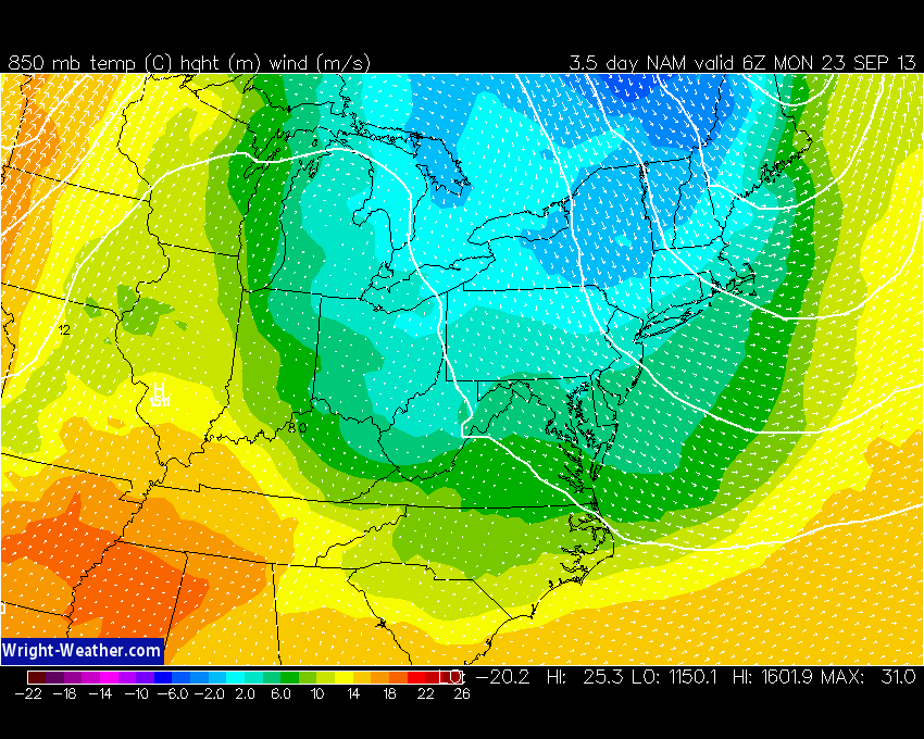
A big plunge of polar air will head in on Monday, which is both good and bad for us. It's good because strong high pressure will squash the tropics off to our south, and keep coastal trouble away. It's bad because it will feel more like late October, with potential frost Monday night. The flow of air will be straight from the north pole. Thanks, Santa.
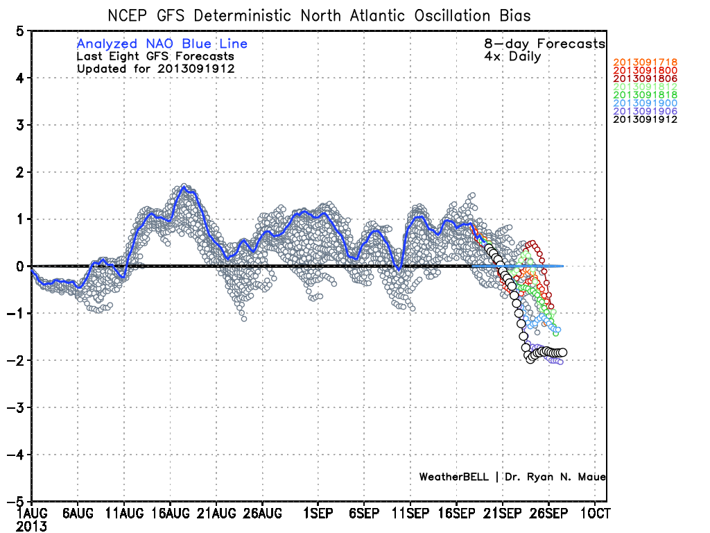
The NAO (North Atlantic Oscillation) is forecast to tank by Monday. This can often mean cold air for the Northeast, and the GFS is showing this signal most strongly. It's worth noting that over recent time, the forecasts have almost always ended up being too negative after looking at actual results. So while we should turn quite chilly, it may not be *as* chilly as projected. There is often East Coast storminess that comes along with a negative NAO, but this may set up outside of our area next week (more likely toward Nova Scotia).
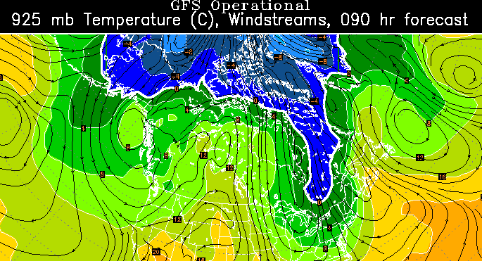
Temperatures at 850mb look to reach their coldest point of the season so far (this is the level of atmosphere that we look at the help gauge surface temperatures. It's the approximate level from which air 'mixes' down from). Take a look at the NAM projections for Sunday night...down to as cold as -4C around the White Mountains! If there's some moisture around, we may be able to squeeze out some snow showers for the mountain peaks with air like that. But we'll wait on the jury for that one :-) We'll also have to watch for a heavy frost potential, but that will be dependent on how windy we are Sunday night, and how quickly the colder air pulls out on Monday night. Updates on that as we get closer, but wanted to give the early heads up for growers and gardening enthusiasts.
This pattern will be short-lived, though. Most models indicate this chilly flow of air to move along pretty quickly, which means we'll warm up as next week wears on. It may end up being yet another glorious fall week with no big storms moving into the region. You gotta love September!
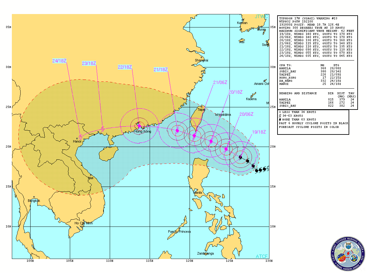
Nothing imminent in the Atlantic Basin when it comes to the tropics, but there is a monster of a storm in the western Pacific. Below is Usagi, a Super-Typhoon that as of this writing is gusting to 190mph! It is feasting on extremely warm water and a low-shear environment. Usagi is expected to track just to the south side of Taiwan, before making a run at Hong Kong. Any interests there will be monitoring this storm very closely.
 Usagi Satellite Loop