September - the month that keeps things interesting
A pretty good smattering of just about everything in the forecast through Saturday, but what else would you expect from New England in fall? Still warm enough to create potentially sultry summer days, keeping a careful eye on the peak of hurricane season in the Atlantic, and a wary other eye to the north to watch for invasions of chilly Canadian air masses. Well this week, we're doing all three!
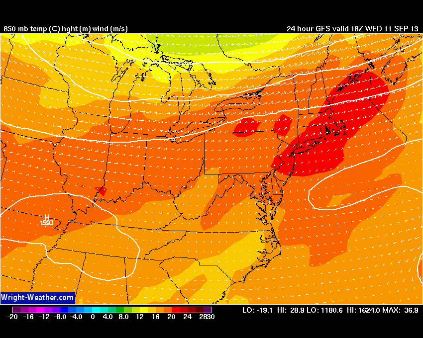
Let's start with the summer details. A Heat Advisory is in effect for much of the area between 1p and 6p. Get the updated advisories from the National Weather Service here. But in general, an anomalous air mass will overspread the Northeast as we firmly enter the warm sector of the approaching system. Temperatures at 850mb, a couple thousand feet off the surface, will be a whopping +22C! If it were July, we'd be talking about 100F degrees. But since it's September, the sun angle is lower and the daylight is more limited. Even so, 90s are a good bet for most away from the SE coast. Humidity will once again be tropical, with dew points soaring into the low 70s. The combination of temperature and humidity, or the 'heat index,' will jump to the 98-104 degree range during the peak heat of the afternoon. Teachers should keep in mind that students should take it easy and drink water, especially in the classrooms that do not have air conditioning.
You would think with highs in the 89-95 range we'd be talking about records, but that probably won't be the case. Here are the record highs for September 11th across SNE climate sites. They're as high as they get for the entire month of September, all set on one hot day in 1983! So we'll fall a bit short in that regard. Still plenty hot enough to be uncomfortable, though.
Boston - 99 (1983)
Providence - 100 (1983)
Worcester - 91 (1983)
Windsor Locks - 99 (1983)
The day should start off gray with low clouds and fog. This is the only fly in the ointment I'm keeping an eye on. There are some suspicious looking model soundings this evening, which lead me to worry about clouds sticking around a little longer than expected to start the day. This one, from the NAM, shows what we call an 'inversion,' and a whopper at that. If you look at the bottom of the chart, you'll notice the temperature line jut out to the right. That's showing you that temperatures above the ground in that layer are actually higher than the surface. So in short, the air below gets trapped. It doesn't mix, and so it takes a while to get the wind going and mix up the atmosphere and bring on the sun. For now, I'm thinking everyone should get that sun by lunch at the latest.
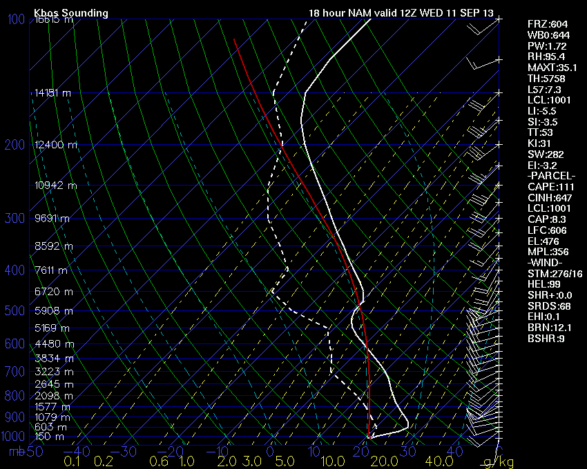
Now there's another thing to be wary of tomorrow, and that's the strong instability that will develop during the afternoon. For now, we're sticking with the idea of a strong 'cap.' A cap is a warm layer of air that rising air runs into and doesn't rise past. Once the rising air is cooler than the air above it, it goes no farther. If by some chance it *does* break around Boston, storms would rapidly develop with approx. 3,000J/Kg of CAPE. The best shot of this actually happening will be to our north and west, across Central New England. Not a great day for hiking, as storms could become severe with damaging wind gusts there tomorrow. SPC has placed interior New England and NYS in 'slight risk' areas for both Wednesday and Thursday (Click here for SPC Outlooks). There may also be some storms that manage to pop under a weakened cap on Wednesday night, but that part of the forecast remains highly uncertain right now.
Thursday is the bigger day for storms across the area. A cold front will start its move across the Northeast. Right now, the timing looks to favor the Hudson Valley region and western New England for severe storms. The falling heights and increasing wind shear will allow some storms to generate hail and damaging wind gusts.
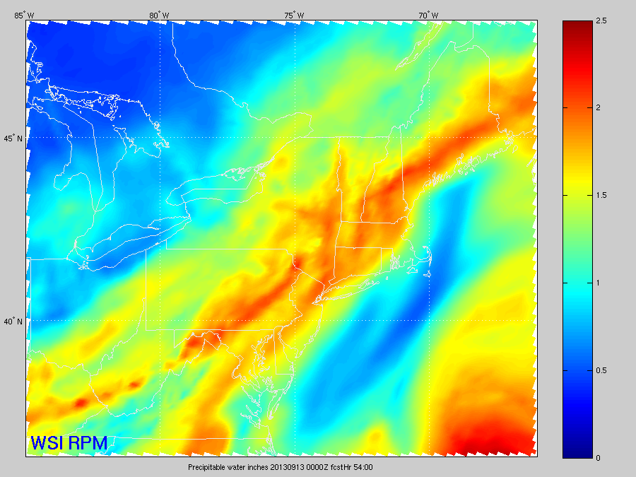
The other concern will be for heavy rain. Check out PWAT values for Thursday! They will once again, like we saw a week ago, approach 2". With extremely high dew points for this time of year (especially considering there is no tropical landfall connection to this), any storms will produce torrential rain.
For us, the timing looks to be late afternoon and into the evening. As a wave of low pressure forms along the front, we could see some hefty rain totals Thursday night. This will also likely impact the Patriots home opener at Gillette, but we'll work out the exact timing as it pertains to that over the next 24-36 hours. For now, I'd plan for rain and potentially storms, especially after kickoff. Not the best way to start the season at Foxboro. It will also still be quite warm and very humid.
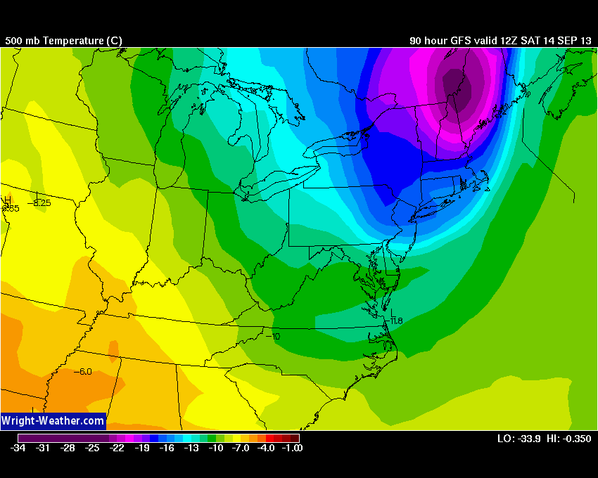
The front won't be in a hurry to leave on Friday, and heavy rain may linger into the morning hours. Even as it slowly moves away, a gusty north wind will develop and with cold air flying in aloft we'll see quite a few clouds and even another round of showers possible to end out the day. It will certainly feel much chillier by the evening, as that cool air continues to plunge out of Canada (and especially considering the fact that we'll be coming off such a hot air mass).
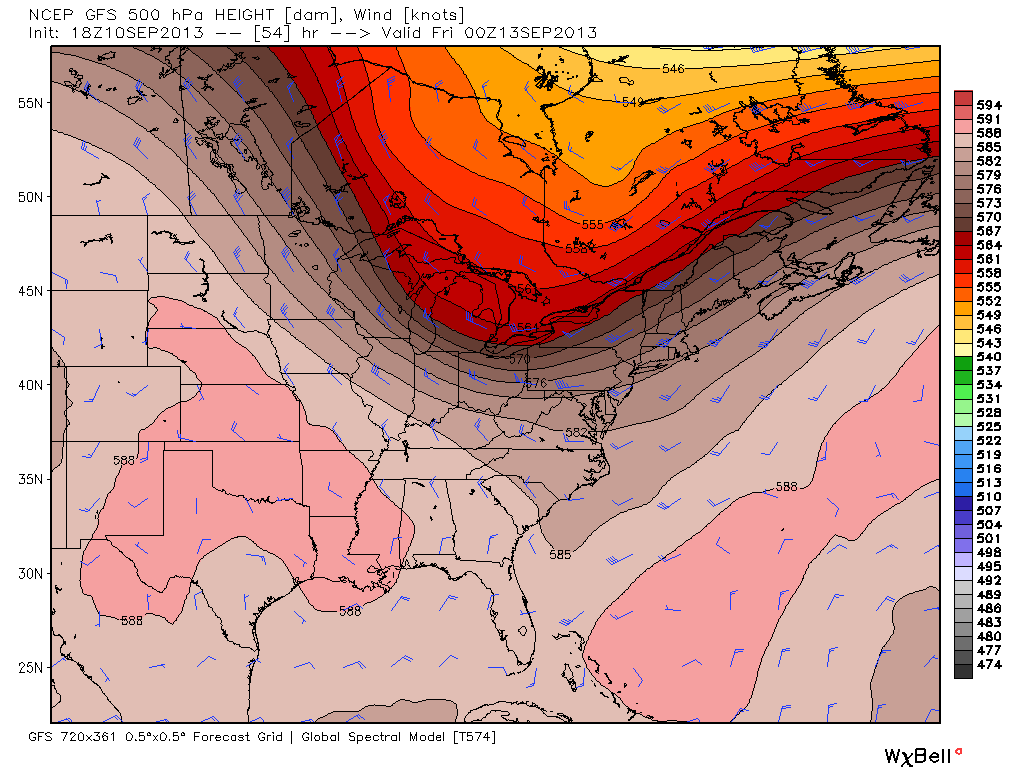
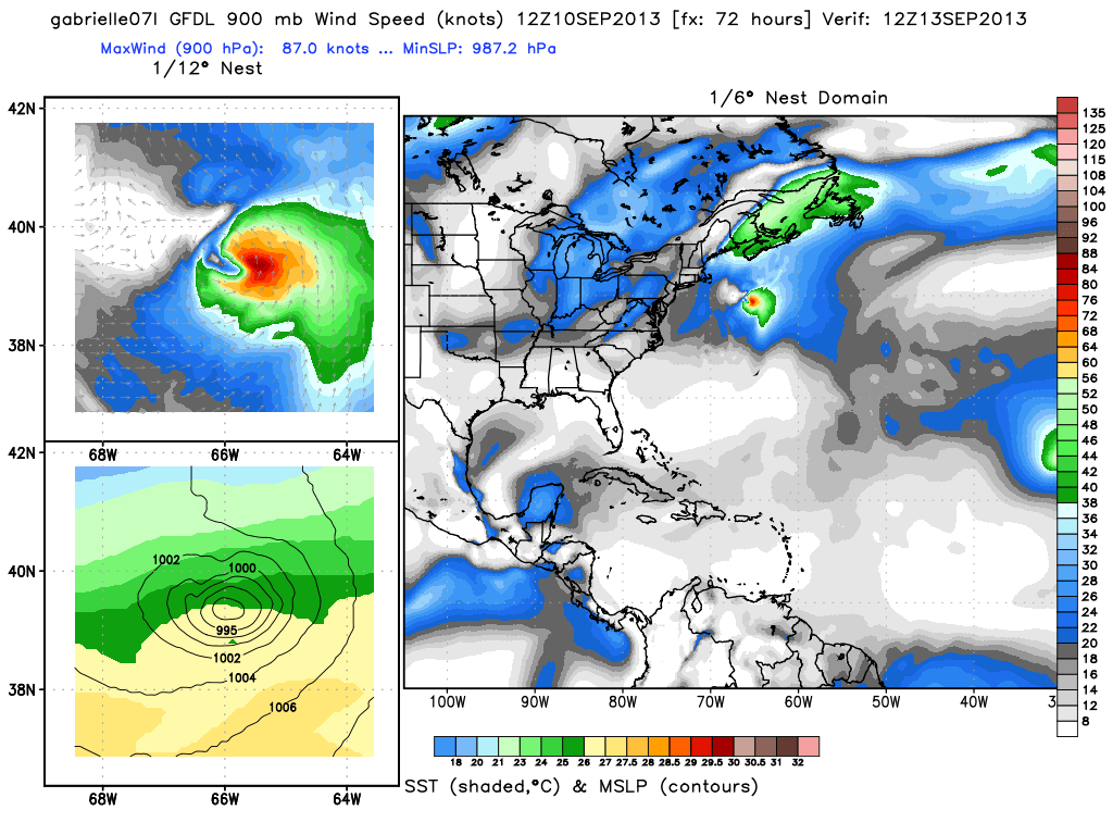
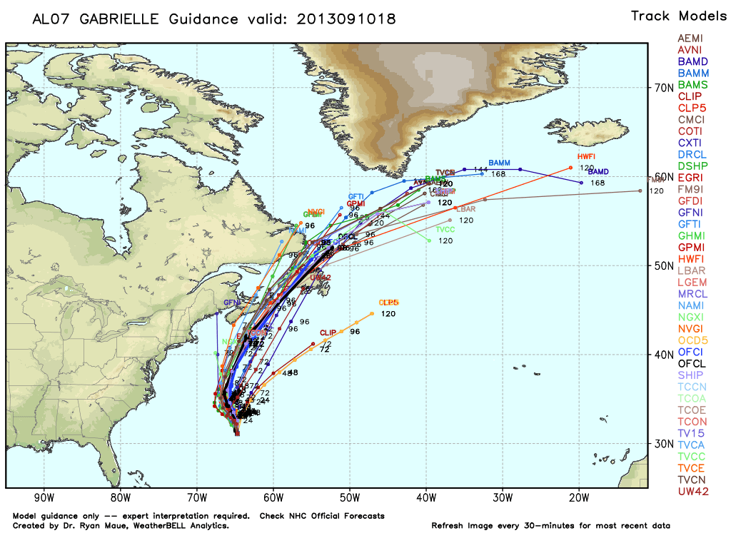
The good news about this front is that it will keep the tropics away. Gabrielle is back from the dead, once again a Tropical Storm. And here's a look at the weather map for Friday. The front will keep Gabby just off to our east and absorb it, creating one heck of a gale for Nova Scotia to start the weekend.
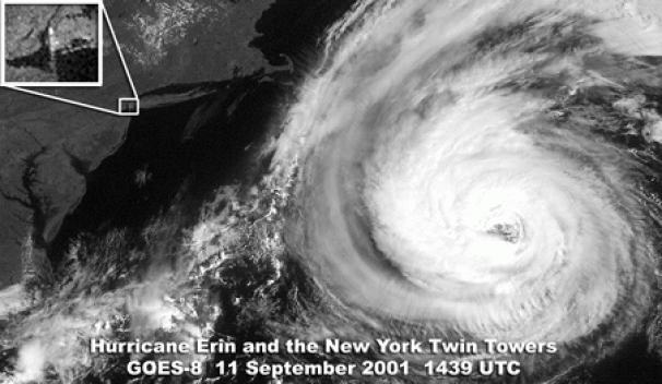
Speaking of the tropics, that reminds me. We are now passing the climatological peak of the Atlantic hurricane season. This is typically the time of year when we watch big storms develop across the Atlantic basin. In fact, here's the satellite picture from 9/11/2001, a day remembered of course for the crisp and beautiful weather shattered by the terrorist attack on the twin towers. While it started out as a day of promise and beauty before that event, Hurricane Erin was at the same time passing just off to our east.
The other tropical story we're watching is the possibility of the latest date the first hurricane of the Atlantic season develops. The record right now (during the satellite era) is owned by Gustav, a storm that become the first hurricane of the 2002 season on September 11th. The storm challenging this record is Humberto, just off the coast of Africa. Humberto poses no threat to land, but it does pose a threat to the record. As of this writing its top wind speeds were sustained at 70mph, just 4mph shy of hurricane force. If it waits to achieve that status until 8am ET Wednesday, it will break the record. There is some dry air on the north side of it and it appears a bit more disorganized today than it did earlier, but we'll see how it all pans out. In any case, refreshing to have a year with so little activity! Don't let your guard down, some of the strongest hurricanes of all-time happen *after* this date. Sandy didn't strike until we were nearly giving out Halloween candy.
 Rainbow Satellite Image of Humberto
And finally, some thoughts on the weekend. Still quite a ways off, but the main idea is that much chillier fall weather will settle back in. A cold pool of air aloft is my focus for Saturday, which should promote plenty of cumulus clouds after the early morning hours. So going with a mostly cloudy day with some showers popping across the mountains to our north and west. Temperatures will be a good 30 degrees cooler than Wednesday's highs, and a gusty breeze will make it feel even chillier than that. Bonfire weather expected for Saturday night, with a stunning Sunday to follow. If you're making outdoor plans, Sunday is your day. I'd give it 10 apples out of 10 for heading to a local orchard and soaking it in.
 <-- cold pool aloft,


