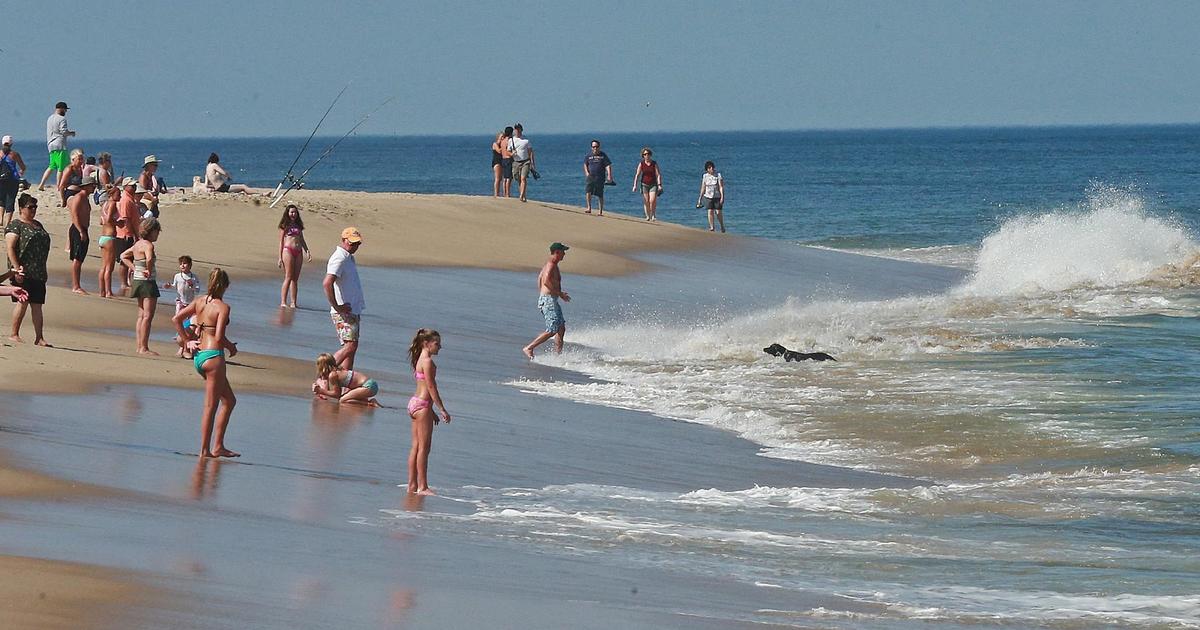
The Return of Summer Warmth
Ever since we said goodbye to our 7 day heat wave in July, the weather has been pretty easy to take. If you watched WBZ this morning, you saw that we have had 14 days this month average near or below normal so far this month. We have not gone above 85 degrees at Logan this August. Incredible. This is not a surprise as we had been advertising the cooler August, but now it looks like the pattern is about to change once again. The trough in the east which has been the major factor in providing the more seasonal, less humid air and suppressing any heat is about to lift out.
Check: Latest Conditions | Radar | Watches & Warnings
A flatter flow to the Jetstream will allow warmth and humidity to build across the nation including into the northeast. It is a pattern which will likely take hold for the rest of the month and could last into September with ridging likely to hold in the northeast bringing above normal temps. So just as you think summer may be coming to an end, don't be fooled. While the kids may be going back to school, there will still be plenty of fine weekends to enjoy before we put this summer to bed. Summer will not go down without a fight! That is fine by me....as this summer has gone much too fast...as they all do.
Today's weather is a bit mixed, not a nice as Saturday...but not awful either. With a broad upper trough still in place across the eastern US, SW winds aloft have been steering clouds and showers up the east coast along a stalled front off the coast. This stalled is the boundary separating the less humid air from the tropical air parked in the SE states. A weak wave of low pressure is riding up along this stalled front and will be tracking off the benchmark later today and tonight.
High pressure remains over us today providing plenty of low level dry air at the surface. We have seen a mix of sun and clouds across Northern and Central New England. So far, not a bad day, but clouds will continue to stream into the region during the afternoon. Generally, clouds and filtered sunshine today with highs in the 70's to near 80. Showers across the mid-Atlantic states have been trying to push north, but raindrops are evaporating before reaching the ground in SNE. The evaporation will help to thicken cloud cover across SNE during the afternoon. Skies will be mostly cloudy south of the Pike which has the best chance of a few spotty light showers or sprinkles along the south coast...if the shows can overcome the dry air in place. These southern locations could get a bit damp in spots late today once clouds saturate. Nothing more than a tenth of an inch is expected if that for the Cape & islands.
Monday will still have enough lift in the air as the trough lifts out to form some high to mid level clouds to push through. The trend will be for filtered sunshine increasing during the day with drying west winds following in behind the departing low. Warming temps aloft will mix down to make for temps to push back into the lwr-mid 80's by afternoon. Once skies clear, we are looking at a couple of days of sunshine and warming temps to enjoy as high climb into the 80's nearing 90 at times through the midweek. A gradual increase in the humidity to. By late Thursday night and early Friday, a front will push through with a few showers and break down the hot, muggy air. Cooler dry air will return for the weekend with temps in the 70's near 80. More warmth will likely follow for the Week starting the 26th.
As the tropics started to flare up, they have just as quickly quieted down again for now. African dust and dry air in the equatorial Atlantic is really making storm development quite a struggle so far. We will continue to watch for you!