1 Step Forward, 2 Steps Back
After a very changeable first day of April, we're right back to bad habits, so to speak, with another intrusion of cold polar air from Canada. Yesterday's 62 is just a pleasant memory now as we are faced with highs not exceeding the lower 40s both today and tomorrow. That is the average maximum for the end of February or early March. This is a typical spring in New England going through ups and downs. It's a battle of the air masses and the cold usually is more victorious around here especially along the coast. Our climate is significantly controlled by the proximity to the ocean and that will be played out many times in the next couple months. While well inland locations enjoy warm ups, the coastal plain is immune to these spikes in temperature thanks to the long delay in warming up the immense sea. With any wind blowing in from the ocean, the cold will win and that will be the case this coming weekend when inland locations warm up to 56-60 on Sunday with coastal locations restricted to the 40s. Next week, the overall weather pattern will transition into a favorable one supporting a big warmup. The jet stream will lift northward and change orientation enabling a big ridge of high pressure to build over the southeastern states. The resultant southwesterly wind at most levels of the atmosphere will escort warmer air into the Northeast. Temperatures have a decent shot at rising into the 60s a week from today and then into the range of 70-75 the day after on April 10 as showers develop across northern New England. As long as no batches of cold air stream across eastern Canada and sneak down the coast as a backdoor cold front, we'll be all set for the warmest weather we have enjoyed since October 20.
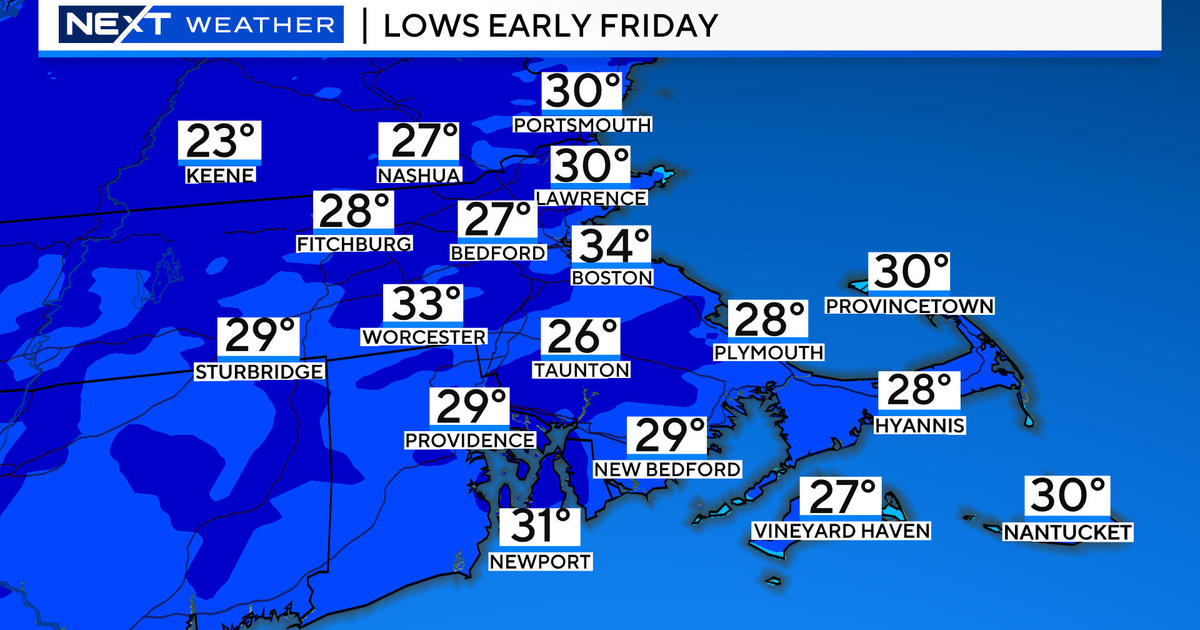
Specifically, today's clear sky early this morning will yield to patches of passing cumulus clouds which might release a few flakes mainly over the Berkshires into the hills of Worcester County. The gusty westerly wind will add chill to the air and make it feel like the 30s this afternoon. The sky will become clear by early this evening and it will turn colder tonight by about 6 degrees so morning mins tomorrow will be all in the 20s! Expect an almost carbon copy tomorrow then a recovery to the lower 50s is anticipated for Thursday. After that, a wave of low pressure in the southern branch of the jet stream will be gathering Gulf of Mexico moisture and spreading a shield of rain into the Mid-Atlantic States later Thursday into Friday. Currently, it appears that the northern jet will be key in forcing the southern stream system out to sea south of New England. A cold front associated with this jet will dip into northern New England with patchy clouds and perhaps a few flurries or light rain showers over the mountains. Meantime, over southern New England, while some cloudiness will increase on Friday, it appears that only the lower Cape or more likely the islands will receive not much more than sprinkles later Friday afternoon. The cold front will shift south of the region Friday night and push the storm out to sea and high pressure will build in behind it making for a brisk northerly breeze Saturday morning. The zone of high pressure will close in on the region over the weekend turning our wind into the northeast then east so that will guarantee that chill along the coast with the warmer 50s inland. It should be bright and sunny through that period.
Todd Gutner posts a fresh blog late this afternoon or early evening and I shall return tomorrow morning.
Make it a great day!


