Happy March!
It's March 1 and the beginning of meteorological spring! Astronomically, it commences at 7:02am on the 20th. It's called the vernal equinox. By then, I predict that there will be very little snow remaining on the ground in much of the region except over portions of the Berkshires extending into the higher terrain of northern New England. There will still be snow for skiing in many of the resorts up north. The real unknown is the amount of snow that might fall this month. Boston's average March snowfall is 7". Last March there was a bit over a half-inch in Boston. The potential exists for some stormy times in the next few weeks with temperatures generally below average with perhaps a few brief warm ups. I can guarantee that March 2013 will sharply contrast March 2012. I am sure you remember how warm it was. Last March was the second warmest on record with 11 days above 60, 5 of them above 70 and 1 exceeding 80! The 83 degrees on March 22 was 11 degrees above the previous record for that date! It was an extraordinary month of March that will not happen again for quite some time. In March, on average, Boston's high temperatures start out at 42 at the beginning of the month then ramp up to 51 at the end of the month. The sun is getting stronger and the daylight is increasing. Furthermore, Daylight Saving Time begins a week from this Sunday! How sweet is that? The sunset leaps to 6:45pm on that day! WOOHOO!
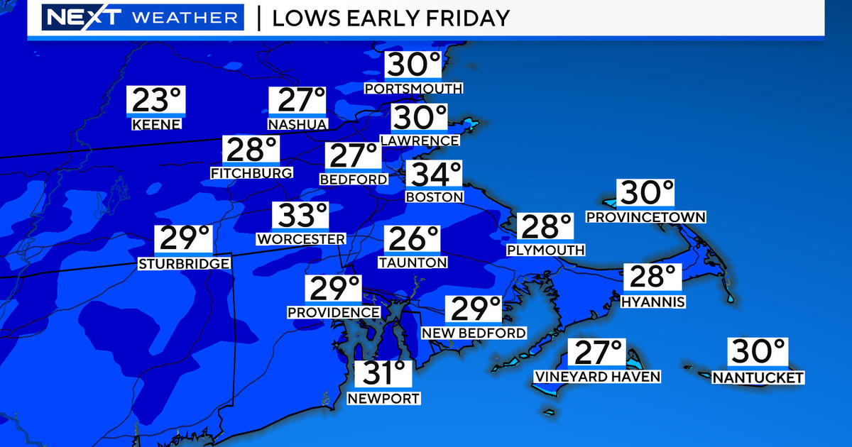
In the more immediate future, we have an interesting pattern evolving as significant blocking sets up from Europe westward into eastern Canada. The so-called NAO is in negative territory and that puts us on our toes going forward over the next week or more. Initially, there is a large storm circulation centered southeast of Nova Scotia. The cyclonic flow is steering the cloud shield from this system westward into the Canadian Maritimes, Quebec and northern New England. Spokes of moisture will continue to rotate and spiral into our region from time to time over the weekend. Consequently, expect cloudy periods and scattered slices of sunshine. As minor impulses pinwheel in this circulation, the risk of scattered rain and snow showers increases. The most frequent snow activity will occur over the mountains of northern New England where a few to several inches may accumulate especially in favorable upslope locations. Over southern New England, the highest risk of snow showers occurs tomorrow night into early Sunday when a coating up to an inch is possible. Otherwise, during the daylight hours, any lighter shower activity will be in the form of rain drops with any increase of intensity yielding snowflakes. Expect high temperatures in the lower to middle 40s through the weekend with a bit colder weather slated next week as a ridge of high pressure noses into the region from the north. Overnight lows will be mostly in the range of 28-34.
Looking ahead, the potential exists for a bundle of energy to dig into the eastern states next week. With the aforementioned block in place, the storm will be unable to pass up over the region. The real question is how far north it can penetrate. Presently, most guidance is shifting the storm a bit closer so we will keep an eye on the storm as it probably will impact the region in some way, shape or form later next Wednesday and Thursday. We may be dealing with accumulating wet snow, rain over Cape Cod and more strong winds. It is too early to be highly confident of any specifics right now. Subsequent forecast cycles will certainly become more defining late this weekend and obviously into next week.
Todd Gutner will present his thoughts later today and Joe Joyce and I will provide updates this weekend.


