One Storm to the Next...
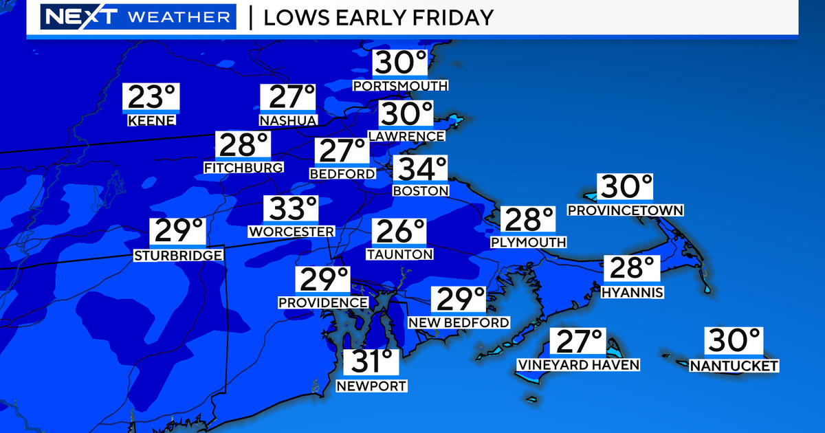
It was a very stormy day and we saw it all...damaging wind and battering waves along the coast...flooding rain in Eastern MA...and heavy snow for the Interior. The storm is now plowing through the Gulf of Maine but it's not through with us just yet. As the storm lifts away, winds have backed to the NNW, this is drawing down subfreezing air from Northern New England and numerous icy spots have developed. Essentially, any untreated surface will become very slippery so please be careful walking and driving tonight and tomorrow morning. We are also seeing several areas of snow and rain changing to snow induced by the mid-level part of the storm which will swirl over us tonight...coatings are likely and a few spots may get a fresh inch. The lift associated with it will shift offshore overnight and some clearing will develop just before dawn...allowing temps to drop even further into the 20s creating more icy spots.
Tomorrow will be a quiet day with lots of sunshine and a brisk breeze...temps should climb to between 34 Inland and 38 near the coast. Of course, the wind will make it feel much colder than the actual air temp however.
On to the weekend and another storm will develop in the South. The upper level winds will try to capture it steering it up the coast, producing another large Nor'easter. However, all of today's guidance has shown a more offshore track...south of Nantucket. This would put us on the northern fringe of the storm, narrowly avoiding a blockbuster. The storm would still be close enough to spread snow into Southern New England Saturday, early in the afternoon, and tapering it off pre-sunrise on Sunday morning. As of now it just looks like a few inches will fall...1-3ish...with the chance for a bit more in Interior SE MA. There would also be a surge of milder air into parts of the Cape and the Islands so some rain may mix in. This is subject to change and a slight shift of the track closer to us will mean a full-fledged snowstorm.
As of now, I'm leaning toward a grazing, here's why: The NAO is positive, this means that the downstream blocking is weak letting storms take the out-to-sea track. Also, the mid-level pattern is quiet progressive and doesn't tighten up and go negative until the storm is far enough to our east. That's what we are seeing and thinking right now...we'll see what happens over the next 24 hours.


