All Aboard The Polar Express!
Do you believe? The Polar Express is a wonderful movie to watch with the kids this time of year, but it also perfectly explains the pattern we are moving into with storm system after storm system following each other like railroad cars. Each storm will interact with more and more cold air. Finally, real Arctic air from Canada is on the move and will become be fully in place once the New Year starts thanks to these passing storms breaking down the formerly mild pattern.
Wave #1 is knocking on the door as we speak. This one will be gentle and kind to us providing a light accumulating snow to many areas for Christmas morning. Perfect timing! This will be an incredible surprise for waking children and absolute beautiful scene for adults to cherish so get you favorite Christmas music ready!
Unfortunately, the closer you are to the water, the greater chance of seeing rain and little to no snow accumulation. Once weak wave of low pressure is heading to the Ohio Valley. This low will be transferring it's energy to the coast to a low which will track south of New England Christmas morning and eventually off the coast. Most area will be seeing snow developing after midnight in SNE with mainly rain at the south coast and for the Cape & islands. Temps are cold enough to support snow across most of SNE during the morning hours, but as snow begins to lighten by mid morning, we will likely start to see light snow mixing with light rain or drizzle which may freeze on some colder surfaces before 10 AM.
Winter weather advisory until 10 AM south of the MA Pike for this light snow to light frz rain/drizzle in the first few early morning hours, so avoiding travel at this time is your best bet...which should not be a problem. As we have said over and over..we are expecting a general 1-2" snowfall for most locations away from the coast, maybe a coating closer to the coast..no snow in SE MA from Plymouth points south. Scattered light snow or rain could linger into the afternoon in Eastern MA before finally ending. Breaking sunshine across in northern and western New england during the afternoon.
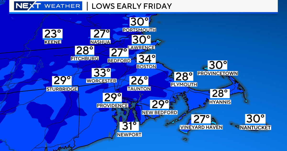
Skies will continue to clear with lows dropping into the lwr 20's on Christmas night with weak high pressure in place Wednesday. Sunshine will fade behind increasing clouds ahead of our next storm which promises to be a much larger storm with more serious implications. If you are planning on traveling any time Wednesday to Thursday...I strongly encourage you to watch the forecast carefully because roads and travel will become hazardous.
Storm #2 will again be coming out of the Gulf, but this time with more moisture and energy to work with. The latest info today on this storm is a bit farther south and east, so it looks like a colder storm which will have quite a winter wallop where it remains all snow. Coming out of the Gulf tracking through the Mid-Atlantic...this low will head to somewhere near the Cape Cod Canal or Nantucket. Precipitation will be arriving by Wednesday night and starting off as a burst of snow before changing to rain pretty quickly at the coast by midnight. Inland cold air will hold on stronger thanks to high pressure to our north supplying the cold air. Much of northern New England looks cold enough to stay all snow. Snow total amounts in the all snow region will range from 8-15" of snow likely in Northern and Western New England by the time this all winds down Thursday night. In SNE, it is a bit more tricky as we will likely pick up 3-6" of snow inland..especially around 495 before a snow rain line will approach making for an icy mix inland. Worcester could see upto a foot of snow possible. Along the coast line, rain and wind is expected and there is the potential for damaging east winds at the coast as this storm wraps in strong winds during the pre dawn hours. The snow will fall for much of the day Thursday with the low just off the coast, and the wet mix at the coast. This will likely be our first sizeable snow of the season.
Weak high pressure will fill back in for Friday Saturday for bit more sunshine and cool temps. But believe it or not...another storm for Saturday Night into Sunday. This will be another nor'easter which has the potential to be another major winter storm. The trusted Euro model had a bomb off the coast today with a cold wintry look and heavy snow and wind all the way the coast this time. The GFS stakes the storm well south of us...for a glancing blow. I lean towards the stormier scenario the way this is all shaping up. This low will direct in te coldest air of the season and the coldest air we have seen since 2010-11's winter which brought the snow blitz. I would expect 1st Night and the first few days of the new year to be frigid. Could we be getting into another pattern like that? That 6 week period of winter storms was extreme. We will likely fall short of that, but we are definitely moving into the heart of winter now like it or not. This is going to get really interesting. Plenty of time to fine tune these storms as they approach. The atmosphere is locked and loaded.
Merry Christmas, Happy Holidays, and Happy New Year from the WBZ weather department! Enjoy the freshly fallen snow!


